


Get to know Fengxian
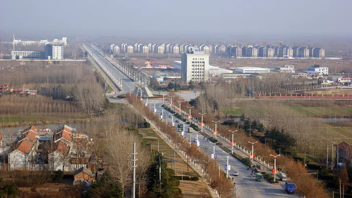
Photo adjustments
Full frame retained; proportionally resized and converted to WebP. No retouching or changes to the photographed subject. Card displays may crop the view.
- Administrative area
- County · 县
- Part of
- Xuzhou
- Chinese name
- 丰县
- Local areas
- County guide
Area & population
- Area in the source
- 1,450.20 km²
- Population · 2020 census
- 935,200
Source: cited geographic source, as of the dates shown.
Setting and landscape
The county borders Jinxiang (金乡), Yutai (鱼台) and Shan County (单县) in Shandong to the north and west, Dangshan (砀山) and Xiao County (萧县) in Anhui to the south, and Peixian (沛县) and Tongshan (铜山) of Xuzhou to the east. The Fuxin River (复新河) connects it to Weishan Lake (微山湖) and the Grand Canal. Along the Dasha River (大沙河) and the old course of the Yellow River, wetlands, orchards and farms form a long scenic belt. The county government puts its orchards at 450,000 mu, calls them the largest continuous orchard in Jiangsu, and styles Fengxian the home of Red Fuji apples and of burdock.
History
Under the Shang and Western Zhou this was the state of Feng (丰国); it became a county in the Warring States period. Liu Bang was born at Zhongyangli (中阳里) in the county. Its old nickname, Phoenix City (凤城), comes from a legend that a phoenix alighted here. In 1265 Peixian was merged into Fengxian, and was split off again the next year. During the war against Japan the Communist Huxi (湖西) base had its political centre here, while Japanese troops held the county town from 1938 to 1945. Fengxian has belonged to Xuzhou city since 1983.
What to see
The Liu Bang Hometown Cultural Scenic Area (刘邦故里文化景区) at Jinliuzhai village (金刘寨村) in Zhaozhuang town (赵庄镇) has a Liu Bang statue, the Han ancestral tomb (汉皇祖陵) and a Han culture hall; it became a national 4A scenic area in 2024. Dashahe Wetland Park (大沙河湿地公园), southwest of Erba village (二坝村), marks where the old Yellow River course enters Jiangsu and was approved as a national wetland park in 2019. At Lixinji village (李新集村) in Liangzhai town (梁寨镇), the Chengzi Academy (程子书院) stands where the Northern Song Neo-Confucian scholar Cheng Yi (程颐) and his brother taught. Zhanghoutun (张后屯) in Shouxian town (首羡镇) keeps the county Communist Party committee's main office from the war against Japan, with a tunnel-warfare park.
Food and local products
Fengxian sugar figures (丰县糖人贡) are white sugar cast by two craftsmen in carved wooden moulds, used mostly as funeral and sacrificial offerings, with peaches and gods of longevity made as birthday gifts; they have been national intangible heritage since 2008. Fengxian pit liquor (丰县泥池酒) is fermented in mud pits from five grains with a wheat starter; a workshop founded in 1873 now operates as a distillery in Wanggou town (王沟镇). Fengxian clapper opera (丰县梆子戏) has been on the national list since 2008.
Highlights
- Liu Bang Hometown Cultural Scenic Area 刘邦故里文化景区: Statue, Han ancestral tomb and culture hall at Jinliuzhai; national 4A since 2024.
- Dashahe Wetland Park 大沙河湿地公园: National wetland park where the old Yellow River course enters Jiangsu.
- Chengzi Academy 程子书院: Site where Cheng Yi and his brother taught in the Northern Song.
- Fengxian sugar figures 丰县糖人贡: Mould-cast sugar offerings; national intangible heritage since 2008.
- Fengxian pit liquor 丰县泥池酒: Five-grain liquor fermented in mud pits; provincial intangible heritage since 2016.
Sources for this guide
概况区划 · Fengxian County People's Government, Xuzhou
悠久历史 · Fengxian County People's Government, Xuzhou
游在丰县 · Fengxian County People's Government, Xuzhou
非遗展示 · Fengxian County People's Government, Xuzhou
Original English written from the listed sources and checked sentence by sentence against quoted extracts by a separate reviewer. Updated 2026-09-25.
Explore Fengxian
Core places to explore, with English and Chinese names.
Plan your visit
Getting there
Fengxian is about 70 km in a straight line from central Xuzhou. Search for 丰县 in a map app to find stations and your accommodation.
Where to stay →More in Xuzhou
Sources & geographic information
Administrative names and parent areas: Official geographic directory · Reference date 2026-09-06.
Map data © OpenStreetMap contributors. Pins mark approximate centres, not entrances or boundaries.