


Get to know Tongshan District
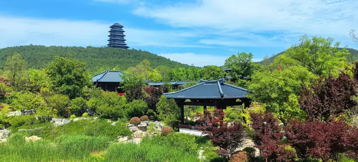
Photo adjustments
EXIF orientation normalized; resized without changing aspect ratio; converted to WebP. No subject edits.
- Administrative area
- District · 市辖区
- Part of
- Xuzhou
- Chinese name
- 铜山区
- Local areas
- District guide
Area & population
- Area in the source
- 2,003.98 km²
- Population · 2019
- 1,331,500
Source: cited geographic source, as of the dates shown.
History
The district government dates local history to Peng Zu (彭祖), said to have founded a state here more than 4,000 years ago. Qin set up Pengcheng County (彭城县) in 221 BC, and Tongshan County was first created in 1733. The name comes from a hill called Tongshan in the north-east of the old county, which now lies under a lake.
Local tradition links three episodes to the area. Confucius is said to have spoken his line on the river flowing on day and night at Lüliang Mountain (吕梁山). Liu Bang (刘邦) drew his sword at the foot of Dingtang Mountain (丁塘山) and a spring gushed out. Su Dongpo (苏东坡) expanded iron smelting at the Liguo post station (利国驿). The calligrapher Zhang Boying (张伯英) and the painters Li Keran (李可染) and Yu Jigao (喻继高) are among the notable people the district government says the area has produced.
What to see
Two sites in Tongshan are on the national key heritage list: the Maocun Han pictorial-stone tomb (茅村汉画像石墓), part of the Xuzhou tomb group, and the tombs of the Western Han kings of Chu on Chuwang Mountain (楚王山), part of the Han Chu Kings' Tombs. Provincially protected sites include the Shihucheng site (石户城遗址) in Liuquan town (柳泉镇), an ancient site of the Warring States to Han period; the Yuan-dynasty Baijia Bridge (白家桥); the former headquarters of the General Front Committee of the 1949 Yangtze crossing campaign (渡江战役总前委旧址); and the Xiangyang Canal (向阳渠), dug between 1970 and 1976.
Highlights
- Maocun Han pictorial-stone tomb 茅村汉画像石墓: Han tomb on the national key heritage list as part of the Xuzhou tomb group.
- Chuwang Mountain tombs 楚王山古墓葬群: Western Han tombs of the kings of Chu, part of the nationally listed Han Chu Kings' Tombs.
- Shihucheng site 石户城遗址: Warring States to Han site in Liuquan town, provincially protected since 2002.
- Baijia Bridge 白家桥: Yuan-dynasty bridge, provincially protected since 2006.
Sources for this guide
概况区划 · Tongshan District People's Government, Xuzhou
铜山区 · Chinese Wikipedia · CC BY-SA 4.0
铜山区各级文物保护单位列表 · Chinese Wikipedia · CC BY-SA 4.0
Original English written from the listed sources and checked sentence by sentence against quoted extracts by a separate reviewer. Updated 2026-09-25.
Explore Tongshan District
Core places to explore, with English and Chinese names.
Tongshan District 铜山区
Plan your visit
Getting there
Tongshan District is about 8 km in a straight line from central Xuzhou. Search for 铜山区 in a map app to find stations and your accommodation.
Where to stay →More in Xuzhou
Sources & geographic information
Administrative names and parent areas: Official geographic directory · Reference date 2026-09-06.
Some facts checked against 铜山区 — Wikipedia contributors, CC BY-SA 4.0.
Some facts checked against 铜山区各级文物保护单位列表 — Wikipedia contributors, CC BY-SA 4.0.
Map data © OpenStreetMap contributors. Pins mark approximate centres, not entrances or boundaries.