


Get to know Gulou District
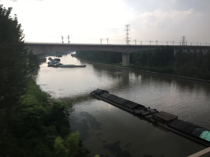
Photo adjustments
Full frame retained; proportionally resized and converted to WebP. No retouching or changes to the photographed subject. Card displays may crop the view.
- Administrative area
- District · 市辖区
- Part of
- Xuzhou
- Chinese name
- 鼓楼区
- Local areas
- District guide
Area & population
- Area in the source
- 90.80 km²
- Population · 2016
- 384,500
Source: cited geographic source, as of the dates shown.
Setting and landscape
Eight hills, among them Jiulishan (九里山) and Pipashan (琵琶山), and 25 rivers, including the Grand Canal and the old course of the Yellow River, lie within the district. Jiulishan takes its name from its length, about nine li from east to west. The Dingwan River (丁万河) was among the first rivers named in a national "most beautiful home river" selection.
History
Until economic development zones were set up in the 1980s, most of Xuzhou's factories stood in Gulou. From 2013 more than 400 of them were closed or moved, and the district became a national pilot for relocating old urban industrial areas in 2014. Jiulishan is said to have been a battlefield of the Chu–Han war, with the Baiyun Cave (白云洞) linked to Xiang Yu's (项羽) defeat; later fighters there include Zhu Quanzhong (朱全忠) of the Tang and the Ming rivals Zhu Di (朱棣) and Zhu Yunwen (朱允炆).
What to see
The district government lists the Jiulishan ancient battlefield, the City-beneath-the-City Museum (城下城博物馆), the Yellow Tower (黄楼) and the "Crossroads of Five Provinces" archway (五省通衢牌楼) among its historic sites. The Yellow Tower, on the south dyke of the old Yellow River, was built by the Northern Song poet Su Shi (苏轼). Revolutionary sites include the scene of the "No. 8 Gate Incident" (八号门事件), where the first Communist Party branch in Jiangsu was founded, and the former home of Wu Yalu (吴亚鲁), who founded the party's Xuzhou organisation.
Getting oriented
The Beijing–Shanghai and Longhai railways meet in the district. Xuzhou North Station, founded in 1915 as Mengjiagou (孟家沟) station, is a national marshalling yard at their junction, about 8 kilometres long. The district also held the Wanzhai (万寨) and Mengjiagou ports on the Grand Canal.
Highlights
- Jiulishan 九里山: Nine-li ridge said to be a Chu–Han battlefield.
- Yellow Tower 黄楼: Tower built by Su Shi on the old Yellow River dyke.
- City-beneath-the-City Museum 城下城博物馆: Listed by the district among its historic sites.
- No. 8 Gate Incident site 八号门事件旧址: Where the first Communist Party branch in Jiangsu was founded.
Sources for this guide
概况区划 · Gulou District People's Government, Xuzhou
Gulou, Xuzhou · English Wikipedia · CC BY-SA 4.0
九里山 · Chinese Wikipedia · CC BY-SA 4.0
徐州北站 · Chinese Wikipedia · CC BY-SA 4.0
黄楼 · Chinese Wikipedia · CC BY-SA 4.0
Original English written from the listed sources and checked sentence by sentence against quoted extracts by a separate reviewer. Updated 2026-09-25.
Explore Gulou District
Core places to explore, with English and Chinese names.
Gulou District 鼓楼区
Plan your visit
Getting there
Gulou District is about 7 km in a straight line from central Xuzhou. Search for 鼓楼区 in a map app to find stations and your accommodation.
Where to stay →More in Xuzhou
Sources & geographic information
Administrative names and parent areas: Official geographic directory · Reference date 2026-09-06.
Some facts checked against Gulou, Xuzhou — Wikipedia contributors, CC BY-SA 4.0.
Some facts checked against 九里山 — Wikipedia contributors, CC BY-SA 4.0.
Some facts checked against 徐州北站 — Wikipedia contributors, CC BY-SA 4.0.
Some facts checked against 黄楼 — Wikipedia contributors, CC BY-SA 4.0.
Map data © OpenStreetMap contributors. Pins mark approximate centres, not entrances or boundaries.