


Get to know Dayu County
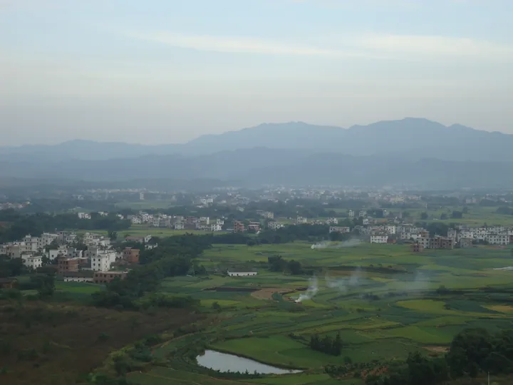
Photo adjustments
Full frame retained; proportionally resized and converted to WebP. No retouching or changes to the photographed subject. Card displays may crop the view.
- Administrative area
- County · 县
- Part of
- Ganzhou
- Chinese name
- 大余县
- Local areas
- County guide
Area & population
- Area in the source
- 1,367.63 km²
- Population · 2019
- 337,700
Source: cited geographic source, as of the dates shown.
Setting and landscape
The county is a long strip, about 127.5 kilometres east to west and 25 kilometres north to south. Mountains rise on the north, west and south, leaving a hilly basin that opens to the east, and the Zhang River runs west to east across it. The highest point is Tianhua Mountain (天华山) in Neiliang (内良乡) at 1,386.6 metres, and the Chijiang basin (池江盆地) is the largest rice-growing plain. The county seat, Nan'an (南安镇), is 85 kilometres from Ganzhou city.
History
The county was set up in 590 under the Sui, and from the Northern Song it was the seat of Nan'an (南安), which as a prefecture governed four counties until 1912. The old name Dayu (大庾) was changed to the present Dayu (大余) in 1957. In 716 the Tang chancellor Zhang Jiuling (张九龄) widened the post road over the Meiguan Pass (梅关), which the county government describes as the core land route of the maritime Silk Road. Su Dongpo (苏东坡) crossed it twice, and Tang Xianzu (汤显祖) based The Peony Pavilion (牡丹亭) on a Dayu folk tale.
In 1045 the Neo-Confucian thinker Zhou Dunyi (周敦颐) served as a judicial official in Nan'an and taught there; the brothers Cheng Hao (程颢) and Cheng Yi (程颐) became his pupils. Wang Yangming (王阳明) died at Qinglongpu (青龙铺) in Dayu in 1529. In 1907 a German pastor found tungsten ore at Xihuashan (西华山), the start of China's tungsten industry. In 1927 Zhu De (朱德) and Chen Yi (陈毅) reorganised the remnants of the Nanchang Uprising army here, and from 1935 Xiang Ying (项英) and Chen Yi led the three-year Red Army guerrilla war in the area, when Chen Yi wrote his Three Poems on Meiling (梅岭三章).
What to see
The Meiguan Pass and ancient post road (梅关和古驿道) and the Jiayou Temple Pagoda (嘉祐寺塔) are both national key cultural relics protection units. Yashan (丫山), 9.5 kilometres from the county town, is a national 4A tourist area with the 2.3-kilometre Wolong Gorge (卧龙峡谷) and its eighteen waterfalls, and Lingyan Temple (灵岩古寺); azaleas cover it in spring and red maples and ginkgo colour it in autumn. The county has also built the Peony Pavilion Culture Park (牡丹亭文化园) and a memorial hall for the Three Poems on Meiling (梅岭三章纪念馆).
Highlights
- Meiguan Pass and ancient post road 梅关和古驿道: Pass road on the Dayu Range widened by Zhang Jiuling in 716; a national key cultural relics protection unit.
- Yashan 丫山: National 4A tourist area 9.5 km from the county town, with the 2.3 km Wolong Gorge and Lingyan Temple.
- Jiayou Temple Pagoda 嘉祐寺塔: National key cultural relics protection unit.
- Xihuashan 西华山: Where tungsten ore was found in 1907, the start of China's tungsten industry.
Sources for this guide
大余县 - 维基百科,自由的百科全书 · Chinese Wikipedia · CC BY-SA 4.0
大余县情概况 | 大余县人民政府 · Dayu County People's Government
丫山风景区(灵秀丫山,度假天堂) | 大余县人民政府 · Dayu County People's Government
自然地理 | 大余县人民政府 · Dayu County People's Government
Original English written from the listed sources and checked sentence by sentence against quoted extracts by a separate reviewer. Updated 2026-09-25.
Explore Dayu County
Core places to explore, with English and Chinese names.
Places to explore around Dayu County
 The stone gate tower of Meiguan Pass on the ancient post road, Dayu County · 大余县梅关古驿道关楼 Source-recorded photograph date: 2014-01-12 13:57:42.
Meiguan Ancient Road梅关古道
The Meiguan old road (梅关古道) is a cobbled Tang-dynasty post road that climbs to the pass on Meiling in Dayu County, southern Jiangxi, at the point where the province meets Guangdong.
Read the place guide →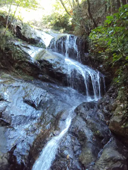 Yashan Scenic Area · 丫山
Yashan Scenic Area丫山
Yashan (丫山) is a forested hill scenic area about 9.5 kilometres from the county town of Dayu in southern Jiangxi, combining a waterfall gorge, an old temple and rural leisure development.
Read the place guide →Plan your visit
Getting there
Dayu County is about 75 km in a straight line from central Ganzhou. Search for 大余县 in a map app to find stations and your accommodation.
Where to stay →Build your route
Meiguan Ancient Road and Yashan Scenic Area are both listed here. The linked place guides have entrance and visit details.
Continue with Ganzhou →More in Ganzhou
Sources & geographic information
Administrative names and parent areas: Official geographic directory · Reference date 2026-09-06.
Some facts checked against 大余县 — Wikipedia contributors, CC BY-SA 4.0.
Photo: Meiguan Ancient Road · Zhangzhugang · CC BY-SA 3.0. Full frame retained; proportionally resized and converted to WebP. No retouching or changes to the photographed subject. Card displays may crop the view.

Photo: Yashan Scenic Area · Source photographer · License not provided. EXIF orientation normalized; resized without changing aspect ratio; converted to WebP. No subject edits.
Map data © OpenStreetMap contributors. Pins mark approximate centres, not entrances or boundaries.