


Get to know Xunwu County
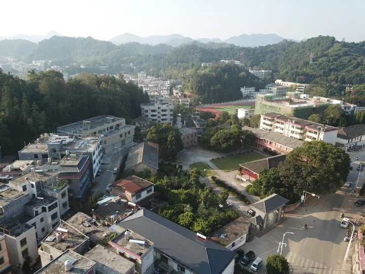
Photo adjustments
Full frame retained; proportionally resized and converted to WebP. No retouching or changes to the photographed subject. Card displays may crop the view.
- Administrative area
- County · 县
- Part of
- Ganzhou
- Chinese name
- 寻乌县
- Local areas
- County guide
Area & population
- Area in the source
- 2,351.00 km²
Source: cited geographic source, as of the dates shown.
Setting and landscape
Xunwu borders Wuping (武平) in Fujian and Pingyuan (平远) in Guangdong to the east, Xingning (兴宁) and Longchuan (龙川) in Guangdong to the south, Anyuan (安远) and Dingnan (定南) to the west and Huichang (会昌) to the north. The county is mountainous. Xiangshan Zeng (项山甑) in the east rises to 1,529 metres, and Yungaidong (云盖岽), 1,077.6 metres, stands just north of the county town. In the northwest, the Yajiboshan–Dongjiang Source nature reserve (桠髻钵山-东江源头自然保护区) has been set up in the Sanbai Mountains (三百山). The climate is southern subtropical monsoon, warm and humid all year.
History
The county was established in 1576, in the Wanli reign of the Ming dynasty, and takes its name from the Xunwu River (寻邬水), which runs through the whole county; until 1957 the name was written with a different second character (寻邬). According to the county government, large-scale migration into the area began in the Southern Song dynasty.
In May 1930 Mao Zedong led part of the Fourth Red Army into the county town and, from 4 May, held more than ten days of meetings with eleven local soviet cadres, craftsmen and shopkeepers. The result, the Xunwu survey (寻乌调查), was the largest investigation Mao ever made; Stanford University Press published an English translation by Roger R. Thompson in 1990.
What to see
The Xunwu Revolutionary History Memorial Hall (寻乌革命历史纪念馆), on the site of the survey at Matigang (马蹄岗) south of the county town, opened in 1968 and was listed as a major historical and cultural site protected at the national level in 2013. Zhoutian Village (周田村) in Chengjiang (澄江镇) is a Hakka village more than 500 years old and a Jiangxi historical and cultural village, with Danxia landforms such as Xianren Bridge (仙人桥) beside it. Qinglongyan (青龙岩) and Panlong Mountain (盘龙山) in Nanqiao (南桥镇) are also Danxia landscapes. Other sights include the Hejiao hot spring (河角温泉) in Chenguang (晨光镇), the Hakka village of Sicheng (司城村), and the Wenchang Pavilion (文昌阁) in Jitan (吉潭镇), first built in the Ming or Qing period.
Food and local products
Xunwu mandarins (寻乌蜜桔) are a geographical-indication product, and the county holds the national titles of home of mandarins and home of navel oranges.
Highlights
- Xunwu Revolutionary History Memorial Hall 寻乌革命历史纪念馆: Site of Mao Zedong's 1930 Xunwu survey; opened 1968, national-level protected site since 2013.
- Zhoutian Village 周田村: Hakka village over 500 years old in Chengjiang, a Jiangxi historical and cultural village with Danxia landforms nearby.
- Wenchang Pavilion, Jitan 文昌阁: Old Wenchang pavilion in Jitan, first built in the Ming or Qing period.
- Xunwu mandarins 寻乌蜜桔: Geographical-indication product.
Explore Xunwu County
Core places to explore, with English and Chinese names.
Xunwu County 寻乌县
Plan your visit
Getting there
Xunwu County is about 120 km in a straight line from central Ganzhou. Search for 寻乌县 in a map app to find stations and your accommodation.
Where to stay →More in Ganzhou
Sources & geographic information
Administrative names and parent areas: Official geographic directory · Reference date 2026-09-06.
Some facts checked against 寻乌县 — Wikipedia contributors, CC BY-SA 4.0.
Some facts checked against 寻乌调查 — Wikipedia contributors, CC BY-SA 4.0.
Map data © OpenStreetMap contributors. Pins mark approximate centres, not entrances or boundaries.