


Get to know De'an County
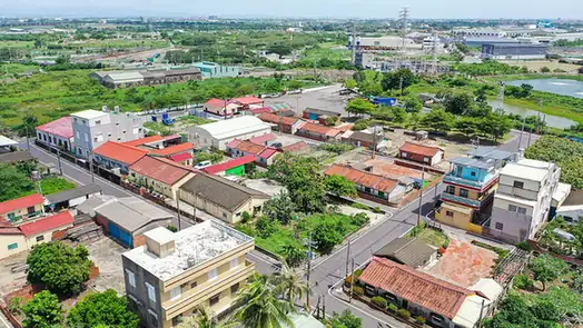
Photo adjustments
EXIF orientation normalized; resized without changing aspect ratio; converted to WebP. No subject edits.
- Administrative area
- County · 县
- Part of
- Jiujiang
- Chinese name
- 德安县
- Local areas
- County guide
Area & population
- Population · 2018
- 161,000
Source: cited geographic source, as of the dates shown.
Setting and landscape
Hills close the county in on three sides, with high ground in the north and south and lower land to the southeast, where the county's corner comes close to the shore of Poyang Lake (鄱阳湖). Its rivers belong to the Poyang Lake system. Wuning County (武宁县) lies to the west and Ruichang (瑞昌市) to the north.
History
Under the Western Han the area was Liling County (历陵县) in Yuzhang Commandery (豫章郡); Wang Mang renamed it Puting (蒲亭县), and the Eastern Han restored the old name. Liling was absorbed into Chaisang County (柴桑县) in 424. In 625 a Putang post (蒲塘场) was set up on the old Liling site, and in 927, under the Wu state of the Five Dynasties, it was raised to De'an County. Through the Ming and Qing it belonged to Jiujiang Prefecture (九江府).
What to see
The Yimen Chen cultural scenic area (中华义门陈文化景区) is in Cheqiao town (车桥镇), in the hills of northern Jiangxi. According to the county government, the Chen clan lived as one household for fifteen generations and 332 years, with more than 3,700 members eating together and a drum calling them to meals. The same account credits the clan with founding Dongjia Academy (东佳书院), which it describes as the country's earliest private university.
The Wanjialing Victory Memorial Park (万家岭大捷纪念园) is a national-level memorial site of the war against Japan and a 3A scenic area. It stands on the south side of the National Highway 105 bridge and spans both banks of the Boyang River, on the county-town battlefield of the Battle of Wanjialing (万家岭战役). Its inscription was written by the academician Yuan Longping (袁隆平), whom the county government calls a De'an native.
Food and local products
The county government names radish cake (萝卜饼) as De'an's best-known breakfast: a dough wrapper filled with shredded radish, pressed flat and fried until the thin skin turns crisp. The filling is savoury and slightly hot, with a light sweetness.
Getting oriented
The Beijing-Kowloon railway (京九铁路), the Nanchang-Jiujiang intercity railway (昌九城际铁路), the Fuzhou-Yinchuan Expressway (福银高速) and National Highways 105 and 316 all pass through the county.
Highlights
- Yimen Chen Cultural Scenic Area 中华义门陈文化景区: Ancestral home in Cheqiao town of the Chen clan, who by the county government's account lived as one household for 332 years.
- Wanjialing Victory Memorial Park 万家岭大捷纪念园: 3A-rated memorial park on the Boyang River, on the county-town battlefield of the Battle of Wanjialing.
- Radish cake 萝卜饼: Pan-fried flatbread with a shredded-radish filling, named by the county government as De'an's best-known breakfast.
Sources for this guide
中华义门陈文化景区,景区信息,德安概况,德安县人民政府 · De'an County People's Government
万家岭大捷纪念园,景区信息,德安概况,德安县人民政府 · De'an County People's Government
萝卜饼,德安美食,德安概况,德安县人民政府 · De'an County People's Government
德安县 - 维基百科,自由的百科全书 · Wikipedia (Chinese) · CC BY-SA 4.0
Original English written from the listed sources and checked sentence by sentence against quoted extracts by a separate reviewer. Updated 2026-09-25.
Explore De'an County
Core places to explore, with English and Chinese names.
De'an County 德安县
Plan your visit
Getting there
De'an County is about 45 km in a straight line from central Jiujiang. Search for 德安县 in a map app to find stations and your accommodation.
Where to stay →More in Jiujiang
Sources & geographic information
Administrative names and parent areas: Official geographic directory · Reference date 2026-09-06.
Some facts checked against 德安县 — Wikipedia contributors, CC BY-SA 4.0.
Map data © OpenStreetMap contributors. Pins mark approximate centres, not entrances or boundaries.