


Get to know Wuning County
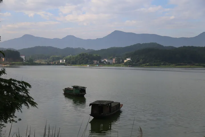
Photo adjustments
Full frame retained; proportionally resized and converted to WebP. No retouching or changes to the photographed subject. Card displays may crop the view.
- Administrative area
- County · 县
- Part of
- Jiujiang
- Chinese name
- 武宁县
- Local areas
- County guide
Area & population
- Area in the source
- 3,507.00 km²
- Population · 2018
- 408,300
Source: cited geographic source, as of the dates shown.
Setting and landscape
The Xiu and Wuning rivers loop past the county town and hills surround it on all sides. The Xihai Bay Wetland Park (西海湾湿地公园), a waterfront park, runs north to south through the town and is made up of Chaoyang Lake Park, the Shatian River wetland park, Yuning Park and the open lake north of town. It covers 10 square kilometres, where Chaoyang Lake, the Shatian River and Lushan Xihai (庐山西海) meet, and is crossed by eleven bridges.
Wuning borders Ruichang (瑞昌), De'an (德安) and Yongxiu (永修) to the east, Jing'an (靖安) to the south, Xiushui (修水) to the west and Yangxin (阳新) and Tongshan (通山) in Hubei to the north.
What to see
The Changshui scenic area (长水景区), a national 4A site, lies among the peaks of the middle Jiuling Mountains (九岭山脉). Changshui village is known as China's "first village of forest-tenure reform", forest covers 93.7 per cent of the area, and more than 200,000 southern Chinese yews (南方红豆杉) grow here. Named spots include a thousand-year-old yew, Yuexi Valley (阅溪谷) and Lingpai Gorge (令牌峡).
Mituo Temple (弥陀寺) stands on Phoenix Hill in Guayuan, Yangzhou township (杨洲乡). The county government says it was founded at the end of the Han, and that Sun Zhong (孙钟), grandfather of the Three Kingdoms ruler Sun Quan (孙权), grew watermelons here, which gave it the name Watermelon Temple (西瓜寺). After later renamings, the Chan master Hongnai (弘耐) restored that name in 1613 and enlarged the temple; in 1985 it took its present name, with an inscription requested from the Buddhist leader Zhao Puchu (赵朴初). Wuwang Peak (吴王峰), where legend places the grave of Sun Quan's great-grandmother, rises in front of it.
History
The county was founded in 704, under the Tang. Two performing traditions are still identified with it. Wuning drum songs (武宁打鼓歌) are field songs led by a drummer who beats the drum and sings, with the others joining in as they work; the drummer must know many songs and set the pace to the progress of the work. Wuning tea-picking opera (武宁采茶戏) grew out of tea songs, has upper-river and lower-river schools, is accompanied only by gongs and drums, and keeps a repertoire of 57 full-length plays and more than 300 single scenes.
Highlights
- Changshui Scenic Area 长水景区: National 4A area in the Jiuling Mountains with more than 200,000 southern Chinese yews.
- Mituo Temple 弥陀寺: Temple on Phoenix Hill, formerly the Watermelon Temple, renamed in 1985.
- Xihai Bay Wetland Park 西海湾湿地公园: 10-square-kilometre waterfront park through the county town, crossed by eleven bridges.
- Wuning Tea-picking Opera 武宁采茶戏: Local opera accompanied only by gongs and drums, with 57 full-length plays in its repertoire.
Sources for this guide
武宁县长水景区 - 武宁县人民政府 · Wuning County People's Government
武宁县弥陀寺 - 武宁县人民政府 · Wuning County People's Government
武宁西海湾湿地公园 - 武宁县人民政府 · Wuning County People's Government
武宁打鼓歌 - 武宁县人民政府 · Wuning County People's Government
武宁县 - 维基百科,自由的百科全书 · Wikipedia (Chinese) · CC BY-SA 4.0
武宁采茶戏 - 武宁县人民政府 · Wuning County People's Government
Original English written from the listed sources and checked sentence by sentence against quoted extracts by a separate reviewer. Updated 2026-09-25.
Explore Wuning County
Core places to explore, with English and Chinese names.
Wuning County 武宁县
Plan your visit
Getting there
Wuning County is about 95 km in a straight line from central Jiujiang. Search for 武宁县 in a map app to find stations and your accommodation.
Where to stay →More in Jiujiang
Sources & geographic information
Administrative names and parent areas: Official geographic directory · Reference date 2026-09-06.
Some facts checked against 武宁县 — Wikipedia contributors, CC BY-SA 4.0.
Map data © OpenStreetMap contributors. Pins mark approximate centres, not entrances or boundaries.