


Get to know Xiushui County
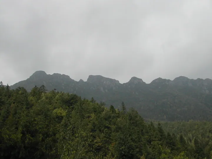
Photo adjustments
Full frame retained; proportionally resized and converted to WebP. No retouching or changes to the photographed subject. Card displays may crop the view.
- Administrative area
- County · 县
- Part of
- Jiujiang
- Chinese name
- 修水县
- Local areas
- County guide
Area & population
- Area in the source
- 4,504.00 km²
- Population · 2017
- 882,356
Source: cited geographic source, as of the dates shown.
Setting and landscape
The climate is subtropical monsoon, with more than 1,600 mm of rain a year, falling mostly in spring and summer; summers are hot and prone to drought. Chinese Wikipedia records 44.9°C here on 15 August 1953, still the highest temperature measured in China outside Xinjiang. There are hot springs at Taiqing (泰清), Siqian (司前) and Tangqiao (汤桥), and the Dongjin Reservoir (东津水库) lies in the southwest.
History
A late Neolithic site at Paomaling (跑马岭) in Shangfeng gave its name to the Shanbei culture (山背文化) in 1978. In the Shang and Zhou the area belonged to the state of Ai (艾国). In 800, under the Tang, eight western townships of Wuning became Fenning County (分宁县); in 1801 the Qing renamed what was then Ningzhou (宁州) as Yining Zhou (义宁州), and in 1914 it became Xiushui to avoid confusion with a Yining County in Guangxi. The Autumn Harvest Uprising (秋收起义) broke out here first, and the first Communist army flag was designed, made and raised here.
What to see
Shuangjing village (双井村) keeps the tomb park of the Song poet Huang Tingjian (黄庭坚) and old stone inscriptions. In the county town, the Nanya-Majiazhou scenic area (南崖-马家洲景区), rated 4A, links the Nanya cliff, where Huang studied and which now holds the Huang Tingjian Memorial Hall and old inscriptions, with Yunyan Chan Temple (云岩禅寺), a plank walk through the Xiu River gorge and Majiazhou Park. Huanglong Temple (黄龙寺) on Mount Huanglong is where the Huanglong school of Chan Buddhism began.
Donghuzhai (东浒寨), another 4A area, lies in Tankeng village, Zhengcun township (征村乡), where Jiangxi, Hunan and Hubei meet. Its sights include a cave waterfall with a drop of more than 30 metres and four via ferrata routes totalling 3,080 metres.
Food and local products
Ning black tea (宁红茶) takes its name from Fenning and Yining, the county's old names; its making entered the national intangible-heritage list in 2021. Picking usually begins before the Qingming festival, in the morning after the mist lifts; the leaves are then given a light withering, heavy rolling and full fermentation, and the finished tea has an apple-like aroma. It has been exported since the mid-19th century. The Xiushui tribute inkstone (修水贡砚), listed the same year, is carved from local Xiukou stone (修口石); an inkstone found in an Eastern Han tomb at Zhajinping (渣津坪) shows that inkstone-making here goes back to that period, and the Daoguang emperor named it the "ochre inkstone" (赭砚) and made it a court tribute.
Highlights
- Nanya-Majiazhou Scenic Area 南崖-马家洲景区: 4A area in the county town with the Huang Tingjian Memorial Hall and a Xiu River gorge plank walk.
- Huanglong Temple 黄龙寺: Birthplace of the Huanglong school of Chan Buddhism.
- Donghuzhai 东浒寨: 4A mountain area with a cave waterfall and four via ferrata routes.
- Ning Black Tea 宁红茶: Gongfu black tea with an apple-like aroma; national intangible heritage since 2021.
- Xiushui Tribute Inkstone 修水贡砚: Carved from Xiukou stone; a Qing court tribute named the ochre inkstone.
Sources for this guide
美丽的修水丨国家4A级旅游景区—南崖-马家洲景区 · Xiushui County Committee and People's Government
【大美修水】东浒寨风景区:山奇水媚两相宜 · Xiushui County Committee and People's Government
修水县 - 维基百科,自由的百科全书 · Wikipedia (Chinese) · CC BY-SA 4.0
砚台制作技艺(修水贡砚制作技艺) - 中国非物质文化遗产网 · China Intangible Cultural Heritage Network (China National Centre for the Safeguarding of ICH)
红茶制作技艺(宁红茶制作技艺) - 中国非物质文化遗产网 · China Intangible Cultural Heritage Network (China National Centre for the Safeguarding of ICH)
Original English written from the listed sources and checked sentence by sentence against quoted extracts by a separate reviewer. Updated 2026-09-25.
Explore Xiushui County
Core places to explore, with English and Chinese names.
Xiushui County 修水县
Plan your visit
Getting there
Xiushui County is about 155 km in a straight line from central Jiujiang. Search for 修水县 in a map app to find stations and your accommodation.
Where to stay →More in Jiujiang
Sources & geographic information
Administrative names and parent areas: Official geographic directory · Reference date 2026-09-06.
Some facts checked against 修水县 — Wikipedia contributors, CC BY-SA 4.0.
Map data © OpenStreetMap contributors. Pins mark approximate centres, not entrances or boundaries.