


Get to know Lianxi District
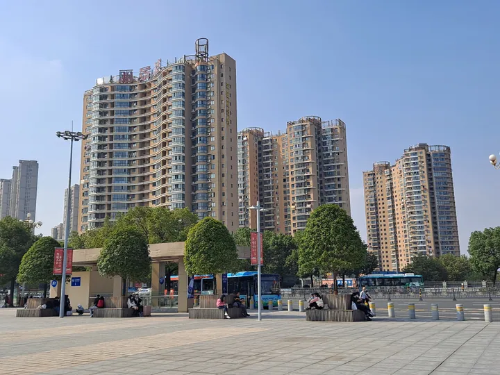
Photo adjustments
Full frame retained; proportionally resized and converted to WebP. No retouching or changes to the photographed subject. Card displays may crop the view.
- Administrative area
- District · 市辖区
- Part of
- Jiujiang
- Chinese name
- 濂溪区
- Local areas
- District guide
Area & population
- Area in the source
- 369.80 km²
- Population · 2018
- 259,480
Source: cited geographic source, as of the dates shown.
History
When Jiujiang became a province-administered city in 1980, a suburban district and a Lushan District were set up around it; the suburban district was merged in 1984. On 29 March 2016 the State Council moved Guling town (牯岭镇) into Lushan City (庐山市) and renamed the remaining Lushan District as Lianxi.
What to see
Donglin Temple (东林寺), on the northwestern foot of Mount Lu, was founded in 386 by the Eastern Jin monk Huiyuan (慧远). The district government describes it as the birthplace of Pure Land Buddhism (净土宗) and notes that the Japanese Jodo and Jodo Shinshu schools regard it as their ancestral temple; the Tang monk Jianzhen (鉴真) came here before taking its teaching to Japan. In 1983 the State Council named it a national key Buddhist temple. Within it are a sutra-translation terrace (译经台), a lotus pond, a Six Dynasties pine (六朝松), a stele by Li Beihai (李北海碑), a broken stele by Liu Gongquan (柳公权残碑), a Tang sutra pillar and Huiyuan's stupa court (远公塔院).
South Hill Park (南山公园), a 4A scenic area of about 1,030 mu, takes its name from a line by the poet Tao Yuanming (陶渊明): "采菊东篱下,悠然见南山" ("picking chrysanthemums by the eastern fence, I see the southern hills at ease"). It holds the Dehua Tower (德化楼), Wuliu Lake (五柳湖), plum and cherry gardens and a martyrs' memorial hall; from the top of the tower the Yangtze, Poyang Lake and Mount Lu are all in view.
The Bilong Pool scenic area (碧龙潭) lies southeast of Xiaotianchi (小天池) on Mount Lu. The geologist Li Siguang (李四光) identified its ice valley as the most representative U-shaped valley of Mount Lu's Quaternary glaciation. The Wangjiapo twin falls (王家坡双瀑) drop side by side about 10 metres apart, and the pool above them was found by a woodcutter in 1920. A viewing pavilion was built above the pool in 1932, and beside it stands a record of the pavilion by the scholar Chen Sanli (陈三立).
Getting oriented
National Highway 105 crosses the district, and Jiujiang railway station (九江站) serves the Beijing-Kowloon, Nanchang-Jiujiang intercity, Quzhou-Jiujiang and Wuhan-Jiujiang lines.
Highlights
- Donglin Temple 东林寺: Founded by Huiyuan in 386 and regarded as the birthplace of Pure Land Buddhism.
- South Hill Park 南山公园: 4A park named after a Tao Yuanming line, with views of the Yangtze, Poyang Lake and Mount Lu from Dehua Tower.
- Bilong Pool 碧龙潭: Pool, twin waterfalls and a glacial U-shaped valley on the north side of Mount Lu.
Sources for this guide
东林寺 - 九江市濂溪区人民政府 · Lianxi District People's Government, Jiujiang
南山景区 - 九江市濂溪区人民政府 · Lianxi District People's Government, Jiujiang
碧龙潭 - 九江市濂溪区人民政府 · Lianxi District People's Government, Jiujiang
濂溪区 - 维基百科,自由的百科全书 · Wikipedia (Chinese) · CC BY-SA 4.0
Original English written from the listed sources and checked sentence by sentence against quoted extracts by a separate reviewer. Updated 2026-09-25.
Explore Lianxi District
Core places to explore, with English and Chinese names.
Places to explore around Lianxi District
 A hall and garden within Donglin Temple at Lushan, Jiujiang, Jiangxi; 21 October 2023.
Plan your visit
Getting there
Lianxi District is about 4 km in a straight line from central Jiujiang. Search for 濂溪区 in a map app to find stations and your accommodation.
Where to stay →Build your route
Start with Donglin Temple (Jiangxi). The linked place guides have entrance and visit details.
Continue with Jiujiang →More in Jiujiang
Sources & geographic information
Administrative names and parent areas: Official geographic directory · Reference date 2026-09-06.
Some facts checked against 濂溪区 — Wikipedia contributors, CC BY-SA 4.0.
Photo: Donglin Temple (Jiangxi) · 沈澄心 · CC0. Proportionally resized and converted to WebP without cropping, retouching or changing the photographed subject.

Map data © OpenStreetMap contributors. Pins mark approximate centres, not entrances or boundaries.