


Get to know Gongqingcheng
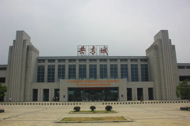
Photo adjustments
Full frame retained; proportionally resized and converted to WebP. No retouching or changes to the photographed subject. Card displays may crop the view.
- Administrative area
- County-level city · 县级市
- Part of
- Jiujiang
- Chinese name
- 共青城市
- Local areas
- County-level city guide
Area & population
- Population · 2019
- 220,000
- Administrative seat
- Chashan Subdistrict
Source: cited geographic source, as of the dates shown.
History
On 18 October 1955, 98 young volunteers of the Shanghai Youth League arrived at Tuogouling in Miliangpu (米粮铺), then part of De'an County (德安县), to clear waste land by the lake. Forty days later Hu Yaobang (胡耀邦), first secretary of the League, visited and named the settlement Gongqing Commune (共青社). It became the Gongqing reclamation farm in 1978, and on 12 December 1984 Hu, by then the Party's general secretary, renamed it Gongqingcheng. He was buried here on 15 April 1990.
The State Council approved the city in September 2010, formed from parts of De'an and Yongxiu (永修县). In July 2014 it became one of six pilot counties and cities run directly by the Jiangxi provincial government.
What to see
A day route suggested by the city government combines the Fuhua Mountain scenic area (富华山景区), Hu Yaobang's tomb, the Lengshuiwa new village (冷水洼新村) that recalls the 1955 reclamation, the tomb of the martyr Gong Bingzhang (龚炳章烈士墓) and a Gongqing spirit experience park (共青精神体验园). Another route follows the dykes to the Poyang Lake planning exhibition hall (鄱阳湖规划展示馆); in November and December migratory birds can be watched from the large bridge on Nanhu Avenue (南湖大道).
Jiuxianling (九仙岭), also called Boyang Mountain (博阳山), rises on the boundary between Miliangpu and Baota in De'an. Its main peak reaches 200.2 metres, the slopes carry slash pine, Chinese fir and Masson pine, and the city government calls it a natural route for hill walking.
Food and local products
Gongqing salted duck (共青板鸭) is the city's signature product and a Chinese geographical-indication product. The city government says the traditional method of selecting and fattening, salting, processing and air-drying the birds has been refined, giving tender meat that is rich without being greasy, crisp bones and a moderate saltiness; the ducks are raised on Poyang Lake water. Feathers piling up at the duck factory led its director, Jiang Zhongping (蒋仲平), to start making down products, and the city is now listed as a down-garment centre.
Highlights
- Hu Yaobang's tomb 胡耀邦墓: Burial place of Hu Yaobang, who named the original settlement in 1955 and the city in 1984.
- Jiuxianling 九仙岭: Forested hill of 200.2 metres on the De'an boundary, which the city government calls a natural route for hill walking.
- Gongqing salted duck 共青板鸭: Salted, air-dried duck with a geographical-indication listing; the duck works gave rise to the local down industry.
Sources for this guide
共青板鸭 ,中国共青城, 旅游向导 , 吃 · Gongqingcheng Municipal People's Government
共青城推荐旅游路线一 ,中国共青城, 旅游向导 , 行 · Gongqingcheng Municipal People's Government
九仙岭 ,中国共青城, 旅游向导 , 游 · Gongqingcheng Municipal People's Government
共青城市 - 维基百科,自由的百科全书 · Wikipedia (Chinese) · CC BY-SA 4.0
Original English written from the listed sources and checked sentence by sentence against quoted extracts by a separate reviewer. Updated 2026-09-25.
Explore Gongqingcheng
Core places to explore, with English and Chinese names.
Gongqingcheng 共青城市
Plan your visit
Getting there
Gongqingcheng is about 50 km in a straight line from central Jiujiang. Search for 共青城市 in a map app to find stations and your accommodation.
Where to stay →More in Jiujiang
Sources & geographic information
Administrative names and parent areas: Official geographic directory · Reference date 2026-09-06.
Some facts checked against 共青城市 — Wikipedia contributors, CC BY-SA 4.0.
Map data © OpenStreetMap contributors. Pins mark approximate centres, not entrances or boundaries.