


Get to know Ruichang
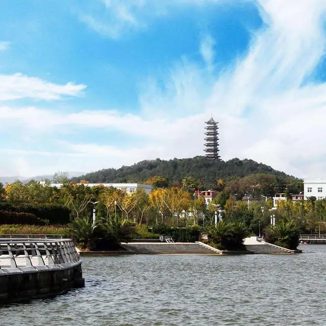
Photo adjustments
EXIF orientation normalized; resized without changing aspect ratio; converted to WebP. No subject edits.
- Administrative area
- County-level city · 县级市
- Part of
- Jiujiang
- Chinese name
- 瑞昌市
- Local areas
- County-level city guide
Area & population
- Area in the source
- 1,423.11 km²
- Population · 2018
- 462,700
Source: cited geographic source, as of the dates shown.
Setting and landscape
The ground is high in the southwest and falls away to the northeast. Qingshan (青山) and Dadeshan (大德山), branches of the Mufu Mountains (幕阜山), rise through the middle of the city and other ranges close off the north and south, which the city government says divides Ruichang into three strips, known as its "three lanes" (三条巷). Low mountains above 500 metres cover 37 per cent of the land and hills another 46 per cent. The Yangtze runs for 19.5 km along the northern edge, and Chihu (赤湖), the largest natural lake, is shared with neighbouring Chaisang District (柴桑区) and covers 68.9 square kilometres at normal water.
History
The Liangtiansi (良田寺) settlement site shows that people lived here in the Neolithic, about 5,000 years ago. In 783, during the Tang, a Chiwu (赤乌场) district was split off from western Xunyang, and in 939 the Southern Tang raised it to Ruichang County, a name meaning "auspicious and prosperous". The State Council approved its change from county to city on 20 December 1989.
Its best-known heritage site is the Tongling copper mine (铜岭铜矿遗址) in Tongling village, Xiafan town (夏畈镇). The city government dates the mining there from the Shang dynasty through the Spring and Autumn and Warring States periods, nearly a thousand years, and says the find overturned the old view that Chinese bronze culture did not cross the Yangtze. Four excavations have exposed 107 shafts and 20 galleries. The site was named one of China's ten major archaeological discoveries of 1991, became a national key cultural relic protection unit in 2001 and was placed on China's World Heritage tentative list in 2007.
Food and local products
Two Ruichang crafts entered the national intangible-heritage list in 2008. Ruichang paper-cutting (瑞昌剪纸) is handed down mainly among village women within families; it mixes northern and southern styles, and its cutters use a non-openwork technique most paper-cutters avoid, so the image looks alternately blurred and sharp. Ruichang bamboo weaving (瑞昌竹编) draws on more than 60,000 mu of mountain bamboo, and a bamboo basket for carrying ore has been unearthed intact at the ancient copper workings. Weavers make beds, chairs, winnowing trays, rice sieves and sleeping mats, and, more recently, flower baskets and animal figures.
Getting oriented
The city government sits in Pencheng subdistrict (湓城街道). De'an (德安) and Wuning (武宁) counties lie to the south. The Wuhan-Jiujiang railway stops at Ruichang station and the Wuhan-Jiujiang passenger line at Ruichang West, and the Hangzhou-Ruili expressway crosses the city.
Highlights
- Tongling Copper Mine Site 铜岭铜矿遗址: Shang to Warring States copper workings with 107 excavated shafts; national key protection unit since 2001.
- Ruichang Paper-cutting 瑞昌剪纸: National intangible heritage (2008), passed down mainly among village women.
- Ruichang Bamboo Weaving 瑞昌竹编: National intangible heritage (2008); an ore basket of bamboo was found at the ancient copper workings.
- Chihu Lake 赤湖: Ruichang's largest natural lake, 68.9 square kilometres at normal water.
Sources for this guide
瑞昌市人民政府,历史沿革 · Ruichang Municipal People's Government
瑞昌市人民政府,秀美瑞昌,自然环境 · Ruichang Municipal People's Government
瑞昌市 - 维基百科,自由的百科全书 · Wikipedia (Chinese) · CC BY-SA 4.0
铜岭铜矿遗址 - 维基百科,自由的百科全书 · Wikipedia (Chinese) · CC BY-SA 4.0
剪纸(瑞昌剪纸) - 中国非物质文化遗产网 · China Intangible Cultural Heritage Network (China National Centre for the Safeguarding of ICH)
竹编(瑞昌竹编) - 中国非物质文化遗产网 · China Intangible Cultural Heritage Network (China National Centre for the Safeguarding of ICH)
Original English written from the listed sources and checked sentence by sentence against quoted extracts by a separate reviewer. Updated 2026-09-25.
Explore Ruichang
Core places to explore, with English and Chinese names.
Plan your visit
Getting there
Ruichang is about 25 km in a straight line from central Jiujiang. Search for 瑞昌市 in a map app to find stations and your accommodation.
Where to stay →More in Jiujiang
Sources & geographic information
Administrative names and parent areas: Official geographic directory · Reference date 2026-09-06.
Some facts checked against 瑞昌市 — Wikipedia contributors, CC BY-SA 4.0.
Some facts checked against 铜岭铜矿遗址 — Wikipedia contributors, CC BY-SA 4.0.
Map data © OpenStreetMap contributors. Pins mark approximate centres, not entrances or boundaries.