


Get to know Jinxian County
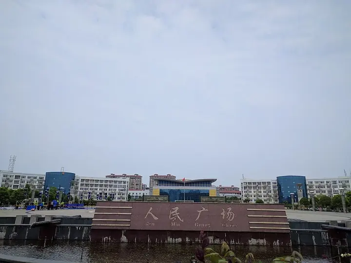
Photo adjustments
Full frame retained; proportionally resized and converted to WebP. No retouching or changes to the photographed subject. Card displays may crop the view.
- Administrative area
- County · 县
- Part of
- Nanchang
- Chinese name
- 进贤县
- Local areas
- County guide
Area & population
- Area in the source
- 1,952.00 km²
- Population · 2018
- 850,500
Source: cited geographic source, as of the dates shown.
Setting and landscape
The county lies on the Gan–Fu Plain (赣抚平原) in north-central Jiangxi. A Xinhua Jiangxi feature describes its land as "three parts hills, three parts water, three parts fields, and one part roads and estates". Its main waters are Junshan Lake (军山湖), whose water surface covers 320,000 mu, and Qinglan Lake (青岚湖), a provincial wetland park where migratory birds winter. Every year from November to March more than ten thousand tundra swans winter around Luoxi (罗溪), which is listed among Jiangxi's 22 best birdwatching spots.
History
The county began as Zhongling (钟陵) in 280, under the Western Jin, and was abolished and restored several times. In 1103, under the Northern Song, the town of Jinxian in Nanchang County was raised to a county; Chinese Wikipedia links the name to Qixian Mountain (栖贤山), where the Tang official Dai Shulun (戴叔伦) settled with his family. The county passed between Nanchang, Yichun (宜春) and Fuzhou (抚州) prefectures after 1949 and returned to Nanchang in 1983. It has nine national-level traditional villages, and in 2024 it was the only county in Jiangxi chosen as a national demonstration county for protecting traditional villages as a group. Historic sites named in the county include the old houses of Luoxi, the Ming-dynasty Zhoujin memorial arch (昼锦坊) at Qili (七里) and Jinshan Temple (金山寺).
Food and local products
The Lidu distillery workshop site (李渡烧酒作坊遗址), dating to the Yuan dynasty, is a national key cultural relics protection unit; it was among the ten major archaeological discoveries of 2002 and became a national 4A tourist site in 2018. Lidu liquor-making is on the Jiangxi intangible heritage list.
Wengang brush-making (文港毛笔制作技艺) entered the national intangible heritage list in 2021. It is practised in 104 villages of Wengang town, with Zhoufang (周坊) village as its birthplace; the whole process has 128 steps, from preparing the core hair to packaging, and the range covers eight classes and more than 1,000 kinds. From the mid-Ming period Wengang brushes were supplied to the imperial palace. The Xinhua Jiangxi feature names Junshan Lake hairy crabs (军山湖大闸蟹) first among the county's special products.
Highlights
- Lidu Yuan-dynasty distillery site 李渡烧酒作坊遗址: National key cultural relics protection unit; among China's ten major archaeological discoveries of 2002.
- Wengang brush-making 文港毛笔制作技艺: National intangible heritage since 2021; 128 production steps, practised in 104 villages of Wengang.
- Junshan Lake 军山湖: Lake with 320,000 mu of water, one of the county's two core waters.
- Qinglan Lake 青岚湖: Provincial wetland park and wintering ground for migratory birds.
- Luoxi swan wintering ground 罗溪: Over ten thousand tundra swans winter here from November to March.
Sources for this guide
进贤县 - 维基百科,自由的百科全书 · Chinese Wikipedia · CC BY-SA 4.0
毛笔制作技艺(文港毛笔制作技艺) - 中国非物质文化遗产网·中国非物质文化遗产数字博物馆 · China Intangible Cultural Heritage Network (ihchina.cn)
朱虹:文脉铸魂 品牌赋能——进贤县文旅高质量发展路径探析-新华网 · Xinhua Net (Jiangxi channel), article from the Jiangxi Culture and Tourism Association
Original English written from the listed sources and checked sentence by sentence against quoted extracts by a separate reviewer. Updated 2026-09-25.
Explore Jinxian County
Core places to explore, with English and Chinese names.
Jinxian County 进贤县
Plan your visit
Getting there
Jinxian County is about 50 km in a straight line from central Nanchang. Search for 进贤县 in a map app to find stations and your accommodation.
Where to stay →More in Nanchang
Sources & geographic information
Administrative names and parent areas: Official geographic directory · Reference date 2026-09-06.
Some facts checked against 进贤县 — Wikipedia contributors, CC BY-SA 4.0.
Map data © OpenStreetMap contributors. Pins mark approximate centres, not entrances or boundaries.