


Get to know Qingshanhu District
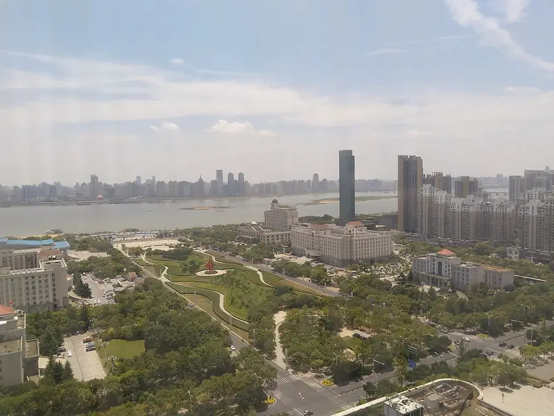
Photo adjustments
EXIF orientation normalized; resized without changing aspect ratio; converted to WebP. No subject edits.
- Administrative area
- District · 市辖区
- Part of
- Nanchang
- Chinese name
- 青山湖区
- Local areas
- District guide
Area & population
- Area in the source
- 127.60 km²
- Population · 2019
- 640,000
Source: cited geographic source, as of the dates shown.
Setting and landscape
The Nanchang city government describes the district as rich in waterways, with "three lakes, four rivers and five canals", and says several hundred thousand migratory birds stop here every year. One bird site is Tianxiang Garden (天香园), a former horticultural farm of 1,150 mu whose wetlands, lakes and marshes host more than 30 species of wild migratory birds; it is a national 4A tourist attraction and houses a China–EU ecological bird research base.
History
People lived in the area in the late Neolithic, about 5,000 years ago. When the Han general Guan Ying (灌婴) built a walled Nanchang in 201 BC, the site he chose is placed around Huangcheng village (黄城村) in today's Hufang (湖坊), which is why the district is sometimes called the ancestor of Nanchang city. The area was Nanchang's suburban district until it was renamed Qingshanhu in 2002; in 2021 Jiaoqiao (蛟桥) was moved out to Xinjian District (新建区).
What the district contains
The city government gives Qingshanhu the title of a famous Chinese city for knitted clothing and names Beijing East Road (北京东路), Jiefang East Road (解放东路) and Shanghai Road (上海路) as shopping districts it is developing. Nanchang Normal University (南昌师范学院) has its campus here, and the Bayi Stadium (南昌八一体育场) at 489 Hongdu North Avenue (洪都北大道) holds 26,000 spectators.
Getting oriented
Besides Nanchang Railway Station (南昌站) and Nanchang East Station (南昌东站), the district has the long-distance bus station, and Metro lines 1 to 4 cross it. Nanchang East, in Luojia (罗家), opened on 27 December 2023 on the Hangzhou–Nanchang high-speed line and connects with the metro.
Highlights
- Tianxiang Garden 天香园: Former horticultural farm of 1,150 mu with wetlands and lakes used by over 30 species of migratory birds; national 4A attraction.
- Huangcheng village 黄城村: Area in Hufang placed as the site of the walled Nanchang Guan Ying built in 201 BC.
- Nanchang East Station 南昌东站: High-speed station in Luojia, opened on 27 December 2023.
Sources for this guide
青山湖区 - 南昌市人民政府 · Nanchang Municipal People's Government
青山湖区 - 维基百科,自由的百科全书 · Chinese Wikipedia · CC BY-SA 4.0
天香园 - 维基百科,自由的百科全书 · Chinese Wikipedia · CC BY-SA 4.0
南昌东站 - 维基百科,自由的百科全书 · Chinese Wikipedia · CC BY-SA 4.0
南昌师范学院 - 维基百科,自由的百科全书 · Chinese Wikipedia · CC BY-SA 4.0
南昌八一体育场 - 维基百科,自由的百科全书 · Chinese Wikipedia · CC BY-SA 4.0
Original English written from the listed sources and checked sentence by sentence against quoted extracts by a separate reviewer. Updated 2026-09-25.
Explore Qingshanhu District
Core places to explore, with English and Chinese names.
Qingshanhu District 青山湖区
Plan your visit
Getting there
Qingshanhu District is about 10 km in a straight line from central Nanchang. Search for 青山湖区 in a map app to find stations and your accommodation.
Where to stay →More in Nanchang
Sources & geographic information
Administrative names and parent areas: Official geographic directory · Reference date 2026-09-06.
Some facts checked against 青山湖区 — Wikipedia contributors, CC BY-SA 4.0.
Some facts checked against 天香园 — Wikipedia contributors, CC BY-SA 4.0.
Some facts checked against 南昌东站 — Wikipedia contributors, CC BY-SA 4.0.
Some facts checked against 南昌师范学院 — Wikipedia contributors, CC BY-SA 4.0.
Some facts checked against 南昌八一体育场 — Wikipedia contributors, CC BY-SA 4.0.
Map data © OpenStreetMap contributors. Pins mark approximate centres, not entrances or boundaries.