


Get to know Nanchang County
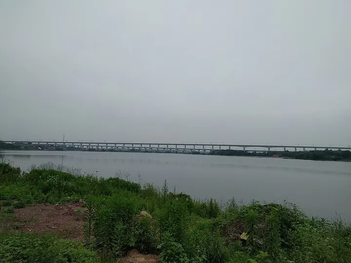
Photo adjustments
Full frame retained; proportionally resized and converted to WebP. No retouching or changes to the photographed subject. Card displays may crop the view.
- Administrative area
- County · 县
- Part of
- Nanchang
- Chinese name
- 南昌县
- Local areas
- County guide
Area & population
- Area in the source
- 1,810.70 km²
- Population · 2019
- 1,058,294
Source: cited geographic source, as of the dates shown.
Setting and landscape
The county is a long strip, 36 kilometres from east to west and 77 kilometres from north to south. Jinxian (进贤) lies to the east and Fengcheng (丰城) to the south; in the northeast it reaches the shore of Poyang Lake (鄱阳湖), and to the west and north the Gan River separates it from Xinjian (新建).
History
This is the county that first carried the name Nanchang. In 202 BC the Han general Guan Ying (灌婴) garrisoned the area and set up Yuzhang Commandery (豫章郡), and Nanchang County was created as the commandery seat; Chinese Wikipedia reads the name as "making the southern frontier prosper" and "southern prosperity". The next year he built a walled town, known as Guan Ying's City (灌婴城), at Huangchengsi (黄城寺), about 4 kilometres southeast of today's Nanchang Railway Station. Fengcheng, Xinjian and Jinxian were split from it between 221 and 1103. The county government moved to Liantang in September 1945 and moved there again on 20 August 1949; Chinese Wikipedia notes that Liantang was chosen partly for its station on a branch of the Zhejiang–Jiangxi railway. Nanchang Xiangtang Airport (南昌向塘机场) in Xiangtang (向塘) was built in 1952 and handled Nanchang's civil flights from 1957 until 1999; it is now a military airfield.
What to see
The Jiangxi provincial heritage list includes the Ming-dynasty Feiying Pagoda (蜚英塔) at Baota village (宝塔村) in Maqiu (麻丘) and the old buildings of Houwan village (后万村), including an old well, a memorial arch, an ancestral hall and a house. It also covers the Deng family ancestral hall at Dazhou (大洲邓氏宗祠), the Linggong Temple (令公庙) site of a Japanese wartime massacre, the former Jiangxi branch campuses of Peking University and Tsinghua University, and a monument at the position where a U-2 aircraft was shot down for the first time. City-level listed sites include the Tang-dynasty tomb of Prince Yong (唐永王墓) at Guangfu (广福) and the Ming Xiufeng Bridge (秀峰桥) at Sanjiang (三江).
Getting oriented
The Beijing–Kowloon railway (京九铁路) runs through the county, with stations including Liantang, Nanchang South and Xiangtang. The southern section of Nanchang Metro Line 3 runs into the county as far as the west side of Liantang.
Highlights
- Feiying Pagoda 蜚英塔: Ming-dynasty pagoda at Baota village, Maqiu; Jiangxi provincial protected site.
- Houwan village old buildings 后万村古建筑群: Provincial protected group including an old well, a memorial arch, an ancestral hall and a house.
- Tomb of Prince Yong 唐永王墓: Tang-dynasty tomb at Guangfu, a Nanchang city protected site.
- Xiufeng Bridge 秀峰桥: Ming-dynasty bridge at Sanjiang, a Nanchang city protected site.
Sources for this guide
南昌县 - 维基百科,自由的百科全书 · Chinese Wikipedia · CC BY-SA 4.0
南昌县各级文物保护单位列表 - 维基百科,自由的百科全书 · Chinese Wikipedia · CC BY-SA 4.0
Original English written from the listed sources and checked sentence by sentence against quoted extracts by a separate reviewer. Updated 2026-09-25.
Explore Nanchang County
Core places to explore, with English and Chinese names.
Nanchang County 南昌县
Plan your visit
Getting there
Nanchang County is about 15 km in a straight line from central Nanchang. Search for 南昌县 in a map app to find stations and your accommodation.
Where to stay →More in Nanchang
Sources & geographic information
Administrative names and parent areas: Official geographic directory · Reference date 2026-09-06.
Some facts checked against 南昌县 — Wikipedia contributors, CC BY-SA 4.0.
Some facts checked against 南昌县各级文物保护单位列表 — Wikipedia contributors, CC BY-SA 4.0.
Map data © OpenStreetMap contributors. Pins mark approximate centres, not entrances or boundaries.