


Get to know Fushun County
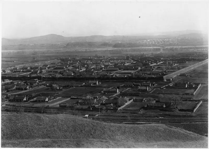
Photo adjustments
EXIF orientation normalized; resized without changing aspect ratio; converted to WebP. No subject edits.
- Administrative area
- County · 县
- Part of
- Fushun
- Chinese name
- 抚顺县
- Local areas
- County guide
Area & population
- Population · 2020 census
- 83,125
Source: cited geographic source, as of the dates shown.
History
The county government traces the old Fushun city to 1384, when a walled town was built under the Ming, followed in 1388 by a garrison post, the Fushun Qianhusuo (抚顺千户所). In 1778 the Qing rebuilt the city about one li south of the Ming site. In 1908 the seat of Xingren County (兴仁县) moved from Shenyang to Fushun and the county took the name Fushun. Coal mining began in 1901, and after the Russo-Japanese War the coalfield came under Japanese occupation. The county was abolished in 1952 and set up again in 1961. It is home to 15 ethnic minorities, among them Manchu, Korean, Mongol and Xibe people.
What to see
Sankuaishi National Forest Park (三块石国家森林公园) takes its name from three huge rocks standing together on a summit. It covers 108.7 square kilometres with 112 peaks, the highest at 1,131 metres, split between a southern area in Hou'an (后安镇) and a northern area in Tangtu (汤图乡). Named spots include the Bailongtan waterfall (白龙潭瀑布), Pigeon Cave (鸽子洞) and the Sankuaishi Reservoir. The county government says the area played an important part in the war against Japan, when it was called "a beacon behind enemy lines in Liaodong (辽东)", and it is now a base for honouring Yang Jingyu (杨靖宇).
Tiannü Mountain (天女山), locally called Wailazi (歪砬子), rises to 780 metres in Majuanzi township (马圈子乡) and is known for the Tiannü magnolia (天女木兰) and wild mushrooms; Chongxing Temple (重兴寺) lies on the same tourist loop. Guanshan Lake (关山湖), a national water-conservancy scenic area on the upper Dongzhou River (东洲河) 22 kilometres southeast of urban Fushun, has 3 square kilometres of water where egrets and wild ducks live year-round.
Food and local products
Around Tiannü Mountain the farmhouse cooking is led by a local folk banquet called "Sanliu Daodi" (三六到底), and frog is eaten in winter. Pollution-free, green and organic grain is grown in a cluster centred on the Dahuofang (大伙房) water-source protection zone, and 29 pick-your-own farms are open to visitors.
Highlights
- Sankuaishi National Forest Park 三块石国家森林公园: 108.7 square kilometres, 112 peaks, main peak 1,131 metres; rated 4A in 2017.
- Tiannü Mountain 天女山: 780-metre peak known for the Tiannü magnolia and wild mushrooms.
- Guanshan Lake 关山湖: National water-conservancy scenic area on the upper Dongzhou River.
Sources for this guide
县情简介 - 抚顺县人民政府 · Fushun County People's Government
人文历史 - 抚顺县人民政府 · Fushun County People's Government
三块石国家森林公园 - 抚顺县人民政府 · Fushun County People's Government
关山湖国家水利风景区 - 抚顺县人民政府 · Fushun County People's Government
天女山风景区 - 抚顺县人民政府 · Fushun County People's Government
Original English written from the listed sources and checked sentence by sentence against quoted extracts by a separate reviewer. Updated 2026-09-26.
Explore Fushun County
Core places to explore, with English and Chinese names.
Fushun County 抚顺县
Plan your visit
Getting there
Fushun County is about 10 km in a straight line from central Fushun. Search for 抚顺县 in a map app to find stations and your accommodation.
Where to stay →More in Fushun
Sources & geographic information
Administrative names and parent areas: Official geographic directory · Reference date 2026-09-06.
Map data © OpenStreetMap contributors. Pins mark approximate centres, not entrances or boundaries.