


Get to know Qingyuan Manchu Autonomous County
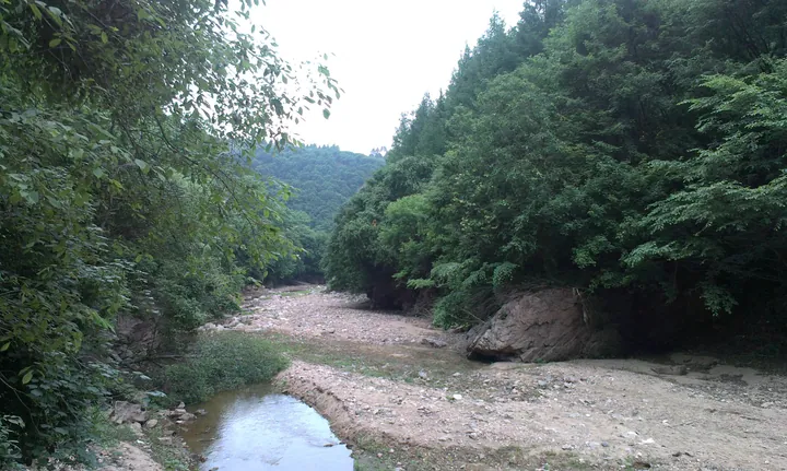
Photo adjustments
Full frame retained; proportionally resized and converted to WebP. No retouching or changes to the photographed subject. Card displays may crop the view.
- Administrative area
- Autonomous county · 自治县
- Part of
- Fushun
- Chinese name
- 清原满族自治县
- Local areas
- Autonomous county guide
Area & population
- Area in the source
- 3,921.00 km²
- Population · 2020 census
- 238,890
- Administrative seat
- Qingyuan
Source: cited geographic source, as of the dates shown.
Setting and landscape
Mountains make up 82.7 percent of the county, flat land 13.8 percent and water 3.5 percent, a mix summed up locally as "eight parts mountain, one part water, one part field". The land is higher in the southeast. The highest peak is Longgang (龙岗) in the south, at 1,100.1 metres, followed by Morihong (莫日红) in the north at 1,013.4 metres. Four rivers rise here: the Hun (浑河), Qing (清河), Chai (柴河) and Liu (柳河). The Hun runs 83 kilometres through the county and forms the uppermost reach of the Dahuofang Reservoir (大伙房水库).
Winters are cold and summers hot: January averages -16°C against 22.9°C in July, and the frost-free season lasts about 130 days, falling to 110 to 120 days in the high mountains of the east and south.
History
The county gazetteer dates Qingyuan's administration to 1925, with the county formally in place by 1928. It was put together from districts and villages taken out of Xinbin (新宾), Tieling (铁岭), Kaiyuan (开原), Hailong (海龙) and Liuhe (柳河) counties. The Wandianzi (湾甸子) area moved back and forth between Qingyuan and Xinbin after 1945, and the gazetteer records no change to the county's extent since 1957.
What to see
The county promotes Red River Gorge rafting (红河峡谷漂流) as a tourism brand; Fushun city opened its 2025 summer tourism season there on 22 June 2025. On the same river (红河), the Nantianmen scenic area (南天门风景区) held a Dragon Boat Festival race in 2019 in which ten traditional crews raced 400 metres. Kuangzigou (筐子沟) was named one of Liaoning's fifty best scenic areas chosen by visitors at the 2019 Liaoning tourism and photography festival.
Food and local products
Farms grow rice, soybeans, maize and sorghum. Wild fern shoots, wild celery, hardy kiwi (软枣子) and hazelnuts grow in the woods and on the hillsides, and 560 kinds of wild medicinal plant have been recorded, among them schisandra (五味子), a Liaoning specialty known as "Liao wuwei" (辽五味). The county is one of Liaoning's main sources of white willow for wickerwork.
Highlights
- Red River Gorge rafting 红河峡谷漂流: Site of Fushun's 2025 summer tourism opening on 22 June 2025.
- Nantianmen scenic area 南天门风景区: Held a Dragon Boat Festival race on the Red River in 2019 with ten crews.
- Kuangzigou 筐子沟: Named one of Liaoning's fifty best scenic areas chosen by visitors in 2019.
- Liao schisandra 辽五味: Liaoning specialty among 560 wild medicinal plants recorded in the county.
Sources for this guide
清原概况 - 抚顺市清原满族自治县人民政府 · Qingyuan Manchu Autonomous County People's Government
自然概况 - 抚顺市清原满族自治县人民政府 · Qingyuan Manchu Autonomous County People's Government (from the Qingyuan county gazetteer)
“抚顺之夏 山水如画”2025抚顺市夏季旅游启动暨红河峡谷漂流开漂仪式在清原举行 · Qingyuan Manchu Autonomous County People's Government
筐子沟景区荣获游客喜爱五十佳景区称号 · Qingyuan Manchu Autonomous County People's Government
南天门风景区举行大苏河2019端午节龙舟赛 · Qingyuan Manchu Autonomous County People's Government
Original English written from the listed sources and checked sentence by sentence against quoted extracts by a separate reviewer. Updated 2026-09-26.
Explore Qingyuan Manchu Autonomous County
Core places to explore, with English and Chinese names.
Places to explore around Qingyuan Manchu Autonomous County
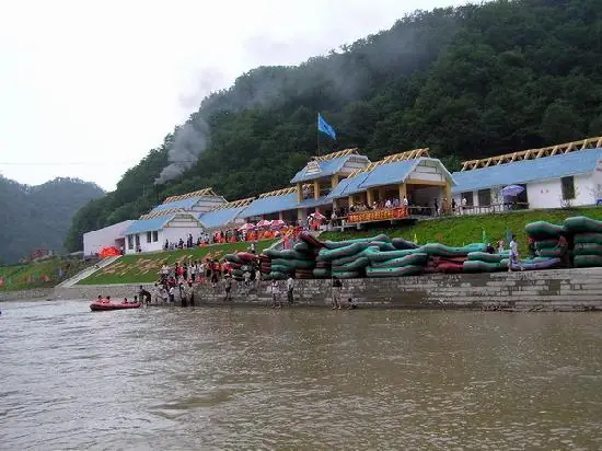 Honghe Valley Rafting ·
 Plan your visit
Getting there
Qingyuan Manchu Autonomous County is about 85 km in a straight line from central Fushun. Search for 清原满族自治县 in a map app to find stations and your accommodation.
Where to stay →Build your route
Start with Honghe Valley Rafting. The linked place guides have entrance and visit details.
Continue with Fushun →More in Fushun
Sources & geographic information
Administrative names and parent areas: Official geographic directory · Reference date 2026-09-06.
Photo: Honghe Valley Rafting · Source photographer · License not provided. EXIF orientation normalized; resized without changing aspect ratio; converted to WebP. No subject edits.
Map data © OpenStreetMap contributors. Pins mark approximate centres, not entrances or boundaries.