


Get to know Dongzhou District
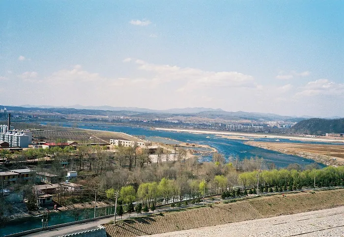
Photo adjustments
Full frame retained; proportionally resized and converted to WebP. No retouching or changes to the photographed subject. Card displays may crop the view.
- Administrative area
- District · 市辖区
- Part of
- Fushun
- Chinese name
- 东洲区
- Local areas
- District guide
Area & population
- Area in the source
- 603.50 km²
- Population · 2020 census
- 236,731
- Administrative seat
- Dongzhou Subdistrict (东洲街道)
Source: cited geographic source, as of the dates shown.
Setting and landscape
The district is hill and mountain country on the Longgang range (龙岗山脉) of the Changbai mountains (长白山), higher in the east and falling to the west. Its built-up area sits on the alluvial plain of the Hun River (浑河), which runs from east to west along the north side of town. The highest point is Beidapo Mountain (北大迫山) in Hada (哈达镇) at 710 metres. The Dahuofang Reservoir (大伙房水库), which supplies drinking water to seven cities in Liaoning, lies within the district, and the Dongzhou River (东洲河) also crosses it.
History
In November 1945 district governments were set up in the area around the Longfeng (龙凤矿) and Laohutai (老虎台矿) mines. The Ministry of Civil Affairs approved the change from Lutian to Dongzhou on 16 June 1999. The new name came from the district's busiest subdistrict, reads as "an oasis in the east", and recalls Dongzhoubu (东洲堡), a Qing garrison post on the Dongzhou River.
The district presents itself as the birthplace of China's shantytown redevelopment: in 2005 Li Keqiang (李克强), then Liaoning party secretary, visited the Modi (莫地) shanty area, setting off a wave of rebuilding. The Fushun Petrochemical (抚顺石化) refinery and ethylene complex is also here.
What to see
Most scenery lies in the eastern hills. The Sarhu scenic area (萨尔浒风景区), rated 3A, covers 268 square kilometres, 110 of them water, and is known as the ground where Nurhaci (努尔哈赤) directed the Battle of Sarhu. Zihualing (紫花岭风景区), also 3A, is used for hiking and fruit picking and is known for purple flowers in spring.
Getting oriented
The Shenyang-Jilin railway (沈吉铁路) and National Highway 202 run side by side through the district, and the Shenyang-Jilin Expressway (沈吉高速公路) has an exit at Zhangdang (章党).
Highlights
- Sarhu scenic area 萨尔浒风景区: 3A area of 268 square kilometres where Nurhaci directed the Battle of Sarhu.
- Zihualing scenic area 紫花岭风景区: 3A hill area for hiking and fruit picking, with purple flowers in spring.
- Dahuofang Reservoir 大伙房水库: Supplies drinking water to seven Liaoning cities.
Sources for this guide
东洲概况 - 抚顺市东洲区人民政府 · Dongzhou District People's Government, Fushun
人文历史 - 抚顺市东洲区人民政府 · Dongzhou District People's Government, Fushun
资源概况 - 抚顺市东洲区人民政府 · Dongzhou District People's Government, Fushun
Original English written from the listed sources and checked sentence by sentence against quoted extracts by a separate reviewer. Updated 2026-09-26.
Explore Dongzhou District
Core places to explore, with English and Chinese names.
Dongzhou District 东洲区
Plan your visit
Getting there
Dongzhou District is about 7 km in a straight line from central Fushun. Search for 东洲区 in a map app to find stations and your accommodation.
Where to stay →More in Fushun
Sources & geographic information
Administrative names and parent areas: Official geographic directory · Reference date 2026-09-06.
Map data © OpenStreetMap contributors. Pins mark approximate centres, not entrances or boundaries.