


Get to know Faku County
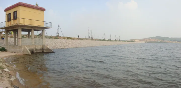
Photo adjustments
Full frame retained; proportionally resized and converted to WebP. No retouching or changes to the photographed subject. Card displays may crop the view.
- Administrative area
- County · 县
- Part of
- Shenyang
- Chinese name
- 法库县
- Local areas
- County guide
Area & population
- Area in the source
- 2,285.00 km²
- Population · 2020
- 340,933
Source: cited geographic source, as of the dates shown.
Setting and landscape
The last spurs of the Yiwulü (医巫闾山) and Changbai (长白山) ranges meet here, and the Songnen and Liao River plains join. The ground rises to the west and north, and the county counts 382 hills and nearly a hundred rivers; the Xiushui (秀水河), Lama (拉马河) and Wang (王河) rivers join the Liao on the southern border. The highest point is Miaotai Peak (庙台山) on Baerhu Mountain, 447.2 m, which the county gives as the highest peak in Shenyang. Cai Lake (财湖) and Lingshan Lake (灵山湖) are among its 23 reservoirs. Wild Siberian cranes (白鹤), common cranes and oriental storks live here, and Faku is called the 'home of the Siberian crane' (白鹤之乡).
History
The county government traces human settlement back more than 6,000 years, and in the late Han and Jin periods the area was a range of the Murong branch of the Xianbei (鲜卑慕容部). Under the Shunzhi and Kangxi emperors the Qing built the Willow Palisade (柳条边) across Faku from east to west; the Faku gate was one of the twelve gates on its western section, which gave Faku the names 'Liusai' (柳塞, 'willow frontier') and Fakumen (法库门). A sub-prefecture was created in 1906 and became Faku County in 1913. The county passed from Tieling (铁岭) to Shenyang in January 1993.
What to see
Baerhu Mountain (巴尔虎山), a 3A scenic area, was a sacred mountain of the Liao dynasty, then called Shixiong Mountain (石熊山, 'stone bear'); its Mongolian name means 'lush vegetation'. Among its 99 peaks are the ruins of several old temples and a Liao beacon tower. The villages at its foot, Wangyeling (王爷陵村) and Gongzhuling (公主陵村), recall Qing marriages between the Manchu court and Mongol nobles; the site of the Qing minister Senggerinchin's (僧格林沁) tombstone at Gongzhuling is protected at city level. At Sijiazi village (四家子村) are the remains of Zongzhou (宗州城), a private walled town built by the Liao chancellor Han Derang (韩德让).
Food and local products
Faku beef, Wulongshan grapes (五龙山葡萄) and Baerhushan hawthorn (巴尔虎山山楂) are national geographical-indication farm products, and Yemaotai peanuts (叶茂台花生) are a known local crop. Below ground, the county government lists China's largest reserves of porcelain clay; in 1976, 200 tonnes of Faku white porcelain clay were supplied for the Chairman Mao Memorial Hall in Beijing.
Getting oriented
The county town is 90 km north of Shenyang and 45 km west of Tieling. National highways 101 and 203 and the Shenyang–Kangping, Tieling–Chaoyang and Tieling–Xinmin expressways cross the county.
Highlights
- Baerhu Mountain 巴尔虎山: Liao sacred mountain; Miaotai Peak, 447.2 m, is Shenyang's highest point.
- Zongzhou city site 宗州城: Private walled town of the Liao chancellor Han Derang at Sijiazi village.
- Senggerinchin tombstone site 僧格林沁墓碑遗址: City-level protected site at Gongzhuling village.
- Wulongshan grapes 五龙山葡萄: National geographical-indication product.
- Faku beef 法库牛肉: Beef from Faku, registered as a national geographical-indication farm product.
Sources for this guide
自然概况-自然概况-法库县人民政府 · Faku County People's Government
历史沿革-历史沿革-法库县人民政府 · Faku County People's Government
巴尔虎山简介-景区景点-法库县人民政府 · Faku County People's Government
法库县 - 维基百科,自由的百科全书 · Chinese Wikipedia · CC BY-SA 4.0
Original English written from the listed sources and checked sentence by sentence against quoted extracts by a separate reviewer. Updated 2026-09-26.
Explore Faku County
Core places to explore, with English and Chinese names.
Places to explore around Faku County
 AI illustration · AI
 Plan your visit
Getting there
Faku County is about 75 km in a straight line from central Shenyang. Search for 法库县 in a map app to find stations and your accommodation.
Where to stay →Build your route
Start with Liaohe Qixing Mountain. The linked place guides have entrance and visit details.
Continue with Shenyang →More in Shenyang
Sources & geographic information
Administrative names and parent areas: Official geographic directory · Reference date 2026-09-06.
Some facts checked against 法库县 — Wikipedia contributors, CC BY-SA 4.0.
Map data © OpenStreetMap contributors. Pins mark approximate centres, not entrances or boundaries.