


Get to know Shenbei New Area
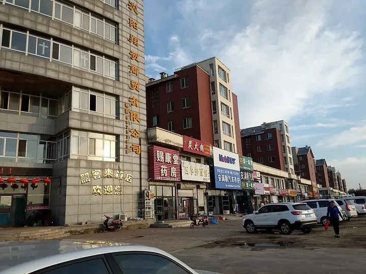
Photo adjustments
Full frame retained; proportionally resized and converted to WebP. No retouching or changes to the photographed subject. Card displays may crop the view.
- Administrative area
- District · 市辖区
- Part of
- Shenyang
- Chinese name
- 沈北新区
- Local areas
- District guide
Area & population
- Area in the source
- 878.00 km²
- Population · 2020
- 619,375
Source: cited geographic source, as of the dates shown.
Setting and landscape
Fushun (抚顺) and Tieling adjoin the district to the east, and Yuhong District (于洪区) and Xinmin (新民) to the west. Qixing Mountain (七星山) and Maoshan (帽山) rise inside the district, and some twenty rivers, among them the Liao and the Pu (蒲河), run through it. The Liaohe Qixing National Wetland Park (辽河七星国家湿地公园) and the Qixing Lake (七星湖) area make up its northern wetland zone.
History
In 1948 the old Shenyang County was abolished and its northern part became Xinchengzi District (新城子区), named after its seat. With the approval of the Ministry of Civil Affairs in October 2006, Xinchengzi was renamed Shenbei New Area and merged with the Huishan (辉山) agricultural high-tech zone, the Hushitai (虎石台) economic zone and the Daoyi (道义) technology zone.
What to see
The Shenyang Guaipo (沈阳怪坡) scenic area in Magang subdistrict (马刚街道), a national 4A site, centres on a "strange slope" found in 1990; the Liaoning provincial government notes it runs high in the west and low in the east, and the area also has a Siberian tiger park and a 330-metre glass viewing bridge. Daomeng Kongjian (稻梦空间), rated 4A in 2022, is a farm park known for pictures planted in rice paddies, in the Xibe (锡伯族) town of Xinglongtai (兴隆台), which carries the title "China's First Xibe Town" (中华锡伯族第一镇).
Fantawild Adventure (方特欢乐世界) is the district's third 4A attraction, while Qixing Lake, Hailanxing (海蓝星) and the Beitang hot springs (北汤温泉) are rated 3A. The Beitang and Qinghe Peninsula (清河半岛) hot springs form the district's spa area.
Getting oriented
The Beijing–Harbin and Harbin–Dalian expressways pass through the district. Shenbei is also Shenyang's university town, with Liaoning University (辽宁大学), Shenyang Aerospace University (沈阳航空航天大学) and China Medical University (中国医科大学) among seven universities here. The area is also a centre of food processing and aerospace industry. Qingshui rice (清水大米) from the district is a Chinese geographical-indication product.
Highlights
- Shenyang Guaipo scenic area 沈阳怪坡风景区: National 4A area around a 'strange slope' found in 1990, with a tiger park and a 330 m glass bridge.
- Daomeng Kongjian 稻梦空间: 4A farm park known for rice-paddy art, in the Xibe town of Xinglongtai.
- Liaohe Qixing National Wetland Park 辽河七星国家湿地公园: Anchor of the district's northern wetland zone.
- Beitang hot springs 北汤温泉: 3A-rated hot-spring area.
Sources for this guide
-区情简介-沈阳市沈北新区人民政府 · Shenbei New Area People's Government, Shenyang
-沈北全域文旅示范区-沈阳市沈北新区人民政府 · Shenbei New Area People's Government, Shenyang
沈阳怪坡风景区(4A) · Liaoning Provincial People's Government (Department of Culture and Tourism)
辽宁省新增4家国家4A级旅游景区_总台东北振兴频道_央视网(cctv.com) · CCTV
沈北新区 - 维基百科,自由的百科全书 · Wikipedia (Chinese) · CC BY-SA 4.0
Original English written from the listed sources and checked sentence by sentence against quoted extracts by a separate reviewer. Updated 2026-09-25.
Explore Shenbei New Area
Core places to explore, with English and Chinese names.
Shenbei New Area 沈北新区
Plan your visit
Getting there
Shenbei New Area is about 30 km in a straight line from central Shenyang. Search for 沈北新区 in a map app to find stations and your accommodation.
Where to stay →More in Shenyang
Sources & geographic information
Administrative names and parent areas: Official geographic directory · Reference date 2026-09-06.
Some facts checked against 沈北新区 — Wikipedia contributors, CC BY-SA 4.0.
Map data © OpenStreetMap contributors. Pins mark approximate centres, not entrances or boundaries.