


Get to know Kaiyuan
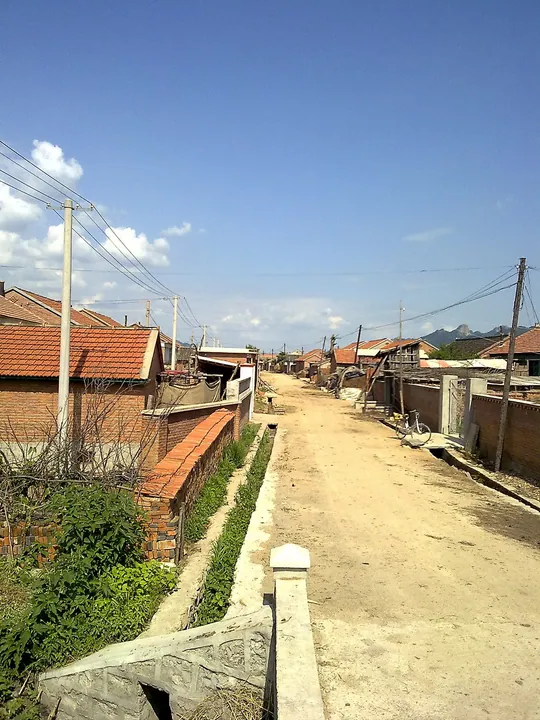
Photo adjustments
Full frame retained; proportionally resized and converted to WebP. No retouching or changes to the photographed subject. Card displays may crop the view.
- Administrative area
- County-level city · 县级市
- Part of
- Tieling
- Chinese name
- 开原市
- Local areas
- County-level city guide
Area & population
- Area in the source
- 2,813.30 km²
- Population · 2020
- 460,927
Source: cited geographic source, as of the dates shown.
Setting and landscape
The land falls from east to west. The southeast is mountainous, on a spur of the Changbai Mountains (长白山), while the west belongs to the flat alluvial plain of the Qing River (清河) and the Liao, and the centre is half plain, half hills. Besides the Liao and the Qing, the main rivers are the Kou (寇河) and the Chai (柴河).
History
In 1019 the Liao raised a fortified town here to Xianzhou (咸州). A Liaoning Daily report on archaeological findings counts Kaiyuan among the province's many cities first built under the Liao, and gives the walls of the Xianzhou city at Laocheng a circuit of about 6.5 kilometres. The Jurchen leader Wanyan Aguda (完颜阿骨打) took Xianzhou at the end of 1114 and proclaimed his Jurchen state on the first day of 1115. The same newspaper says that under the Jin the city, as Xianping (咸平), was raised to a leading city because shipping on the Liao River flourished.
The place name dates from the Yuan: the seat of Kaiyuan Circuit (开元路) moved to Xianping in 1342, and the town became known as Kaiyuan. In the Ming it was the seat of the northern route of the Great Wall defences, and through its tribute passes and four horse markets it oversaw Jurchen states such as Hada (哈达) and Yehe (叶赫) and the Mongol tribes. Nurhaci (努尔哈赤) captured it in 1619; in 1664 the Qing made it one of the first four counties of Fengtian prefecture. Kaiyuan became a county-level city in 1989.
What to see
The Chongshou Temple Pagoda (崇寿寺塔) stands in the southwest corner of the old town. Begun late in the Liao and finished early in the Jin, it is a solid brick pagoda of 13 octagonal tiers with close-set eaves, 45.82 metres high, with a Buddha image in a niche on each of its eight faces. It was among Liaoning's first provincial heritage sites in 1963 and became a national key cultural relic in 2019.
Highlights
- Chongshou Temple Pagoda 崇寿寺塔: 45.82-metre, 13-tier octagonal brick pagoda of the late Liao to early Jin; national key cultural relic since 2019.
- Laocheng old town 老城: Site of Liao-dynasty Xianzhou, with walls about 6.5 kilometres round.
Sources for this guide
开原市 · Wikipedia (Chinese) · CC BY-SA 4.0
开原崇寿寺塔 · Wikipedia (Chinese) · CC BY-SA 4.0
古城遗址考古成果与史料记载相印证——我省很多城市始建于辽代 · Liaoning Daily (reporter Zhu Zhonghe), republished by the Liaoning Provincial Department of Culture and Tourism
Original English written from the listed sources and checked sentence by sentence against quoted extracts by a separate reviewer. Updated 2026-09-26.
Explore Kaiyuan
Core places to explore, with English and Chinese names.
Plan your visit
Getting there
Kaiyuan is about 45 km in a straight line from central Tieling. Search for 开原市 in a map app to find stations and your accommodation.
Where to stay →More in Tieling
Sources & geographic information
Administrative names and parent areas: Official geographic directory · Reference date 2026-09-06.
Some facts checked against 开原市 — Wikipedia contributors, CC BY-SA 4.0.
Some facts checked against 开原崇寿寺塔 — Wikipedia contributors, CC BY-SA 4.0.
Map data © OpenStreetMap contributors. Pins mark approximate centres, not entrances or boundaries.