


Get to know Tieling County
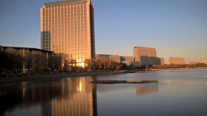
Photo adjustments
Full frame retained; proportionally resized and converted to WebP. No retouching or changes to the photographed subject. Card displays may crop the view.
- Administrative area
- County · 县
- Part of
- Tieling
- Chinese name
- 铁岭县
- Local areas
- County guide
Area & population
- Area in the source
- 2,243.00 km²
- Population · 2020 census
- 324,383
Source: cited geographic source, as of the dates shown.
History
The Liao dynasty called the area Yinzhou (银州); the name Tieling dates from the Ming, when a military garrison was moved here, and the Qing replaced the garrison with a county. The county government counts among its people the painter Gao Qipei (高其佩), known for finger painting, and the Ming general Li Chengliang (李成梁). It names Yaopu town (腰堡镇) as the ancestral home outside the Great Wall of Cao Xueqin (曹雪芹), author of the first eighty chapters of Dream of the Red Chamber; the site of the Cao family's old house survives at Fanjiatun (范家屯). Gao E (高鹗), who completed the novel's last forty chapters, also traced his family to the county.
The Cuizhenpu mountain city (催阵堡山城) at Liqianhu town (李千户镇), on the north bank of the Fan River, is a Goguryeo military stronghold with earth-and-stone walls up to 6 to 7 metres high and a perimeter of 5,200 metres. Also in Liqianhu town, the Li Chengliang family tombs keep Tieling's only group of Ming stone sculptures: pairs of lions, horses and civil and military officials.
What to see
Lei Feng (雷锋) spent the last 170 days of his working life at Xiashibeishan village (下石碑山村) in Hengdaohezi town (横道河子镇), where a memorial hall now covers his time in Tieling. In the same town, Xiang'er Mountain (想儿山) is tied to a legend of Nurhaci (努尔哈赤) grieving for his executed son Cuyen (褚英).
Chaihe Reservoir (柴河水库) lies in the middle of the county, with Qingyun Temple (青云寺) built against a cliff and forest cover the county government puts above 95 per cent. Zhenziling Reservoir (榛子岭水库), a national 2A-rated scenic area at Jiguanshan township (鸡冠山乡), holds 32 named spots including Sanxian Cave (三仙洞). Gunmaling (滚马岭), at 703 metres the highest peak in the Tieling area, is the source of the Fan River and a provincial nature reserve. Datai Mountain (大台山), a lone 225-metre peak with the Liao River (辽河) winding past, in Zhenxipu town (镇西堡镇), carries the Baoyuan Palace (抱元宫) temple.
Food
Dadianzi town (大甸子镇) in the hilly east is known for Dadianzi mutton soup (大甸子羊汤), made from goats raised locally on Inner Mongolian lamb stock. Local tradition says the soup revived the Tang general Xue Rengui (薛仁贵) during his eastern campaign. Since 2006 the town has held twenty mutton-soup culture and tourism festivals, and it has registered the name as a trademark.
Highlights
- Cuizhenpu mountain city 催阵堡山城: Goguryeo military stronghold on the north bank of the Fan River, with walls 5,200 metres round.
- Tieling Lei Feng Memorial Hall 铁岭雷锋纪念馆: At Xiashibeishan village, where Lei Feng worked for the last 170 days of his life.
- Chaihe Reservoir 柴河水库: Reservoir in the centre of the county with a cliffside temple, Qingyun Temple.
- Gunmaling 滚马岭: 703-metre peak, highest in the Tieling area and source of the Fan River.
- Dadianzi mutton soup 大甸子羊汤: Goat soup from Dadianzi town, which has held twenty festivals for it since 2006.
Sources for this guide
地理位置 · Tieling County People's Government
历史沿革 · Tieling County People's Government
县域文化 · Tieling County People's Government
历史文化宗教 · Tieling County People's Government
自然山水 · Tieling County People's Government
大甸子镇:传承发扬羊汤文化产业 助推全镇乡村旅游产业快速发展 · Tieling County People's Government
Original English written from the listed sources and checked sentence by sentence against quoted extracts by a separate reviewer. Updated 2026-09-25.
Explore Tieling County
Core places to explore, with English and Chinese names.
Tieling County 铁岭县
Plan your visit
Getting there
Tieling County is about 5 km in a straight line from central Tieling. Search for 铁岭县 in a map app to find stations and your accommodation.
Where to stay →More in Tieling
Sources & geographic information
Administrative names and parent areas: Official geographic directory · Reference date 2026-09-06.
Map data © OpenStreetMap contributors. Pins mark approximate centres, not entrances or boundaries.