


Get to know Mangnai
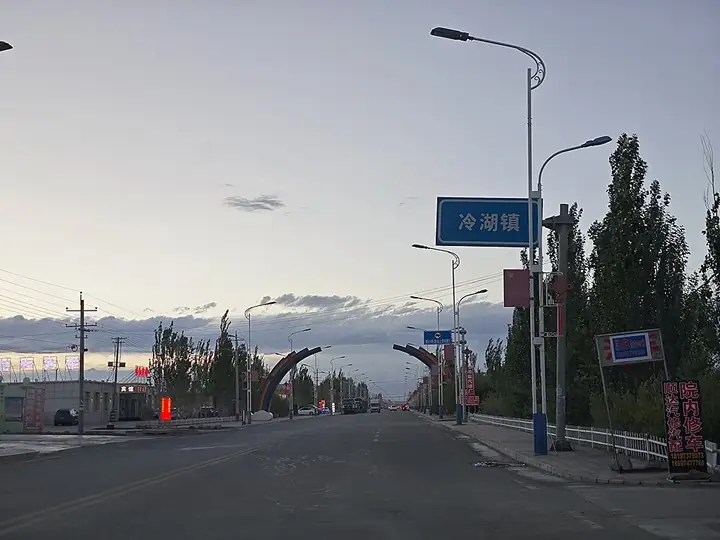
Photo adjustments
Full frame retained; resized proportionally to a maximum dimension of 960 pixels and converted to WebP quality 88. No crop, retouch, generated elements, or subject alteration. Final website rendition: full frame retained, proportionally resized to at most 720 pixels and converted to WebP. No additional retouching or subject alteration. Card displays may crop the view.
- Administrative area
- County-level city · 县级市
- Part of
- Haixi Mongol and Tibetan Autonomous Prefecture
- Chinese name
- 茫崖市
- Local areas
- County-level city guide
Area & population
- Area in the source
- 49,900.00 km²
- Population · 2020
- 18,856
- Administrative seat
- Huatugou
Source: cited geographic source, as of the dates shown.
Setting and landscape
The city borders the Da Qaidam (大柴旦) administrative area to the east and Golmud (格尔木市) to the south, and lies at an average altitude of 3,000 m. Its name, from Mongolian for "forehead", comes from Mangnai Lake (茫崖湖) inside the city. Wild yak, Tibetan wild ass, brown bear and black-necked crane are among more than 100 wild animal species recorded here. Mining of oil, mirabilite and asbestos carries the local economy.
History
Mangnai is a new city: in February 2018 the Ministry of Civil Affairs approved merging the Mangnai and Lenghu (冷湖) administrative committees into one county-level city, which opened in December 2018. The prefecture government lists the oil-field sites of Lenghu, among them the Dizhong No. 4 well (地中四井) and the Lenghu petroleum industry ruins, and the old workings of the Mangnai asbestos mine among the area's "red" heritage (红色资源).
What to see
Aiken Spring (艾肯泉), a 3A scenic area on the Aral (阿拉尔) grassland, is a sulphur-rich spring whose name is Mongolian for "source spring". It keeps flowing in winter, and its red water spreads in a pattern called "dragon's eye and phoenix feathers" before draining into Gas Kul Lake (尕斯库勒湖).
The Mangnai Emerald Lake (茫崖翡翠湖) in Huatugou (花土沟镇), the city seat, is a magnesium-sulphate salt lake; Xinhua describes its water as shades of jade green that change with mineral concentration. At Lenghu, the Mars Camp (冷湖火星营地) opened in March 2019 as a sealed "Mars capsule" modelled on the Mars-like terrain of the Eboliang yardangs (俄博梁雅丹). Lenghu is designated a dark-sky reserve, and telescope projects of the National Astronomical Observatories and the Purple Mountain Observatory are based there.
Getting oriented
Huatugou Airport serves the city, and the Qinghai–Xinjiang Highway and the Golmud–Dunhuang and Golmud–Korla railways cross its territory.
Highlights
- Aiken Spring 艾肯泉: A 3A sulphur spring whose red outflow drains into Gas Kul Lake.
- Mangnai Emerald Lake 茫崖翡翠湖: A magnesium-sulphate salt lake in Huatugou with water in shades of green.
- Lenghu Mars Camp 冷湖火星营地: A sealed Mars-style camp opened in 2019, modelled on the Eboliang yardangs.
Sources for this guide
茫崖市-海西州人民政府 · Haixi Mongol and Tibetan Autonomous Prefecture People's Government
艾肯泉景区 AAA-海西州人民政府 · Haixi Mongol and Tibetan Autonomous Prefecture People's Government
茫崖冷湖火星营地-海西州人民政府 · Haixi Mongol and Tibetan Autonomous Prefecture People's Government
茫崖市 - 维基百科,自由的百科全书 · Wikipedia (Chinese) · CC BY-SA 4.0
在茫崖翡翠湖,感受大自然神奇的色彩-新华网 · Xinhua (Qinghai channel)
Original English written from the listed sources and checked sentence by sentence against quoted extracts by a separate reviewer. Updated 2026-09-26.
Explore Mangnai
Core places to explore, with English and Chinese names.
Places to explore around Mangnai
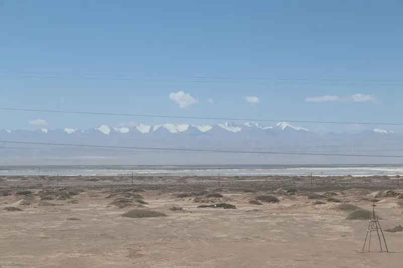 Mangya Emerald Lake · 茫崖翡翠湖
Mangya Emerald Lake茫崖翡翠湖
Mangya Emerald Lake lies southwest of Huatugou in the western Qaidam Basin. Green saltwater pools and white saline edges stand out against the surrounding desert, making it a distinct stop on a Mangya journey. It is…
Read the place guide →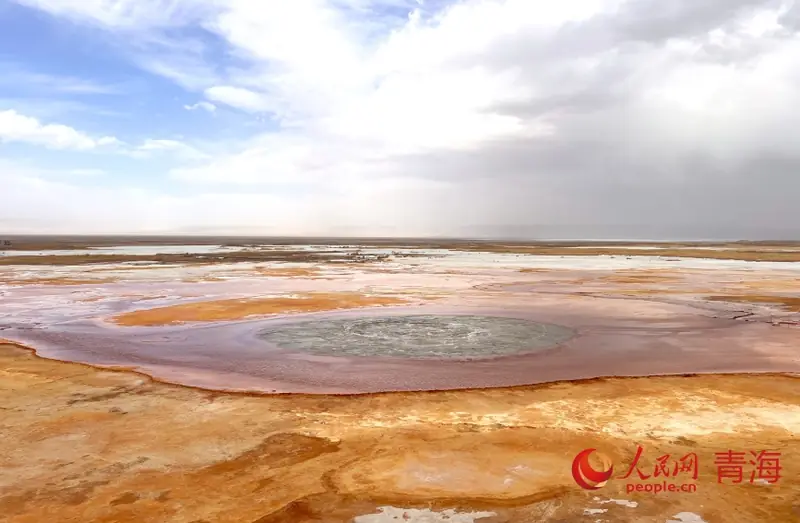 Aiken Spring Viewing Area · 艾肯泉开放观景区
Aiken Spring Viewing Area艾肯泉开放观景区
Aiken Spring (艾肯泉) is a mineral spring in Mohe'erbuleke village, Huatugou town, Mangya city, Haixi Mongolian and Tibetan Autonomous Prefecture, Qinghai, whose ringed red-brown and gold deposits and round spring mouth seen from the air have given it the names "eye of the earth" and "devil's eye".
Read the place guide →Plan your visit
Getting there
Mangnai is about 580 km in a straight line from central Haixi Mongol and Tibetan Autonomous Prefecture. Search for 茫崖市 in a map app to find stations and your accommodation.
Where to stay →Build your route
Mangya Emerald Lake and Aiken Spring Viewing Area are both listed here. The linked place guides have entrance and visit details.
Continue with Haixi Mongol and Tibetan Autonomous Prefecture →More in Haixi Mongol and Tibetan Autonomous Prefecture
Sources & geographic information
Administrative names and parent areas: Official geographic directory · Reference date 2026-09-06.
Some facts checked against 茫崖市 — Wikipedia contributors, CC BY-SA 4.0.
Photo: Mangya Emerald Lake · Source photographer · License not provided. EXIF orientation normalized; resized without changing aspect ratio; converted to WebP. No subject edits.

Photo: Aiken Spring Viewing Area · Source photographer · License not provided. EXIF orientation normalized; resized without changing aspect ratio; converted to WebP. No subject edits.
Map data © OpenStreetMap contributors. Pins mark approximate centres, not entrances or boundaries.