


Get to know Lueyang County
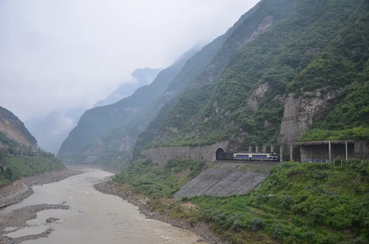
Photo adjustments
Full frame retained; proportionally resized and converted to WebP. No retouching or changes to the photographed subject. Card displays may crop the view.
- Administrative area
- County · 县
- Part of
- Hanzhong
- Chinese name
- 略阳县
- Local areas
- County guide
Area & population
- Area in the source
- 2,831.00 km²
- Population · 2019
- 178,828
Source: cited geographic source, as of the dates shown.
Forests and stream valleys
Wulongdong Forest Park (五龙洞国家森林公园) provides a close view of the county’s mountain terrain. Its wooded slopes are crossed by stream valleys, with fallen leaves covering paths through the forest. A mountain-running event held here in 2026 followed routes through forests, mountains and valleys.
A borderland crossroads
The county was established in 111 BCE, during the Western Han dynasty (西汉). It borders Gansu (甘肃) to the west and north, while its cultural setting reflects the adjoining regions of Shaanxi, Gansu and Sichuan (四川). The Baoji–Chengdu Railway (宝成铁路) runs north–south through the county; National Highway 345 (345国道) and the Shiyan–Tianshui Expressway (十天高速公路) cross it east–west.
Sources for this guide
走进略阳-略阳县人民政府 · Lueyang County Government
穿林海 越山巅 登高峰!这场千人的盛会沸腾了略阳穿林海 越山巅 登高峰!这场千人的盛会沸腾了略阳 - 略阳县人民政府 · Lueyang County Government / County Media Centre
Original English written from the listed sources and checked sentence by sentence against quoted extracts by a separate reviewer. Updated 2026-09-27.
Explore Lueyang County
Core places to explore, with English and Chinese names.
Lueyang County 略阳县
Plan your visit
Getting there
Lueyang County is about 85 km in a straight line from central Hanzhong. Search for 略阳县 in a map app to find stations and your accommodation.
Where to stay →More in Hanzhong
Sources & geographic information
Administrative names and parent areas: Official geographic directory · Reference date 2026-09-06.
Map data © OpenStreetMap contributors. Pins mark approximate centres, not entrances or boundaries.