


Get to know Lingcheng District
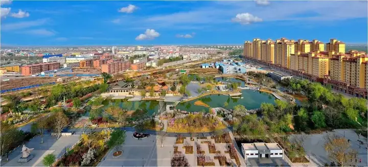
Photo adjustments
EXIF orientation normalized; resized without changing aspect ratio; converted to WebP. No subject edits.
- Administrative area
- District · 市辖区
- Part of
- Dezhou
- Chinese name
- 陵城区
- Local areas
- District guide
Area & population
- Area in the source
- 1,213.00 km²
- Population · 2019
- 451,000
Source: cited geographic source, as of the dates shown.
Rivers and landscape
The Majia River (马颊河) crosses the middle of Lingcheng District and serves as its principal drainage and irrigation river. The Dehui New River (德惠新河), in the southeast, was excavated in 1968. Both main channels run from southwest to northeast, linking the district’s low plain through a network of tributaries.
Historic sites
The Shentou Tomb Group (神头墓群), in Shentou Town (神头镇), dates to the Han dynasty. The remains of Yanci Ancient City (厌次故城) are also in Shentou Town and are dated to the Qin and Han dynasties in the district government’s heritage register. Lingcheng Lingxing Gate (陵城棂星门) is listed as Ming dynasty architecture. The modern district replaced Ling County (陵县) in 2014.
Sources for this guide
中国·陵城区--陵城区政府门户网站 · Lingcheng District Government
德州市陵城区省、市、县三级文物保护单位名录 · Lingcheng District Government
中国·陵城区--陵城区政府门户网站 · Lingcheng District Government
Original English written from the listed sources and checked sentence by sentence against quoted extracts by a separate reviewer. Updated 2026-09-26.
Explore Lingcheng District
Core places to explore, with English and Chinese names.
Lingcheng District 陵城区
Plan your visit
Getting there
Lingcheng District is about 20 km in a straight line from central Dezhou. Search for 陵城区 in a map app to find stations and your accommodation.
Where to stay →More in Dezhou
Sources & geographic information
Administrative names and parent areas: Official geographic directory · Reference date 2026-09-06.
Map data © OpenStreetMap contributors. Pins mark approximate centres, not entrances or boundaries.