


Get to know Pingyuan County
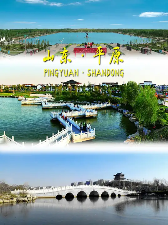
Photo adjustments
EXIF orientation normalized; resized without changing aspect ratio; converted to WebP. No subject edits.
- Administrative area
- County · 县
- Part of
- Dezhou
- Chinese name
- 平原县
- Local areas
- County guide
Area & population
- Area in the source
- 1,047.00 km²
- Population · 2019
- 447,000
Source: cited geographic source, as of the dates shown.
What to see
Pipa Bay (琵琶湾) occupies a central part of the county town. Its waterbody has the outline of a pipa, the Chinese plucked instrument. The scenic area connects the Luobei Main Canal (洛北干渠) on its eastern side with the Duma River (笃马河) on the west. Grass lawns, woodland and lakes form the main landscape, with Qilong Bridge (起龙桥), waterside viewing areas and an outdoor music theatre among its features.
Heritage and local food
Pingyuan County retains the Longmen Stone Carving (龙门石刻), Wenchang Pavilion (文昌阁), Thousand Buddha Pagoda (千佛塔) and Senluo Hall Site (森罗殿遗址). Its local intangible heritage includes Tongde Vinegar Brewing (通德醋传统酿造技艺), Encheng Qianzi Steamed Buns (恩城签子馒头), Beiren Braised Chicken (北任扒鸡) and Pingyuan Old Tofu (平原老豆腐).
Explore Pingyuan County
Core places to explore, with English and Chinese names.
Pingyuan County 平原县
Plan your visit
Getting there
Pingyuan County is about 30 km in a straight line from central Dezhou. Search for 平原县 in a map app to find stations and your accommodation.
Where to stay →More in Dezhou
Sources & geographic information
Administrative names and parent areas: Official geographic directory · Reference date 2026-09-06.
Map data © OpenStreetMap contributors. Pins mark approximate centres, not entrances or boundaries.