


Get to know Zhifu District

Photo adjustments
Full frame retained; resized proportionally to a maximum dimension of 960 pixels and converted to WebP quality 88. No crop, retouch, generated elements, or subject alteration. Final website rendition: full frame retained, proportionally resized to at most 720 pixels and converted to WebP. No additional retouching or subject alteration. Card displays may crop the view.
- Administrative area
- District · 市辖区
- Part of
- Yantai
- Chinese name
- 芝罘区
- Local areas
- District guide
Area & population
- Area in the source
- 179.20 km²
- Population · 2017
- 701,000
Source: cited geographic source, as of the dates shown.
Setting and landscape
The district is ringed by hills on three sides and open to the sea on the fourth. The south and west are fairly flat, while the northern shore is a broken line of headlands and bays that forms four large natural harbours. The island's shape is said to resemble a giant lingzhi fungus, which gives the first character of the name. The Records of the Grand Historian (史记) say that the First Emperor of Qin climbed Zhifu Mountain (之罘山) on his eastern tour in 219 BC.
History
People lived here about 7,000 years ago, according to finds at the Baishi village site (白石村遗址). After repeated raids by Japanese pirates, the Ming founded the Qishan garrison (奇山守御千户所) in 1398, and a Ming wolf-smoke beacon set up against the pirates on Yantai Hill gave the city, 'smoke tower', its name. After the Treaty of Tianjin, the port opened to foreign trade on 22 August 1861, and by 1932 seventeen countries had set up consulates on and around Yantai Hill. In 1892 the overseas Chinese Zhang Bishi (张弼士) founded the Changyu (张裕) winery in Yantai. When Yantai became a prefecture-level city in November 1983, the old city became Zhifu District.
What to see
Yantai Hill (烟台山), 53 metres high in the north of the district, carries 38 well-preserved modern-era buildings, many of them former consulates, listed together as a national key protected site in 2006. Several now house museums: the former US consul's residence is the Yantai Port Opening Exhibition Hall (烟台开埠陈列馆), and a customs officer's house is the Bing Xin Memorial Hall (冰心纪念馆). There is also a lighthouse on the hill.
Suochengli (所城里), the old Qishan garrison town, keeps a crossroads street plan and courtyard houses from the Ming, Qing and early Republic, and has been a Shandong provincial protected site since 2006. Xinhua quotes a resident saying that the Xuanhua Gate (宣化门), lost for almost a century, has been restored, and reports that visitors can hear Jiaodong drum singing (胶东大鼓) in the old courtyards. The Changyu Wine Culture Museum (张裕酒文化博物馆) shows a century-old underground wine cellar and an inscription by Sun Yat-sen (孙中山).
Highlights
- Yantai Hill 烟台山: Hill with 38 preserved modern-era buildings, many of them former consulates; a national key protected site since 2006.
- Suochengli 所城里: Ming garrison town of 1398 with a crossroads plan and old courtyard houses.
- Changyu Wine Culture Museum 张裕酒文化博物馆: Museum of the winery founded in 1892, with a century-old underground cellar.
- Zhifu Island 芝罘岛: Tied island at the northern tip that gave the district its name.
Sources for this guide
芝罘区 - 维基百科,自由的百科全书 · Wikipedia (Chinese) · CC BY-SA 4.0
烟台市 - 维基百科,自由的百科全书 · Wikipedia (Chinese) · CC BY-SA 4.0
烟台山近代建筑群 (山东省) - 维基百科,自由的百科全书 · Wikipedia (Chinese) · CC BY-SA 4.0
奇山所城 - 维基百科,自由的百科全书 · Wikipedia (Chinese) · CC BY-SA 4.0
山海“实”业共潮生——人文经济视野下的烟台观察-新华网 · Xinhua
Original English written from the listed sources and checked sentence by sentence against quoted extracts by a separate reviewer. Updated 2026-09-25.
Explore Zhifu District
Core places to explore, with English and Chinese names.
Places to explore around Zhifu District
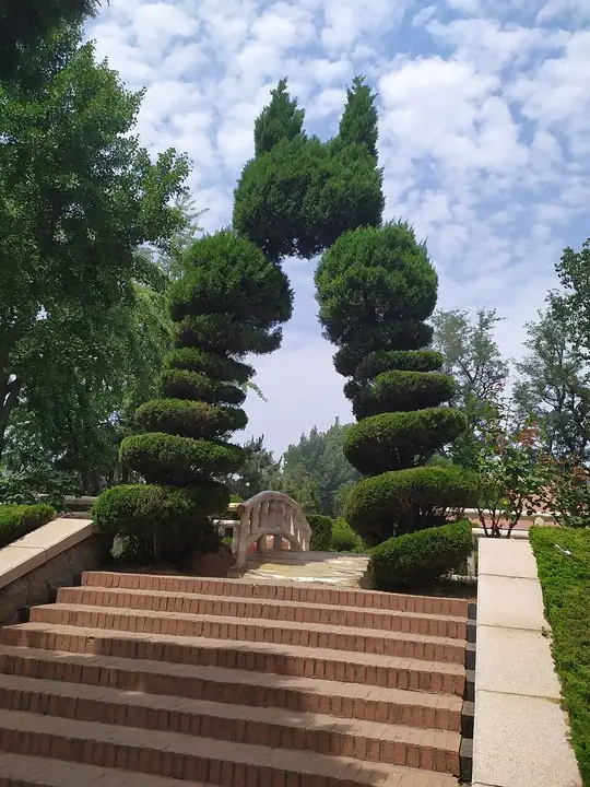 Steps and garden trees in Yantai Hill Park · 烟台山公园阶梯与园林树木 Photograph date recorded by the source: 25 July 2019, 10:51:32.
Yantai Hill Park烟台山
Yantai Hill forms a small coastal headland above the old waterfront, with a lighthouse rising among trees and former consular buildings. The buildings reflect the city’s period as a treaty port, while the paths connect them with…
Read the place guide →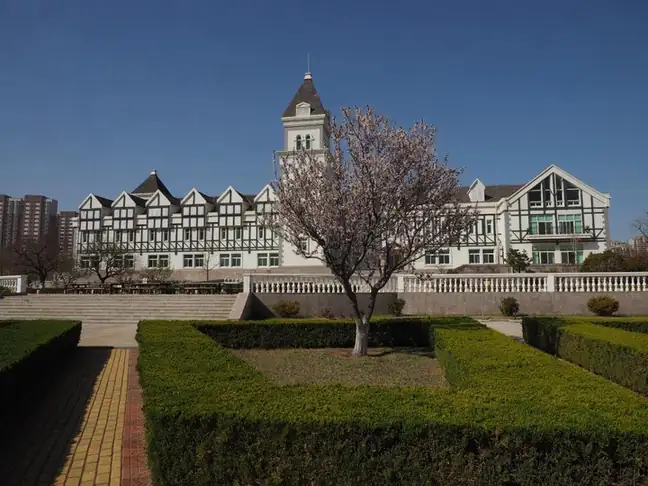 Changyu Wine Culture Museum · 张裕酒文化博物馆
Changyu Wine Culture Museum张裕酒文化博物馆
The Changyu Wine Culture Museum occupies the company’s historic Yantai site, connecting the story of its 1892 founding with the physical spaces of wine production. Its underground cellar is the strongest architectural feature…
Read the place guide →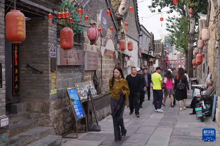 Suochengli Historic District · 所城里
Suochengli Historic District所城里
Suochengli is the historic quarter of Zhifu District in Yantai, Shandong, laid out inside the walls of the Ming Qishan garrison. It is the settlement from which the modern city of Yantai grew.
Read the place guide →Plan your visit
Getting there
Zhifu District is about 9 km in a straight line from central Yantai. Search for 芝罘区 in a map app to find stations and your accommodation.
Where to stay →Build your route
Yantai Hill Park and Changyu Wine Culture Museum are less than 1 km apart. The linked place guides have entrance and visit details.
Continue with Yantai →More in Yantai
Sources & geographic information
Administrative names and parent areas: Official geographic directory · Reference date 2026-09-06.
Some facts checked against 芝罘区 — Wikipedia contributors, CC BY-SA 4.0.
Some facts checked against 烟台市 — Wikipedia contributors, CC BY-SA 4.0.
Some facts checked against 烟台山近代建筑群 (山东省) — Wikipedia contributors, CC BY-SA 4.0.
Some facts checked against 奇山所城 — Wikipedia contributors, CC BY-SA 4.0.
Photo: Yantai Hill Park · Ngguls · Ngguls — 烟台山公园.jpg — CC0 · CC0. The exact downloaded source bytes are separately retained and hashed. Prepared JPEG is proportionally reduced to a maximum 720-pixel long edge; full frame retained, no subject alteration. Final website rendition: full frame retained, proportionally resized to at most 720 pixels and converted to WebP. No additional retouching or subject alteration. Card displays may crop the view.

Photo: Changyu Wine Culture Museum · Source photographer · License not provided. EXIF orientation normalized; resized without changing aspect ratio; converted to WebP. No subject edits.
Photo: Suochengli Historic District · Source photographer · License not provided. EXIF orientation normalized; resized without changing aspect ratio; converted to WebP. No subject edits.
Map data © OpenStreetMap contributors. Pins mark approximate centres, not entrances or boundaries.