


Get to know Penglai District
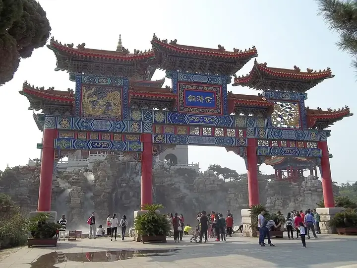
Photo adjustments
Full frame retained; resized proportionally to a maximum dimension of 960 pixels and converted to WebP quality 88. No crop, retouch, generated elements, or subject alteration. Final website rendition: full frame retained, proportionally resized to at most 720 pixels and converted to WebP. No additional retouching or subject alteration. Card displays may crop the view.
- Administrative area
- District · 市辖区
- Part of
- Yantai
- Chinese name
- 蓬莱区
- Local areas
- District guide
Area & population
- Area in the source
- 1,197.10 km²
- Population · 2020
- 410,000
Source: cited geographic source, as of the dates shown.
History
A Penglai county with its own walled seat was created in 707 and served as the seat of Dengzhou (登州). Ancient texts place a mountain of immortals named Penglai in the sea, and the Qin and Han emperors sought elixirs of long life here. The county became a county-level city in 1991, and in 2020 Penglai city and Changdao County (长岛县) were merged to form today's district.
In 1042 the Northern Song built the Daoyu naval fort (刀鱼水寨) here against the Khitan. In 1376 the Ming enclosed the natural inlet called Xiaohai (小海) inside a walled water city, first named Beiwo City (备倭城, 'the fort against the Japanese pirates') and now known as Penglai Water City (蓬莱水城), with a sea gate that could be closed. The general Qi Jiguang (戚继光) trained a fleet here in the Jiajing years. A Yuan warship 28.6 metres long was dug out of the harbour mud in 1984, and in January 1895 Japanese warship fire damaged one character of the 'Sea Without Waves' (海不扬波) inscription on the north face of Penglai Pavilion.
What to see
Penglai Water City and Penglai Pavilion form one national key protected site, listed by the State Council in February 1982; the Yantai water bureau describes the water city as China's earliest ancient military harbour. The water city has a harbour with a breakwater and wave-breaking platform, city walls, gun batteries and a moat, and the scenic area includes an old-ship museum. Other national protected sites in the district are the Qi Jiguang Shrine (戚继光祠), the Wulin Christian church (武霖基督教圣会堂), the lighthouse on Houji Island (猴矶岛灯塔) and the Beizhuang archaeological site (北庄遗址).
The Sanxianshan and Eight Immortals Crossing the Sea scenic area (三仙山·八仙过海景区) is built around the immortals theme. At Tianheng Mountain (田横山) the Shandong civil affairs department describes a spot where the Bohai and Yellow Seas meet. Penglai is also known for mirages over the sea, the Dengzhou mirage (登州海市). The Changdao islands (长岛列岛) have belonged to the district since 2020.
Food and local products
Penglai is a wine district. The Shandong civil affairs department calls it one of the world's seven grape coasts, lying at 37 degrees north on the western Pacific shore, and the only 'Chinese Wine City'. Wineries such as the COFCO Junding estate (中粮君顶酒庄) and Guobin winery (国宾酒庄) are scattered through the district.
Highlights
- Penglai Water City 蓬莱水城: Ming walled naval harbour around the Xiaohai inlet, a national key protected site since 1982.
- Penglai Pavilion 蓬莱阁: Where the Eight Immortals are said to have drunk before crossing the sea; listed together with the water city.
- Qi Jiguang Shrine 戚继光祠: National protected site honouring the Ming general who trained a fleet at the water city.
- Houji Island Lighthouse 猴矶岛灯塔: Island lighthouse listed as a national key protected site.
Sources for this guide
蓬莱区 - 维基百科,自由的百科全书 · Wikipedia (Chinese) · CC BY-SA 4.0
烟台水利故事(九) · Yantai Water Resources Bureau
山东省民政厅 地名文化 到蓬莱,过神仙日子 · Shandong Provincial Department of Civil Affairs
Original English written from the listed sources and checked sentence by sentence against quoted extracts by a separate reviewer. Updated 2026-09-25.
Explore Penglai District
Core places to explore, with English and Chinese names.
Places to explore around Penglai District
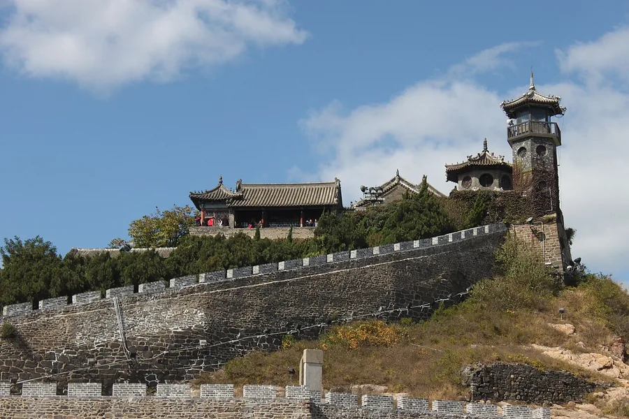 The coastal fortification and traditional pavilions of Penglai Pavilion, Yantai, Shandong; 17 October 2009.
Penglai Pavilion蓬莱阁
Penglai Pavilion crowns Danya Hill above the coast, within a cluster of shrines and halls rather than standing alone as a single tower. Tianhou Palace, Lüzu Hall and other religious buildings link maritime worship with Taoist…
Read the place guide → Changdao Islands · 长岛列岛
Changdao Islands长岛列岛
Changdao, also called the Miaodao Archipelago, is a chain of 151 islands strung north to south across the Bohai Strait between the Jiaodong and Liaodong peninsulas. It is administered within Penglai District of Yantai in Shandong.
Read the place guide →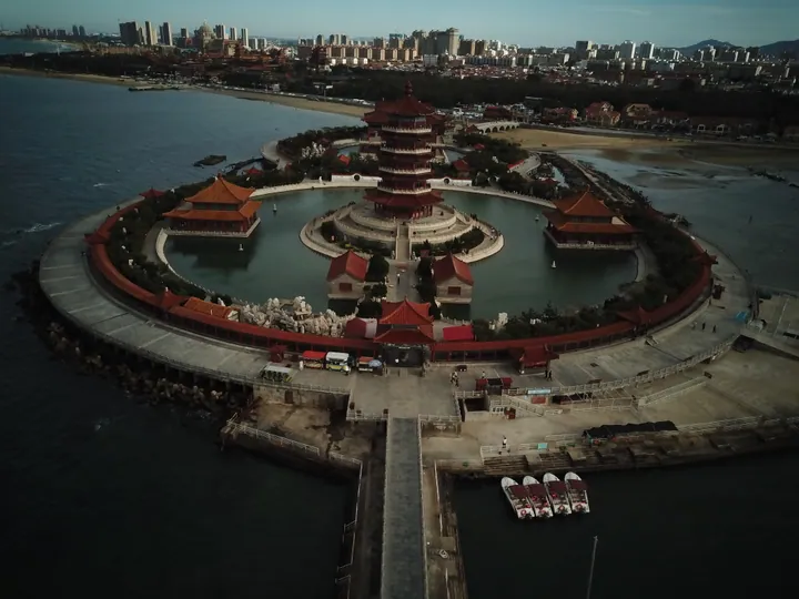 Aerial view of the circular pavilion complex at the Eight Immortals Crossing the Sea scenic area, Penglai · 烟台市蓬莱区八仙过海景区圆形楼阁建筑群航拍 Source-recorded photograph date: 2019-09-14 16:01:35.
Eight Immortals Crossing the Sea Scenic Area八仙过海景区
The Eight Immortals Crossing the Sea scenic area is a themed complex built on the shore of Penglai District in Yantai, Shandong, east of the north-shore bathing beach. It is laid out around the legend of the Eight Immortals crossing the sea.
Read the place guide →Plan your visit
Getting there
Penglai District is about 75 km in a straight line from central Yantai. Search for 蓬莱区 in a map app to find stations and your accommodation.
Where to stay →Build your route
Penglai Pavilion and Changdao Islands are both listed here. The linked place guides have entrance and visit details.
Continue with Yantai →More in Yantai
Sources & geographic information
Administrative names and parent areas: Official geographic directory · Reference date 2026-09-06.
Some facts checked against 蓬莱区 — Wikipedia contributors, CC BY-SA 4.0.
Photo: Penglai Pavilion · Chrishcn · CC BY 2.0. Proportionally resized and converted to WebP without cropping, retouching or changing the photographed subject.

Photo: Changdao Islands · Ngguls · CC BY-SA 4.0. EXIF orientation normalized; resized without changing aspect ratio; converted to WebP. No subject edits.

Photo: Eight Immortals Crossing the Sea Scenic Area · David290 · CC BY-SA 4.0. Full frame retained; proportionally resized and converted to WebP. No retouching or changes to the photographed subject. Card displays may crop the view.

Map data © OpenStreetMap contributors. Pins mark approximate centres, not entrances or boundaries.