


Get to know Lucheng District
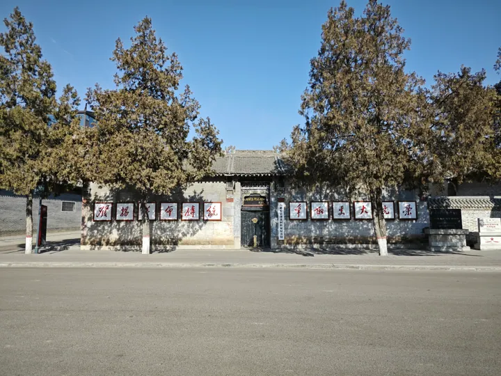
Photo adjustments
Full frame retained; proportionally resized and converted to WebP. No retouching or changes to the photographed subject. Card displays may crop the view.
- Administrative area
- District · 市辖区
- Part of
- Changzhi
- Chinese name
- 潞城区
- Local areas
- District guide
Setting and landscape
Most of the district is hill country, with mountains in the east, level ground in the middle and hills in the west. The highest point is Dayunao (大禹垴) at 1,316.1 metres and the lowest is the valley of the Xin'an River (辛安河) at 616 metres. The district government explains the river's name, Zhuozhang or "muddy Zhang", by its fast current laden with loess silt; the southern branch of the Zhuozhang also flows north through the district into Xiangyuan (襄垣).
History
Local tradition places a Shang-era fief of Weizi (微子) here, still recalled in the name of Weizi town (微子镇), and a Zhou state of Lu (潞子国). The Qin created Lu county under the Shangdang commandery (上党郡), and the name Lucheng dates from 596. Lucheng became a county-level city in 1994 and a district of Changzhi in 2018.
Zhangzhuang (张庄村), a village here sometimes rendered in English as Long Bow, is the subject of William Hinton's book Fanshen, which follows its land reform after the defeat of the Japanese occupiers. His later book Shenfan returns to the village and covers the Cultural Revolution years.
What to see
Yuanqi Temple (原起寺) stands on the top of Fenghuang Mountain (凤凰山), on the west bank of the Zhuozhang north-east of Xin'an village (辛安村). Founded in 747, it keeps a Song-dynasty main hall and the Qinglong Pagoda (青龙宝塔) of 1087, an octagonal brick pagoda of seven storeys, 17 metres tall, braced at each corner by iron figures pulling iron chains. It has been a national protected site since 2001, and Chinese Wikipedia also lists the Dongyi Dragon King Temple (东邑龙王庙) and the Confucian and military temples of Lizhuang (李庄文庙, 李庄武庙) as national protected sites. Wartime sites named by the district government include the former Eighth Route Army headquarters at Beicun (八路军总部北村旧址) and the Shentou ambush battlefield (神头伏击战遗址). The district government also names Shangdang Luozi opera (上党落子) and the folk festival performances known as shehuo (社火) as national intangible heritage.
Highlights
- Yuanqi Temple 原起寺: Hilltop temple founded in 747 with a Song main hall and a brick pagoda of 1087; national protected site since 2001.
- Qinglong Pagoda 青龙宝塔: Seven-storey octagonal brick pagoda of 1087, 17 metres tall, braced by iron figures and chains.
- Former Eighth Route Army headquarters at Beicun 八路军总部北村旧址: Wartime headquarters site at the centre of the district government's western tourist route.
- Zhangzhuang village 张庄村: The "Long Bow" village of William Hinton's Fanshen and Shenfan.
Sources for this guide
自然地理 · Lucheng District People's Government
潞城区 - 维基百科,自由的百科全书 · Wikipedia (Chinese) · CC BY-SA 4.0
Lucheng District, Changzhi - Wikipedia · Wikipedia (English) · CC BY-SA 4.0
原起寺 - 维基百科,自由的百科全书 · Wikipedia (Chinese) · CC BY-SA 4.0
旅游概况 · Lucheng District People's Government
Original English written from the listed sources and checked sentence by sentence against quoted extracts by a separate reviewer. Updated 2026-09-26.
Explore Lucheng District
Core places to explore, with English and Chinese names.
Lucheng District 潞城区
Plan your visit
Getting there
Lucheng District is about 15 km in a straight line from central Changzhi. Search for 潞城区 in a map app to find stations and your accommodation.
Where to stay →More in Changzhi
Sources & geographic information
Administrative names and parent areas: Official geographic directory · Reference date 2026-09-06.
Some facts checked against 潞城区 — Wikipedia contributors, CC BY-SA 4.0.
Some facts checked against Lucheng District, Changzhi — Wikipedia contributors, CC BY-SA 4.0.
Some facts checked against 原起寺 — Wikipedia contributors, CC BY-SA 4.0.
Map data © OpenStreetMap contributors. Pins mark approximate centres, not entrances or boundaries.