


Get to know Luzhou District
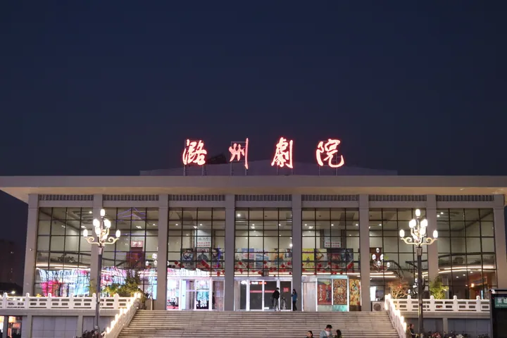
Photo adjustments
Full frame retained; proportionally resized and converted to WebP. No retouching or changes to the photographed subject. Card displays may crop the view.
- Administrative area
- District · 市辖区
- Part of
- Changzhi
- Chinese name
- 潞州区
- Local areas
- District guide
Setting and landscape
East of the main urban area lies the Laoding Mountain National Forest Park (老顶山国家森林公园), about 40 square kilometres, where legend has the Flame Emperor (炎帝) tasting herbs and teaching farming. To the west are the Changzhi wetland and the Zhangze Lake National Urban Wetland Park (漳泽湖国家城市湿地公园), about 60 square kilometres.
History
The Qin placed the area in the Shangdang commandery (上党郡), and in 578 the Northern Zhou carved Luzhou out of it. Li Longji (李隆基), the future Tang emperor Xuanzong, served here as assistant prefect for four years from 707. In 1529 the Ming raised Luzhou to Lu'an prefecture (潞安府) and created Changzhi county, the origin of the city's present name. The Shangdang Campaign (上党战役) was fought here in the opening stage of the civil war, and Changzhi was taken by the Communists in 1945.
What to see
Shangdang Gate (上党门), at the north end of Fupo Street (府坡街), was the gateway of the old commandery office. First built between 583 and 600 and rebuilt in 1370, it is flanked by a bell tower and a drum tower named "Fengchi" (风驰) and "Yundong" (云动), and two steles of 1541 recording the founding of Lu'an prefecture stand inside.
Guanyin Hall (观音堂), west of Liangjiazhuang village (梁家庄村) about 3 kilometres from the city centre, was founded in 1582 and became a national protected site in 2001. Its main hall holds painted clay figures and hanging sculptures (悬塑) from the Wanli reign: Guanyin with Manjushri and Samantabhadra, the eighteen arhats, twelve bodhisattvas on their mounts, and Confucius, the Buddha and Laozi seated side by side. The district government says it is hailed as the crown of Chinese hanging-sculpture art. Other old buildings in the district include the City God Temple (城隍庙) and Chongjiao Temple (崇教寺).
Crafts
Changzhi duijin (长治堆锦) is a local craft of padded silk pictures in relief, made on a paper backing with cotton padding under coloured silk, and known as "three-dimensional Chinese painting". It takes its name from the Changzhi area, where it began in the Ming and Qing. A duijin company built the Changzhi Duijin Museum (长治堆锦博物馆) in 2014.
Highlights
- Guanyin Hall 观音堂: Founded in 1582; its main hall holds Wanli-era painted clay and hanging sculptures; national protected site since 2001.
- Shangdang Gate 上党门: Gateway of the old commandery office with bell and drum towers and two steles of 1541.
- Laoding Mountain National Forest Park 老顶山国家森林公园: About 40 square kilometres of forest on the city's east side.
- Changzhi duijin 长治堆锦: Padded silk relief pictures that began in the Ming and Qing; a museum was built in 2014.
Sources for this guide
潞州概况 · Luzhou District Committee Office (Luzhou district government portal)
历史沿革 · Luzhou District Gazetteer Compilation Committee (Luzhou district government portal)
潞州区 - 维基百科,自由的百科全书 · Wikipedia (Chinese) · CC BY-SA 4.0
上党门 · Luzhou District Gazetteer Compilation Committee (Luzhou district government portal)
观音堂 · Luzhou District Gazetteer Compilation Committee (Luzhou district government portal)
长治堆锦 · Luzhou District Bureau of Culture and Tourism (Luzhou district government portal)
Original English written from the listed sources and checked sentence by sentence against quoted extracts by a separate reviewer. Updated 2026-09-26.
Explore Luzhou District
Core places to explore, with English and Chinese names.
Luzhou District 潞州区
Plan your visit
Getting there
Luzhou District covers the centre of Changzhi. Search for 潞州区 in a map app to find stations and your accommodation.
Where to stay →More in Changzhi
Sources & geographic information
Administrative names and parent areas: Official geographic directory · Reference date 2026-09-06.
Official administrative update
Official administrative update
Changzhi Municipal Government and Development and Reform Commission
Some facts checked against 潞州区 — Wikipedia contributors, CC BY-SA 4.0.
Map data © OpenStreetMap contributors. Pins mark approximate centres, not entrances or boundaries.