


Get to know Licheng County
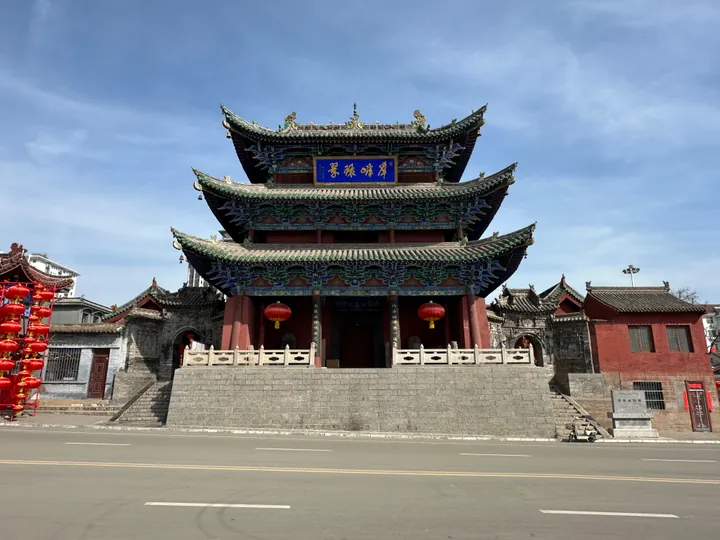
Photo adjustments
Full frame retained; proportionally resized and converted to WebP. No retouching or changes to the photographed subject. Card displays may crop the view.
- Administrative area
- County · 县
- Part of
- Changzhi
- Chinese name
- 黎城县
- Local areas
- County guide
Area & population
- Area in the source
- 1,166.00 km²
- Population · 2002
- 160,000
Source: cited geographic source, as of the dates shown.
History
Under the Shang the area belonged to the state of Li (黎国). The first county here was Yiling (刈陵县), created in 450 with its seat at Gucun village (古县村) in today's Lihou town; it was renamed Licheng in 598. The seat moved in 1025 to the Baima post station (白马驿), 4 kilometres to the south-east, which is the present county town. Licheng was folded into Lucheng (潞城) in 1072 and restored in 1086, and the name has not changed since. The county government also credits the area with the idioms "the Li common people" (黎民百姓) and "washing one's ears to listen respectfully" (洗耳恭听).
Setting and landscape
The Qingzhang and Zhuozhang rivers (清、浊两漳河) flow through the county, and with three irrigation canals and more than forty small springs it is known as the "Little Jiangnan of Shangdang" (上党小江南). The north is steep mountain country of deep gorges. The Banshan scenic area (板山景区), in Xijing town (西井镇) in the north-west, covers 30 square kilometres and reaches 2,008 metres; the county government says its scenery was the model for the walnut-wood carving "Taihang Sunrise" in the Shanxi Hall of the Great Hall of the People.
What to see
The Huangyadong Arsenal site (黄崖洞兵工厂旧址), in Xiachiyu village (下赤峪村) of Huangyadong town, was the Eighth Route Army's largest weapons and ammunition works during the war against Japan. It occupies about 10 square kilometres of mountains around Huanglong Cave (黄龙洞), a natural cave 18 metres wide, 25 metres high and 72 metres deep. The works was set up in July 1939, made grenades and light mortars, and moved to Pingshun (平顺) in 1943; it became a national protected site in 2006. Chinese Wikipedia also lists the Licheng City God Temple (黎城城隍庙) and the Western Zhou tombs of the Lihou (西周黎侯墓群) among the county's national protected sites.
Crafts and local products
The Lihou tiger (黎侯虎) is a cloth toy tiger made around Lihou town and Tinghepu (停河铺), entered on the national intangible-heritage list in 2008. Dyed cotton is sewn into a standing tiger with its head raised, then decorated with appliqué, painted details and tassels. The county government also names Shangdang Luozi opera (上党落子) as national intangible heritage, and the county holds the title of China's home of walnuts.
Highlights
- Huangyadong Arsenal site 黄崖洞兵工厂旧址: The Eighth Route Army's largest arsenal, built around a natural cave from 1939; national protected site since 2006.
- Banshan scenic area 板山景区: Mountain area in Xijing town reaching 2,008 metres, the model for the carving "Taihang Sunrise".
- Lihou tiger 黎侯虎: Cloth tiger of Lihou town, on the national intangible-heritage list since 2008.
Sources for this guide
黎城县情 · Licheng County People's Government Office
黎城县 - 维基百科,自由的百科全书 · Wikipedia (Chinese) · CC BY-SA 4.0
历史沿革 · History Office of the CPC Licheng County Committee (Licheng county government portal)
板山景区 · Licheng County Tourism Bureau (Licheng county government portal)
黄崖洞兵工厂旧址 - 维基百科,自由的百科全书 · Wikipedia (Chinese) · CC BY-SA 4.0
布老虎(黎侯虎) - 中国非物质文化遗产网·中国非物质文化遗产数字博物馆 - 中国非物质文化遗产网非遗 · China Intangible Cultural Heritage Network (ihchina.cn)
Original English written from the listed sources and checked sentence by sentence against quoted extracts by a separate reviewer. Updated 2026-09-26.
Explore Licheng County
Core places to explore, with English and Chinese names.
Places to explore around Licheng County
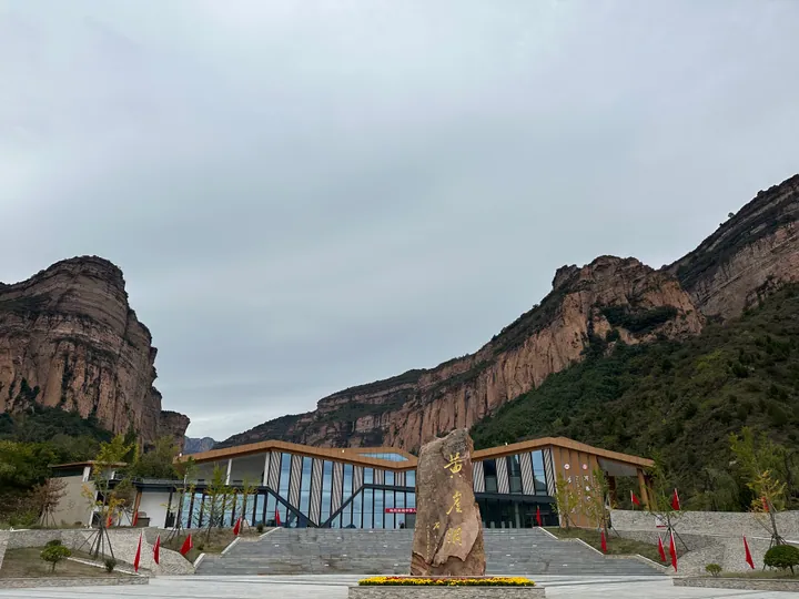 The visitor entrance and marker stone at Huangyadong scenic area, below red cliffs in Licheng ·
 Plan your visit
Getting there
Licheng County is about 60 km in a straight line from central Changzhi. Search for 黎城县 in a map app to find stations and your accommodation.
Where to stay →Build your route
Start with Huangyadong Scenic Area. The linked place guides have entrance and visit details.
Continue with Changzhi →More in Changzhi
Sources & geographic information
Administrative names and parent areas: Official geographic directory · Reference date 2026-09-06.
Some facts checked against 黎城县 — Wikipedia contributors, CC BY-SA 4.0.
Some facts checked against 黄崖洞兵工厂旧址 — Wikipedia contributors, CC BY-SA 4.0.
Photo: Huangyadong Scenic Area · Kmchang28 · CC BY-SA 4.0. Full frame retained; proportionally resized and converted to WebP. No retouching or changes to the photographed subject. Card displays may crop the view.

Map data © OpenStreetMap contributors. Pins mark approximate centres, not entrances or boundaries.