


Get to know Qinxian
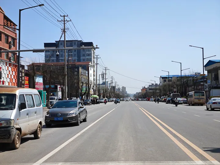
Photo adjustments
Full frame retained; proportionally resized and converted to WebP. No retouching or changes to the photographed subject. Card displays may crop the view.
- Administrative area
- County · 县
- Part of
- Changzhi
- Chinese name
- 沁县
- Local areas
- County guide
Area & population
- Area in the source
- 1,321.00 km²
- Population · 2020
- 138,578
Source: cited geographic source, as of the dates shown.
Setting and landscape
Qinxian is loess hill country ringed by mountains, at an average elevation of about 1,000 metres. The county government calls it a "water town of the north" (北方水城) and a "county of a thousand springs" (千泉之县), counts 126 streams, 17 reservoirs and more than 270 springs, and describes it as the first source of the Hai River (海河).
History
The old name is Tongdi (铜鞮). The state of Jin made it a town in 593 BC and a county in 514 BC, and the county government counts it among China's earliest counties. It later belonged to Qinzhou (沁州), which became Qinxian in 1912. Wu Tian (吴琠), a native of the county, became chief grand secretary under the Kangxi Emperor in 1703. During the war against Japan, Zhu De (朱德) held a meeting of senior commanders at Xiaodongling village (小东岭村) on 24 March 1938, and the county has a memorial hall to the Sacrifice League (牺盟会) and Shanxi's New Army.
What to see
The Nannieshui stone carvings are a buried hoard dug up in 1957 at Nannieshui village and now shown in the Nannieshui Stone Carving Museum (南涅水石刻馆) on Erlang Hill (二郎山) south of the county town. Dated inscriptions run from 510 to 1031, across six dynasties from the Northern Wei to the Northern Song. About four hundred of the pieces are carved stone pagodas with Buddhist niches, most on all four sides, alongside nearly three hundred single figures and fifty to sixty steles. Chinese Wikipedia lists the Nannieshui carvings, Dayun Yuan (大云院) and the main hall of Puzhao Temple (普照寺大殿) among the county's national protected sites.
Food and local products
Qinzhou Huang millet was sent to the court as tribute under the Ming Jiajing Emperor, and the county government says the Kangxi Emperor gave it the name "Qinzhou Huang" (Qinzhou yellow). Chinese Wikipedia also names dried buns with braised meat (卤肉干馍) as a local speciality, and Qinzhou sanxian storytelling (沁州三弦书) entered the national intangible-heritage list in 2008.
Highlights
- Nannieshui Stone Carving Museum 南涅水石刻馆: Buddhist carvings dated 510 to 1031, found as a hoard in 1957.
- Qinzhou Huang millet 沁州黄小米: Tribute millet from the Ming Jiajing reign, named by the Kangxi Emperor.
- Qinzhou sanxian storytelling 沁州三弦书: Storytelling tradition on the national intangible-heritage list since 2008.
Sources for this guide
地理区位 · Qinxian Media Centre (Qinxian county government portal)
沁县 - 维基百科,自由的百科全书 · Wikipedia (Chinese) · CC BY-SA 4.0
沁县县情概况 · Qinxian County Government Office
建置沿革 · Qinxian History and Gazetteer Office (Qinxian county government portal)
县城旅游景点简介 | 南涅水石刻馆 · Qinxian Culture and Tourism (Qinxian county government portal)
Original English written from the listed sources and checked sentence by sentence against quoted extracts by a separate reviewer. Updated 2026-09-26.
Explore Qinxian
Core places to explore, with English and Chinese names.
Plan your visit
Getting there
Qinxian is about 75 km in a straight line from central Changzhi. Search for 沁县 in a map app to find stations and your accommodation.
Where to stay →More in Changzhi
Sources & geographic information
Administrative names and parent areas: Official geographic directory · Reference date 2026-09-06.
Some facts checked against 沁县 — Wikipedia contributors, CC BY-SA 4.0.
Map data © OpenStreetMap contributors. Pins mark approximate centres, not entrances or boundaries.