


Get to know Xiangfen County
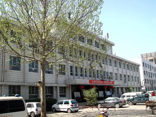
Photo adjustments
EXIF orientation normalized; resized without changing aspect ratio; converted to WebP. No subject edits.
- Administrative area
- County · 县
- Part of
- Linfen
- Chinese name
- 襄汾县
- Local areas
- County guide
Area & population
- Area in the source
- 1,034.00 km²
- Population · 2010
- 442,614
- Administrative seat
- Xincheng (新城镇)
Source: cited geographic source, as of the dates shown.
History
The Dingcun site is a Middle Palaeolithic site on the third terrace of the Fen's east bank, stretching 11 kilometres from the county town south to Chaizhuang (柴庄) station. Digging began in 1954 and has produced three human teeth, part of a child's skull and more than 2,000 stone artefacts; it was among the first national monuments listed in 1961.
Taosi, 7 kilometres northeast of the county town, is a walled Longshan-period (龙山文化) site. Its early town dates from about 2300–2100 BC, and the middle-period city of about 2.8 million square metres from 2100–2000 BC. Excavations since 1978 have found a palace area, large tombs, walls and what may be an astronomical observatory, and scholars have suggested it may have been the capital of the legendary ruler Yao (尧). It has been a national monument since 1988.
The county government adds that Duke Xian of Jin (晋献公) moved his capital to Zhaokang (赵康) in 668 BC, a seat remembered as Gujiang (故绛), and that the old town of Fencheng (汾城) goes back to the Sui and Tang.
What to see
From the Ming onward, merchant families of the Taiping merchant group (太平商帮) built large mansions in the county, and Dingcun village still keeps more than 40 of their courtyards intact. The county counts 1,019 protected monuments, seven of them national. Newer attractions it names are the lotus and hot-spring area at Yancun (燕村), the Longshuyu (龙澍峪) mountain area, Dongling ski field (东岭滑雪场) and Shuanglong Lake National Wetland Park (双龙湖国家湿地公园).
Food and local products
Farm products named by the county are Yaojing grapes (尧京葡萄) and Guantan red dates (官滩红枣); it describes itself as the largest trading base for the medicinal root rehmannia (地黄) in China and a major grower of Sanying chillies (三樱椒). Local crafts and customs still practised include drum-cart running (跑鼓车), Pingyang hemp paper (平阳麻笺), the Tianta lion dance (天塔狮舞) and Jin-style furniture making (晋作家具).
Getting oriented
The Datong–Yuncheng Expressway (大运高速), the Nantongpu Railway (南同蒲铁路) and the Datong–Xi'an high-speed line run north to south through the county, and the county town is about 30 kilometres from Linfen's airport.
Highlights
- Dingcun Site 丁村遗址: Middle Palaeolithic site on the Fen's east bank, excavated from 1954; national listing 1961.
- Taosi Site 陶寺遗址: Longshan-period walled city of about 2300–2000 BC, which scholars suggest may have been Yao's capital; national listing 1988.
- Dingcun village 丁村: Keeps more than 40 merchant-family courtyards.
- Tianta lion dance 天塔狮舞: Lion dance the county traces to the Tang.
Sources for this guide
襄汾简介-襄汾简介-襄汾县人民政府门户网站 · Xiangfen County People's Government
丁村遗址 - 维基百科,自由的百科全书 · Chinese Wikipedia · CC BY-SA 4.0
陶寺遗址 - 维基百科,自由的百科全书 · Chinese Wikipedia · CC BY-SA 4.0
Original English written from the listed sources and checked sentence by sentence against quoted extracts by a separate reviewer. Updated 2026-09-26.
Explore Xiangfen County
Core places to explore, with English and Chinese names.
Places to explore around Xiangfen County
 AI illustration · AI
 Plan your visit
Getting there
Xiangfen County is about 25 km in a straight line from central Linfen. Search for 襄汾县 in a map app to find stations and your accommodation.
Where to stay →Build your route
Start with Dingcun Folk Houses and Dingcun Site Museum. The linked place guides have entrance and visit details.
Continue with Linfen →More in Linfen
Sources & geographic information
Administrative names and parent areas: Official geographic directory · Reference date 2026-09-06.
Some facts checked against 丁村遗址 — Wikipedia contributors, CC BY-SA 4.0.
Some facts checked against 陶寺遗址 — Wikipedia contributors, CC BY-SA 4.0.
Map data © OpenStreetMap contributors. Pins mark approximate centres, not entrances or boundaries.