


Get to know Xiangning County
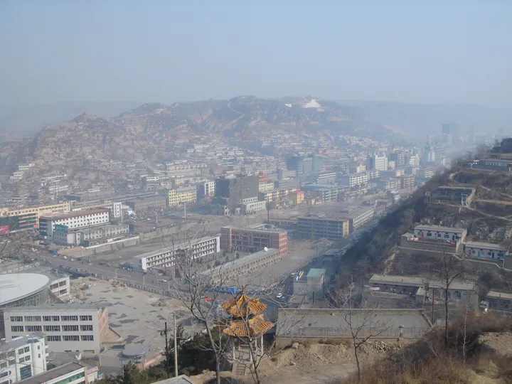
Photo adjustments
Full frame retained; proportionally resized and converted to WebP. No retouching or changes to the photographed subject. Card displays may crop the view.
- Administrative area
- County · 县
- Part of
- Linfen
- Chinese name
- 乡宁县
- Local areas
- County guide
Area & population
- Area in the source
- 2,029.00 km²
- Population · 2013
- 240,000
Source: cited geographic source, as of the dates shown.
Setting and landscape
The county covers about 2,029 square kilometres. Its neighbours are Yaodu (尧都) and Xiangfen (襄汾) to the east, Xinjiang (新绛), Jishan (稷山) and Hejin (河津) to the south and Jixian (吉县) to the north. The county government sits in Changning (昌宁镇). Coal underlies roughly 78 percent of the land, and the county also holds iron, limestone and purple clay for zisha (紫砂) pottery, which it is now promoting as a local craft. A Yellow River bridge links it to Shaanxi.
History
The county government traces the area to E (鄂邑), where Marquis E of Jin (晋鄂侯) lived in the Spring and Autumn period. The place was later called Changping, Pingchang, Lüxiang and Changning before taking the name Xiangning in 923, under the Later Tang. Local figures it remembers include the Ming minister of war Zheng Chongjian (郑崇俭), the Qing gazetteer compiler Yang Du (杨笃), and 24 men who fought the Japanese at Hualing Temple (华灵庙).
What to see
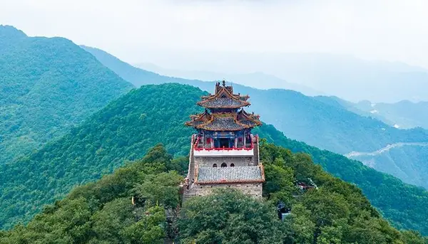
The county government singles out Yunqiu Mountain (云丘山), long praised as the finest peak of the Gushe Mountains (姑射山) and "the first scenic spot of the Fen and Yellow River region"; it is known for an ice cave and a folk-custom experience. Two monuments are on the national protection list. The Yingli Thousand-Buddha Caves (营里千佛洞石窟) are cut into a cliff at Yingli village, 5 kilometres east of the county town; listed by Shanxi in 1996 and nationally in 2019, they are dated from the Northern Qi to the Tang. Shousheng Temple (寿圣寺), inside the Dongjie primary school in the county town, was founded in 1049 according to Wikipedia; its main hall survives from the Song and its two-storey bell tower was built in 1312. It was listed nationally in 2006. Other old sites named by the county include the Warring States tomb of Xun Xi (荀息墓), the Song-period Baishan Temple (柏山寺) and the Qing-period Du family courtyard (杜家院).
Food and local products
The county lists Sichuan pepper (花椒), apples, long yams (长山药) and hollow mooncakes (空心月饼) among its best-known products, together with oil pressed from the samara fruit tree (翅果油) and wine sold under the Rongzi (戎子) name.
Highlights
- Yunqiu Mountain 云丘山: Called the finest peak of the Gushe Mountains; known for its ice cave and folk-custom experience.
- Yingli Thousand-Buddha Caves 营里千佛洞石窟: Northern Qi to Tang cave temples 5 km east of the county town; national listing 2019.
- Shousheng Temple 寿圣寺: Song-period main hall and 1312 bell tower in the county town; national listing 2006.
- Hollow mooncakes 空心月饼: Named by the county government among its best-known local products.
Sources for this guide
乡宁县 - 维基百科,自由的百科全书 · Chinese Wikipedia · CC BY-SA 4.0
乡宁简介-乡宁简介-乡宁县人民政府门户网站 · Xiangning County People's Government
营里千佛洞石窟 - 维基百科,自由的百科全书 · Chinese Wikipedia · CC BY-SA 4.0
寿圣寺 (乡宁) - 维基百科,自由的百科全书 · Chinese Wikipedia · CC BY-SA 4.0
Original English written from the listed sources and checked sentence by sentence against quoted extracts by a separate reviewer. Updated 2026-09-26.
Explore Xiangning County
Core places to explore, with English and Chinese names.
Places to explore around Xiangning County
 Yunqiu Mountain ·
 Plan your visit
Getting there
Xiangning County is about 60 km in a straight line from central Linfen. Search for 乡宁县 in a map app to find stations and your accommodation.
Where to stay →Build your route
Start with Yunqiu Mountain. The linked place guides have entrance and visit details.
Continue with Linfen →More in Linfen
Sources & geographic information
Administrative names and parent areas: Official geographic directory · Reference date 2026-09-06.
Some facts checked against 乡宁县 — Wikipedia contributors, CC BY-SA 4.0.
Some facts checked against 营里千佛洞石窟 — Wikipedia contributors, CC BY-SA 4.0.
Some facts checked against 寿圣寺 (乡宁) — Wikipedia contributors, CC BY-SA 4.0.
Photo: Yunqiu Mountain · Source photographer · License not provided. EXIF orientation normalized; resized without changing aspect ratio; converted to WebP. No subject edits.
Map data © OpenStreetMap contributors. Pins mark approximate centres, not entrances or boundaries.