


Get to know Jiancaoping District
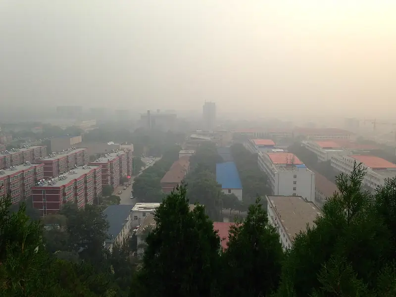
Photo adjustments
Full frame retained; EXIF orientation normalized, proportionally resized to at most 800 pixels and converted to WebP. No generated pixels or subject changes. Cards may crop the display.
- Administrative area
- District · 市辖区
- Part of
- Taiyuan
- Chinese name
- 尖草坪区
- Local areas
- District guide
Area & population
- Area in the source
- 296.00 km²
- Population · 2020
- 530,499
Source: cited geographic source, as of the dates shown.
What to see
The Dou Dafu Shrine is in Shanglan village (上兰村), with Lieshi Mountain (烈石山) behind it, the Fen River (汾河) to the southwest and the North University of China (中北大学) to the east. It honours Dou Chou (窦犨), a minister of the state of Jin in the Spring and Autumn period, and was long a place where officials and villagers prayed for rain. The present shrine was founded in 1085 and rebuilt in 1267; the district government notes the bold, broad Yuan style of its surviving halls. The complex also takes in the Ming-dynasty Baoning Temple (保宁寺) with late-Ming painted statues of Guan Yu and his attendants, a Qing Guanyin hall, and the Lieshi cold spring (烈石寒泉), one of the eight outer sights of old Jinyang (晋阳). A cave under the drum tower, called the "rainbow nest" (虹巢), is where the scholar Fu Shan (傅山) lived in seclusion at the turn of the Ming and Qing.
Juewei Mountain (崛围山), a provincial scenic area 24 km from the city and 1,345 m high, is known for its autumn red leaves, which earned it the name "little Xiangshan" (小香山); "red leaves of Juewei" is another of the eight outer sights of Jinyang. Pines cover its southern slope and cypresses its northern one, and a seven-storey Ming relic pagoda, the Qingfeng Pagoda (青峰塔), stands on the south peak. The Qisong Hermitage (七松庵) was where Fu Shan read in his late years.
Duofu Temple sits in a small hollow at the top of Juewei Mountain. Founded in 786, burned at the end of the Song and rebuilt in the Hongwu era of the Ming, it has three courtyards facing south. The main hall holds statues of three Buddhas and four bodhisattvas, and 84 Ming murals of the life of the Buddha, done with raised gilded lines, cover three walls. Beside the sutra library is the Red Leaf Cave (红叶洞), where Fu Shan wrote the collection Shuanghong Kan Ji (霜红龛集); his brushwork on the rock face in front is still legible.
Other heritage
The former site of the private Jinshan School (山西私立进山学校旧址) is a provincial cultural relics site, and the Guangji Temple at Shanglan (上兰广济寺) is among the district's city-level listed sites.
Highlights
- Dou Dafu Shrine 窦大夫祠: Rain-prayer shrine to a Jin minister, founded 1085, with Fu Shan's 'rainbow nest' cave.
- Duofu Temple 多福寺: Hilltop temple founded 786 with 84 gilded Ming murals of the Buddha's life.
- Juewei Mountain 崛围山: Provincial scenic area known for autumn red leaves and a Ming seven-storey pagoda.
- Jingyin Temple 净因寺: National key cultural relics site in the district.
Sources for this guide
窦大夫祠 - 畅游尖草坪 - 太原市尖草坪区人民政府门户网站 · Jiancaoping District People's Government, Taiyuan
多福寺 - 畅游尖草坪 - 太原市尖草坪区人民政府门户网站 · Jiancaoping District People's Government, Taiyuan
崛围山 - 畅游尖草坪 - 太原市尖草坪区人民政府门户网站 · Jiancaoping District People's Government, Taiyuan
尖草坪区 - 维基百科 · Wikipedia (Chinese) · CC BY-SA 4.0
Original English written from the listed sources and checked sentence by sentence against quoted extracts by a separate reviewer. Updated 2026-09-26.
Explore Jiancaoping District
Core places to explore, with English and Chinese names.
Jiancaoping District 尖草坪区
Plan your visit
Getting there
Jiancaoping District is about 10 km in a straight line from central Taiyuan. Search for 尖草坪区 in a map app to find stations and your accommodation.
Where to stay →More in Taiyuan
Sources & geographic information
Administrative names and parent areas: Official geographic directory · Reference date 2026-09-06.
Some facts checked against 尖草坪区 — Wikipedia contributors, CC BY-SA 4.0.
Map data © OpenStreetMap contributors. Pins mark approximate centres, not entrances or boundaries.