


Get to know Loufan County
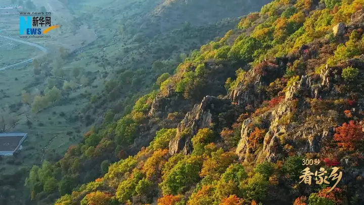
Photo adjustments
EXIF orientation normalized; resized without changing aspect ratio; converted to WebP. No subject edits.
- Administrative area
- County · 县
- Part of
- Taiyuan
- Chinese name
- 娄烦县
- Local areas
- County guide
Area & population
- Population · 2020
- 91,208
Source: cited geographic source, as of the dates shown.
Setting and landscape
Loufan borders Gujiao (古交) to the east, Fangshan (方山) to the west, Jiaocheng (交城) to the south, Jingle (静乐) to the north and Lan County (岚县) to the northwest. Mountains ring the county, and the rest is cut by gullies and loess hills. The Fen and its tributary the Jian River (涧河) flow through it, and the Fen River Reservoir (汾河水库) lies within its borders.
History
The name comes from Loufan (楼烦), first a tribe and later a region. The county government places the capital of the ancient Loufan kingdom northwest of Chengdonggou (城东沟) in Majiazhuang township (马家庄乡); King Wuling of Zhao (赵武灵王) overcame it, yet traces of its walls still stand, and pottery, blades, halberds and warhorse bones of the Spring and Autumn and Warring States periods have been dug up there. In 641 the Tang set up the Loufan Directorate (楼烦监), an important horse farm. Loufan became part of Jingle County after 1949, was re-created as a county in May 1971 and joined Taiyuan in April 1972.
What to see
Yunding Mountain (云顶山), two kilometres southwest of Dushihe village (独石河村), rises to 2,789 m by the county's figure and is covered in forest. Its summit opens into a small grassland with natural pools that legend links to the Sui general Yuchi Gong (尉迟恭), and ice survives on the mountain through the hottest weeks of summer. A ridge on the east slope is called "One Banner" (一杆旗) after the Song heroine Mu Guiying (穆桂英). In 1630 rebels sent by Li Zicheng (李自成) camped here; after Li's fall the mountain was the main base of the Jiaoshan peasant army (交山农民军) until the Qing crushed it in 1671. Brown eared pheasants (褐马鸡) and golden eagles live in its forests.
The Gao Junyu Former Residence (高君宇故居) in Fenglingdi village (峰岭底村), Jingyou town (静游镇), 25 km from the county town, is a national red tourism classic scenic area. It combines the house where Gao Junyu, founder of the Communist Party and Youth League organisations in Shanxi, lived until 16, a memorial hall with six exhibition sections, and a square.
Food and local products
Naked-oat flour (莜面) is eaten in many ways. For youmian yuyu (莜面鱼鱼), the dough is rolled into small fish-shaped strips pointed at both ends, and some is pushed into "cat's ears" with the thumb; both are steamed and then stirred into a pot of potatoes, tofu and vermicelli to make hucaca (糊擦擦). Loufan potatoes (娄烦山药蛋) received a geographical-indication certification mark in 2015, and mountain mushrooms are a Yunding speciality.
Highlights
- Yunding Mountain 云顶山: Forested peak of 2,789 m with a summit grassland and pools linked to Yuchi Gong.
- Gao Junyu Former Residence 高君宇故居: House and memorial hall of a founder of the Shanxi Communist Party organisation, at Fenglingdi.
- Loufan kingdom capital ruins 楼烦古国都城遗址: Wall remains near Chengdonggou; pottery, weapons and horse bones found.
- Youmian yuyu 莜面鱼鱼: Fish-shaped oat-flour strips steamed and stirred with potatoes and tofu.
Sources for this guide
走进娄烦 - 太原市娄烦县人民政府门户网站 · Loufan County People's Government
云顶山 - 太原市娄烦县人民政府门户网站 · Loufan County People's Government
高君宇故居红色旅游景区简介 - 太原市娄烦县人民政府门户网站 · Loufan County People's Government
莜面鱼鱼 - 太原市娄烦县人民政府门户网站 · Loufan County People's Government
楼烦古国都城遗址 - 太原市娄烦县人民政府门户网站 · Loufan County People's Government
娄烦县 - 维基百科 · Wikipedia (Chinese) · CC BY-SA 4.0
Original English written from the listed sources and checked sentence by sentence against quoted extracts by a separate reviewer. Updated 2026-09-26.
Explore Loufan County
Core places to explore, with English and Chinese names.
Loufan County 娄烦县
Plan your visit
Getting there
Loufan County is about 70 km in a straight line from central Taiyuan. Search for 娄烦县 in a map app to find stations and your accommodation.
Where to stay →More in Taiyuan
Sources & geographic information
Administrative names and parent areas: Official geographic directory · Reference date 2026-09-06.
Some facts checked against 娄烦县 — Wikipedia contributors, CC BY-SA 4.0.
Map data © OpenStreetMap contributors. Pins mark approximate centres, not entrances or boundaries.