


Get to know Wuzhai County
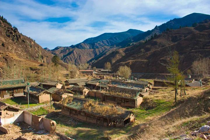
Photo adjustments
Full frame retained; proportionally resized and converted to WebP. No retouching or changes to the photographed subject. Card displays may crop the view.
- Administrative area
- County · 县
- Part of
- Xinzhou
- Chinese name
- 五寨县
- Local areas
- County guide
Two contrasting summits
Luya Mountain stands 27 kilometres due south of the county town. Its jagged rocks give the peak a shape compared to a reed shoot breaking through the ground. Heyeping lies seven kilometres west of the main peak and is known for its wide, flat top. Pine and fir woods cover the surrounding mountain range.
Five military settlements
Wuzhai takes its name from five military settlements. A fortress was built here in 1537, and the county was established in 1725. In the central agricultural plain, the Qinglian River (清涟河) runs north–south and the Zhujiachuan River (朱家川河) crosses east–west. Sweet glutinous maize and flaxseed oil are local products.
Sources for this guide
五寨概况 · Wuzhai County Government
芦芽山脉及芦芽山、荷叶坪 · Wuzhai County Government
Original English written from the listed sources and checked sentence by sentence against quoted extracts by a separate reviewer. Updated 2026-09-26.
Explore Wuzhai County
Core places to explore, with English and Chinese names.
Wuzhai County 五寨县
Plan your visit
Getting there
Wuzhai County is about 95 km in a straight line from central Xinzhou. Search for 五寨县 in a map app to find stations and your accommodation.
Where to stay →More in Xinzhou
Sources & geographic information
Administrative names and parent areas: Official geographic directory · Reference date 2026-09-06.
Map data © OpenStreetMap contributors. Pins mark approximate centres, not entrances or boundaries.