


Get to know Jiangxian
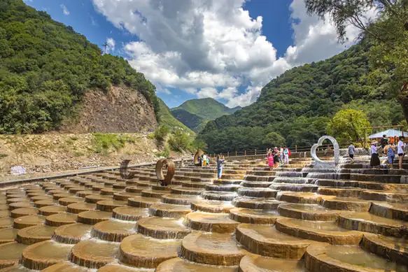
Photo adjustments
EXIF orientation normalized; resized without changing aspect ratio; converted to WebP. No subject edits.
- Administrative area
- County · 县
- Part of
- Yuncheng
- Chinese name
- 绛县
- Local areas
- County guide
Setting and landscape
The county government describes the land as seven parts mountain, two parts ridge and one part river plain, with the county town at an average of 736 metres above sea level. The Sushui (涑水) and Huishui (浍水) river systems drain it, and the county counts six major valley mouths, among them Moliyu (磨里峪) and Lengkouyu (冷口峪). Yicheng (翼城) lies to the east, Wenxi (闻喜) to the west and south, and Yuanqu (垣曲) beyond the Hengling range (横岭山) to the south; Quwo (曲沃) and Houma (侯马) border it to the north.
History
In the Western Zhou and Spring and Autumn periods the area lay within the home territory of the state of Jin, and Jiang (绛) served as a Jin capital. The county government dates the county to 541 BC. The Northern Wei set up Nanjiang County in 494; the name became plain Jiang in 539, and in 618 the seat moved from Chexiangcheng (车厢城) to the present town. At Hengbei village (横北村), rescue excavations from 2004 to 2007 opened 1,266 Western Zhou tombs, identified as the cemetery of the Peng state (倗国); a burial shroud and a large body of bronze inscriptions came from it, and it was named one of China's ten major archaeological finds of 2005. The site has since been backfilled.
What to see
Taiyin Temple (太阴寺), known locally as the Reclining Buddha Temple, stands in Zhangshang village (张上村), Weizhuang town, and faces north. Inscriptions date its founding to the Northern Wei; of its buildings only the passage hall and the main hall survive, the main hall a Jin-dynasty structure, with five wooden statues, four painted clay figures and seven steles from the Five Dynasties to the Qing. The Zhoujiazhuang site (周家庄遗址), a Neolithic site covering about five million square metres on a terrace north of the Sushui, has been excavated by the National Museum of China since 2004 and became a national key protected monument in 2013. Jiangbei Canyon (绛北大峡谷), a 4A scenic area in Moli town (么里镇), offers canyon rafting and the old village of Shi'e (石娥古村).
Highlights
- Taiyin Temple 太阴寺: North-facing temple founded under the Northern Wei; its main hall is a Jin-dynasty structure.
- Zhoujiazhuang site 周家庄遗址: Neolithic site north of the Sushui; national key protected monument since 2013.
- Hengbei Peng state cemetery 横北倗国墓地: 1,266 Western Zhou tombs excavated 2004–2007; one of the ten major archaeological finds of 2005.
- Jiangbei Canyon 绛北大峡谷: 4A scenic area with canyon rafting in Moli town.
Sources for this guide
绛县 · Wikipedia (Chinese) · CC BY-SA 4.0
绛县概况 · Jiangxian People's Government
太阴寺 · Jiangxian People's Government
周家庄遗址 · Jiangxian People's Government
横北倗国墓地 · Jiangxian People's Government
绛北大峡谷 · Jiangxian People's Government
Original English written from the listed sources and checked sentence by sentence against quoted extracts by a separate reviewer. Updated 2026-09-26.
Explore Jiangxian
Core places to explore, with English and Chinese names.
Plan your visit
Getting there
Jiangxian is about 75 km in a straight line from central Yuncheng. Search for 绛县 in a map app to find stations and your accommodation.
Where to stay →More in Yuncheng
Sources & geographic information
Administrative names and parent areas: Official geographic directory · Reference date 2026-09-06.
Some facts checked against 绛县 — Wikipedia contributors, CC BY-SA 4.0.
Map data © OpenStreetMap contributors. Pins mark approximate centres, not entrances or boundaries.