


Get to know Pengxi County
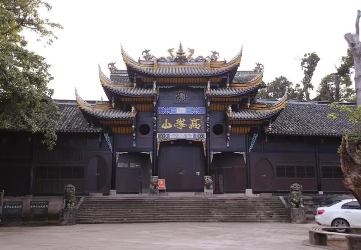
Photo adjustments
Full-frame source proportionally resized and converted to WebP for display. No subject alteration. Source-supplied marks and edits remain; cards may crop the view.
- Administrative area
- County · 县
- Part of
- Suining
- Chinese name
- 蓬溪县
- Local areas
- County guide
Area & population
- Area in the source
- 1,251.00 km²
- Population · 2020 census
- 430,344
- Administrative seat
- Chicheng Town
Source: cited geographic source, as of the dates shown.
What to see
Baofan Temple (宝梵寺) stands about 15 kilometres west of the county town on Shizi Mountain (狮子山). Founded during the Northern Song as Luohan Courtyard (罗汉院), it has a south-facing arrangement with three successive halls and side rooms. These include the Tianwang Hall (天王殿), Daxiong Hall (大雄殿) and Pilu Hall (毗卢殿). Inscriptions commemorating construction and resident monks occupy the courtyard.
Setting and landscape
Chicheng Lake (赤城湖) is an artificial lake about 1.5 kilometres west of the county town, within Chicheng Town (赤城镇). Greenery and buildings line its shores; the county government describes it as a place used by residents for lakeside walks.
Sources for this guide
书乡蓬溪 - 蓬溪县人民政府手机版 · Pengxi County Government
宝梵寺 - 蓬溪县人民政府 · Pengxi County Government
赤城湖 - 蓬溪县人民政府 · Pengxi County Government
Original English written from the listed sources and checked sentence by sentence against quoted extracts by a separate reviewer. Updated 2026-09-27.
Explore Pengxi County
Core places to explore, with English and Chinese names.
Pengxi County 蓬溪县
Plan your visit
Getting there
Pengxi County is about 30 km in a straight line from central Suining. Search for 蓬溪县 in a map app to find stations and your accommodation.
Where to stay →More in Suining
Sources & geographic information
Administrative names and parent areas: Official geographic directory · Reference date 2026-09-06.
Map data © OpenStreetMap contributors. Pins mark approximate centres, not entrances or boundaries.