


Get to know Dashe District
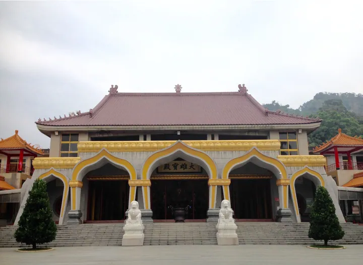
Photo adjustments
Full frame retained; proportionally resized and converted to WebP. No retouching or changes to the photographed subject. Card displays may crop the view.
- Administrative area
- District · 區
- Part of
- Kaohsiung City
- Chinese name
- 大社區
- Local areas
- District guide
Setting and landscape
Guanyin Mountain takes its name from a main summit resembling the seated Guanyin (觀音). Its rock is largely siltstone, coloured yellowish by iron. Acacia woodland is prominent, with shrubs on the windswept summit and denser vegetation in lower valleys and wetlands. Red-bellied squirrels, Formosan macaques and birds inhabit the mountain.
History
The name Dashe preserves the memory of an Indigenous settlement west of Guanyin Mountain, associated with the Makatao (馬卡道) people. Dashe separated from Renwu (仁武) as its own township in 1951.
Food and local products
Jujubes and guavas are characteristic farm products of Dashe, which also has dairy farming. The district office’s 2017 guide describes a holiday market extending from Guanyin Mountain’s entrance towards the environmental park.
Sources for this guide
高雄市大社區公所-旅遊景點 · Kaohsiung Dashe District Office
高雄市大社區公所-關於大社 · Kaohsiung Dashe District Office
Original English written from the listed sources and checked sentence by sentence against quoted extracts by a separate reviewer. Updated 2026-09-30.
Explore Dashe District
Core places to explore, with English and Chinese names.
Dashe District 大社區
Plan your visit
Getting there
Dashe District is about 15 km in a straight line from central Kaohsiung City. Search for 大社區 in a map app to find stations and your accommodation.
Where to stay →More in Kaohsiung City
Sources & geographic information
Administrative names and parent areas: Official geographic directory · Reference date 2026-09-06.
Map data © OpenStreetMap contributors. Pins mark approximate centres, not entrances or boundaries.