


Get to know Zuoying District
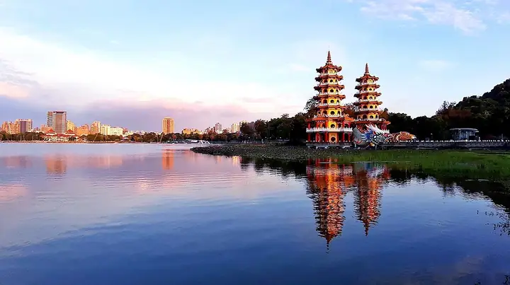
Photo adjustments
Full-frame source proportionally resized and converted to WebP for display. No subject alteration. Source-supplied marks and edits remain; cards may crop the view.
- Administrative area
- District · 區
- Part of
- Kaohsiung City
- Chinese name
- 左營區
- Local areas
- District guide
Reef rock and migrating birds
Banping Mountain stands about 175 metres high and consists of coral-reef limestone. Its terrain includes cliffs, gullies and rock faces where shell fossils can be found. The central lookout is a place to observe migrating raptors in spring and autumn, alongside resident birds of prey.
An old house café
In lanes near the old town, Xiyue Coffee (曦玥珈琲) occupies the owner’s grandmother’s house. Low partition walls, wooden furnishings and an old kitchen cabinet preserve elements of the domestic setting. Its drinks include an iced Americano made with locally supplied star-fruit soup.
Sources for this guide
尋訪春天 蓮池潭半日輕旅行 - 高雄畫刊-高雄市政府新聞局 · Kaohsiung City Government Information Bureau
Original English written from the listed sources and checked sentence by sentence against quoted extracts by a separate reviewer. Updated 2026-09-27.
Explore Zuoying District
Core places to explore, with English and Chinese names.
Places to explore around Zuoying District
Plan your visit
Getting there
Zuoying District is about 7 km in a straight line from central Kaohsiung City. Search for 左營區 in a map app to find stations and your accommodation.
Where to stay →Build your route
Start with Lotus Pond. The linked place guides have entrance and visit details.
Continue with Kaohsiung City →More in Kaohsiung City
Sources & geographic information
Administrative names and parent areas: Official geographic directory · Reference date 2026-09-06.
Photo: Lotus Pond · WEI, WAN-CHEN(魏琬臻) · CC BY-SA 4.0. Full-frame source proportionally resized and converted to WebP for display. No subject alteration. Source-supplied marks and edits remain; cards may crop the view.
.jpg)
Map data © OpenStreetMap contributors. Pins mark approximate centres, not entrances or boundaries.