


Get to know Sanmin District
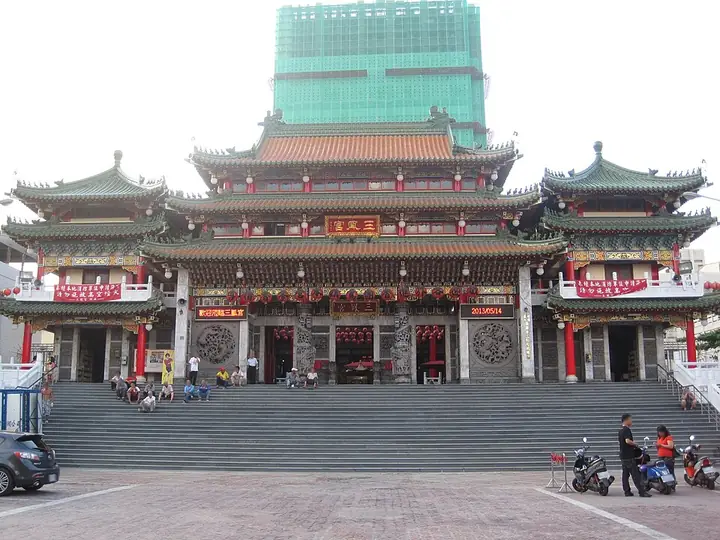
Photo adjustments
Full-frame source proportionally resized and converted to WebP for display. No subject alteration. Source-supplied marks and edits remain; cards may crop the view.
- Administrative area
- District · 區
- Part of
- Kaohsiung City
- Chinese name
- 三民區
- Local areas
- District guide
The New Hakka Cultural Park
The New Hakka Cultural Park (新客家文化園區) occupies a triangular area between Tongmeng Second Road (同盟二路), Zili First Road (自立一路) and Tongxie Road (同協路). Its heritage museum combines exhibits with educational interpretation. A round building, performance hall and centres displaying crafts and agricultural products form part of the complex. Outdoor features include flowering paths, an ecological pond, rain trees and a teaching area. The main construction finished in 2010, and the refurbished museum reopened in 2012.
Settlement and faith
Kaohsiung’s Hakka Affairs Commission identifies Baozhong Yimin Temple (褒忠義民廟) and Baozhugou Fude Shrine (寶珠溝福德祠) in Sanmin as places to explore the religious life of Hakka communities settling in the city. The park adds museum displays and performances to that account of urban Hakka culture.
Sources for this guide
高雄市政府客家事務委員會-客家景點 (https://chakcg.kcg.gov.tw/cp.aspx?n=6501F7D3D7CCA8A0) · Kaohsiung Hakka Affairs Commission
chakcg.kcg.gov.tw (https://chakcg.kcg.gov.tw/cp.aspx?n=2F1A20C11B459EA9) · Kaohsiung Hakka Affairs Commission
Original English written from the listed sources and checked sentence by sentence against quoted extracts by a separate reviewer. Updated 2026-09-30.
Explore Sanmin District
Core places to explore, with English and Chinese names.
Places to explore around Sanmin District
Plan your visit
Getting there
Sanmin District is about 5 km in a straight line from central Kaohsiung City. Search for 三民區 in a map app to find stations and your accommodation.
Where to stay →Build your route
Start with Sanfeng Temple. The linked place guides have entrance and visit details.
Continue with Kaohsiung City →More in Kaohsiung City
Sources & geographic information
Administrative names and parent areas: Official geographic directory · Reference date 2026-09-06.
Photo: Sanfeng Temple · Pbdragonwang · CC BY-SA 3.0. Full-frame source proportionally resized and converted to WebP for display. No subject alteration. Source-supplied marks and edits remain; cards may crop the view.

Map data © OpenStreetMap contributors. Pins mark approximate centres, not entrances or boundaries.