


Get to know Neimen District
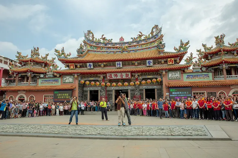
Photo adjustments
Full frame retained; EXIF orientation normalized, proportionally resized to at most 800 pixels and converted to WebP. No generated pixels or subject changes. Cards may crop the display.
- Administrative area
- District · 區
- Part of
- Kaohsiung City
- Chinese name
- 內門區
- Local areas
- District guide
Temples and performance
Neimen Zizhu Temple (內門紫竹寺) was completed in 1733. The Luohanmen Yingfozu procession (羅漢門迎佛祖) brings together village troupes performing Songjiang formations (宋江陣), drum dances and dragon dances. In front of Nanhai Zizhu Temple (南海紫竹寺), the Songjiang Weapons Exhibition Hall (宋江兵器展示館) displays crescent shovels, iron forks, blades and axes, showing the links between farm implements and performance weapons.
Reading the terrain
The Seven Star Towers (七星塔) stand on mounds arranged like the Big Dipper. Five can be seen along Provincial Highway 3 (臺3線), while two lie among town lanes. At Wangzai Shangtian (尪仔上天), erosion by the Erren River (二仁溪) has created small earth formations resembling figures climbing toward the sky.
Sources for this guide
走讀羅漢門時間深處 慢遊山城的文化風景 - 高雄畫刊-高雄市政府新聞局 · Kaohsiung City Government Information Bureau
Original English written from the listed sources and checked sentence by sentence against quoted extracts by a separate reviewer. Updated 2026-09-27.
Explore Neimen District
Core places to explore, with English and Chinese names.
Neimen District 內門區
Plan your visit
Getting there
Neimen District is about 40 km in a straight line from central Kaohsiung City. Search for 內門區 in a map app to find stations and your accommodation.
Where to stay →More in Kaohsiung City
Sources & geographic information
Administrative names and parent areas: Official geographic directory · Reference date 2026-09-06.
Map data © OpenStreetMap contributors. Pins mark approximate centres, not entrances or boundaries.