


Get to know Taoyuan District
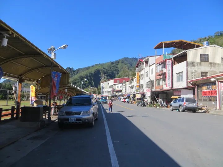
Photo adjustments
Full frame retained; proportionally resized and converted to WebP. No retouching or changes to the photographed subject. Card displays may crop the view.
- Administrative area
- District · 區
- Part of
- Kaohsiung City
- Chinese name
- 桃源區
- Local areas
- District guide
Area & population
- Area in the source
- 928.98 km²
Source: cited geographic source, as of the dates shown.
Seasons and community
Plum blossom spreads across the mountains in winter, followed by cherry blossom in early spring. Bunun (布農族) communities hold the traditional Ear-shooting Festival (射耳祭) in April and May.
Mountain products
Aiyu (愛玉) grows in the high mountains and is made into a cooling jelly using spring water. Jianshan Village (建山村) produces fragrant, sweet-sour passion fruit, eaten fresh or made into juice, jam and desserts. Plum products include sauces, wine and vinegar. In the misty mountains of Baoshan Village (寶山村), cultivated lion’s mane mushrooms (猴頭菇) are used in soups, fried dishes and stir-fries.
Sources for this guide
桃源區-茂林國家風景區管理處 · Maolin National Scenic Area Administration
Original English written from the listed sources and checked sentence by sentence against quoted extracts by a separate reviewer. Updated 2026-09-27.
Explore Taoyuan District
Core places to explore, with English and Chinese names.
Taoyuan District 桃源區
Plan your visit
Getting there
Taoyuan District is about 90 km in a straight line from central Kaohsiung City. Search for 桃源區 in a map app to find stations and your accommodation.
Where to stay →More in Kaohsiung City
Sources & geographic information
Administrative names and parent areas: Official geographic directory · Reference date 2026-09-06.
Map data © OpenStreetMap contributors. Pins mark approximate centres, not entrances or boundaries.