


Get to know Tianliao District
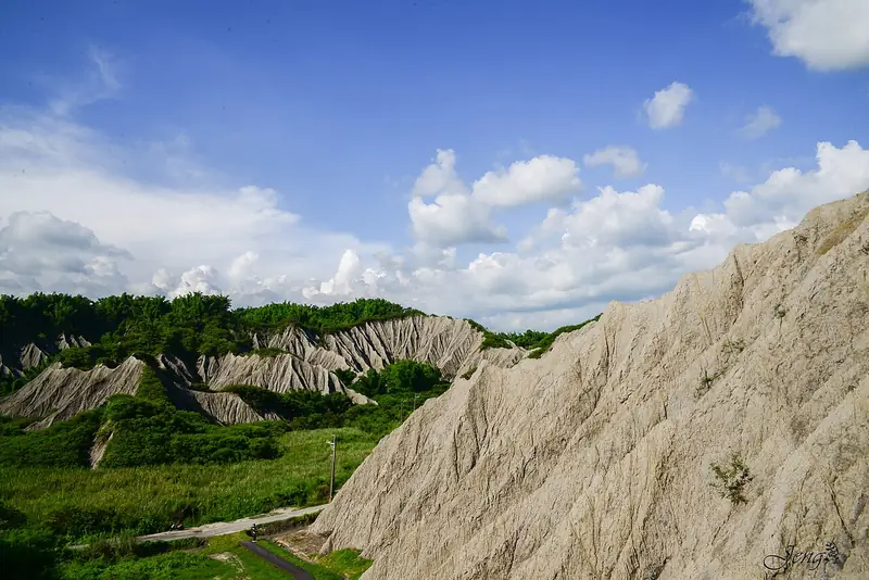
Photo adjustments
Full frame retained; EXIF orientation normalized, proportionally resized to at most 800 pixels and converted to WebP. No generated pixels or subject changes. Cards may crop the display.
- Administrative area
- District · 區
- Part of
- Kaohsiung City
- Chinese name
- 田寮區
- Local areas
- District guide
Mudstone and mud volcanoes
The mudstone originally accumulated beneath the sea. Its silvery salt coating explains the local name haiyintu (海銀土), or sea-silver earth. Xiaogunshui Mud Volcano (小滾水泥火山) lies near the Chongde community. Mud volcanoes form when underground gas forces a mixture of sediment and water through cracks to the surface; wetter mixtures form mud pools rather than tall cones.
Farming beside the river
Along the Erren River (二仁溪), farmers use sediment deposited at river bends to grow vegetables, sweet potatoes, pumpkins, tomatoes and maize. Cultivation starts after the typhoon season and continues until the following rainy season floods the ground again. These riverside plots contrast with the surrounding mudstone badlands.
Sources for this guide
惡地農夫工作室創立人梁舒婷 x 探索田寮的生態異界 - 高雄畫刊-高雄市政府新聞局 · Kaohsiung City Government Information Bureau
Original English written from the listed sources and checked sentence by sentence against quoted extracts by a separate reviewer. Updated 2026-09-27.
Explore Tianliao District
Core places to explore, with English and Chinese names.
Tianliao District 田寮區
Plan your visit
Getting there
Tianliao District is about 30 km in a straight line from central Kaohsiung City. Search for 田寮區 in a map app to find stations and your accommodation.
Where to stay →More in Kaohsiung City
Sources & geographic information
Administrative names and parent areas: Official geographic directory · Reference date 2026-09-06.
Map data © OpenStreetMap contributors. Pins mark approximate centres, not entrances or boundaries.