


Get to know Yong'an District
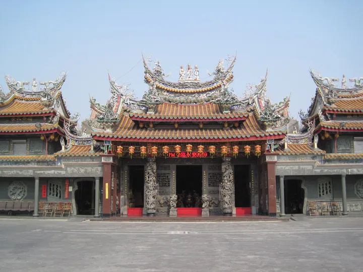
Photo adjustments
Full frame retained; proportionally resized and converted to WebP. No retouching or changes to the photographed subject. Card displays may crop the view.
- Administrative area
- District · 區
- Part of
- Kaohsiung City
- Chinese name
- 永安區
- Local areas
- District guide
Village houses and oyster shells
Zhu Haibian Xinshoucun (住海邊新手村) occupies renovated houses, combining a creative community space with activities for older residents. At Zhuzigang Wenxing Temple (竹仔港文興宮), artist Yang Yi (楊逸) and local elders created a mural using oyster shells. It tells the local legend of the monk Yingxiang (應祥) arriving by sea. The material recalls the area’s earlier oyster cultivation in coastal lagoons.
Fishpond reuse
The Xingang Community Development Association (新港社區發展協會) began planting seagrass in abandoned fishponds in 2025. Its approach also seeks to use the whole fish: processed viscera become liquid fertiliser, bones are made into pet food, and collagen extracted from scales can be used in ice cream.
Sources for this guide
靠海慢步調 永安小漁村一日散策 - 高雄畫刊-高雄市政府新聞局 · Kaohsiung City Government Information Bureau
Original English written from the listed sources and checked sentence by sentence against quoted extracts by a separate reviewer. Updated 2026-09-27.
Explore Yong'an District
Core places to explore, with English and Chinese names.
Yong'an District 永安區
Plan your visit
Getting there
Yong'an District is about 25 km in a straight line from central Kaohsiung City. Search for 永安區 in a map app to find stations and your accommodation.
Where to stay →More in Kaohsiung City
Sources & geographic information
Administrative names and parent areas: Official geographic directory · Reference date 2026-09-06.
Map data © OpenStreetMap contributors. Pins mark approximate centres, not entrances or boundaries.