


Get to know Honghe County
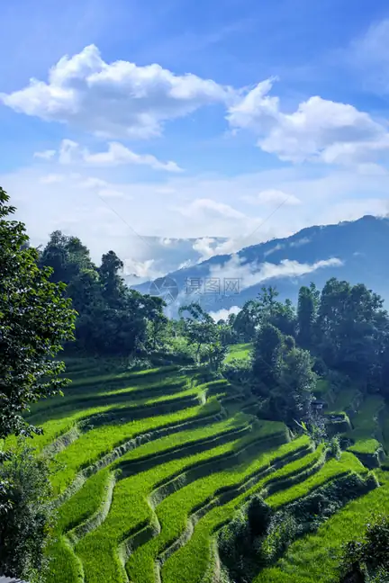
Photo adjustments
EXIF orientation normalized; resized without changing aspect ratio; converted to WebP. No subject edits.
- Administrative area
- County · 县
- Part of
- Honghe Hani and Yi Autonomous Prefecture
- Chinese name
- 红河县
- Local areas
- County guide
Area & population
- Area in the source
- 2,034.00 km²
Source: cited geographic source, as of the dates shown.
A caravan town
Yisa prospered through copper mining and caravan commerce. Merchants who had travelled abroad returned to build European-style houses and buildings combining Chinese and Western designs. Caravans carried home building materials as well as commercial wealth.
Dongmen residences
Dongmen Caravan Ancient Town (东门马帮古城) brings together the East Gate Tower (东门城楼), Yao Chuju Residence (姚初居民居) and Qian Erguan Courtyard (钱二官迷宫大院). Dating from the early Republican period, these groups of residences cover more than 20,000 square metres and include both traditional Qing-style and mixed Chinese–Western architecture. Triangular courtyards are among the unusual details encountered inside the old houses.
Sources for this guide
迤萨古镇的另类闲暇-红河县人民政府 · Honghe County People’s Government
Original English written from the listed sources and checked sentence by sentence against quoted extracts by a separate reviewer. Updated 2026-09-27.
Explore Honghe County
Core places to explore, with English and Chinese names.
Places to explore around Honghe County
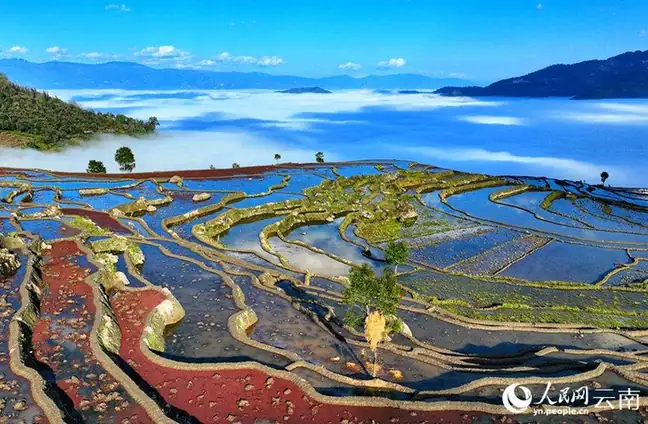 Samaba Rice Terraces · 撒玛坝梯田
Samaba Rice Terraces撒玛坝梯田
The Samaba terraces (撒玛坝梯田) are a Hani terraced-farming landscape in Baohua township, Honghe County, Yunnan, about 37 km from the county seat.
Read the place guide → Yisa Ancient Town · 迤萨古镇
Yisa Ancient Town迤萨古镇
Yisa (迤萨) is a hilltop caravan-trade old town and a major hometown of overseas Chinese in Honghe County, Yunnan, on the south bank of the Red River.
Read the place guide →Plan your visit
Getting there
Honghe County is about 120 km in a straight line from central Honghe Hani and Yi Autonomous Prefecture. Search for 红河县 in a map app to find stations and your accommodation.
Where to stay →Build your route
Samaba Rice Terraces and Yisa Ancient Town are both listed here. The linked place guides have entrance and visit details.
Continue with Honghe Hani and Yi Autonomous Prefecture →More in Honghe Hani and Yi Autonomous Prefecture
Sources & geographic information
Administrative names and parent areas: Official geographic directory · Reference date 2026-09-06.
Photo: Samaba Rice Terraces · Source photographer · License not provided. EXIF orientation normalized; resized without changing aspect ratio; converted to WebP. No subject edits.
Photo: Yisa Ancient Town · Source photographer · License not provided. EXIF orientation normalized; resized without changing aspect ratio; converted to WebP. No subject edits.
Map data © OpenStreetMap contributors. Pins mark approximate centres, not entrances or boundaries.