


Get to know Pingbian Miao Autonomous County
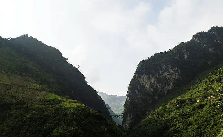
Photo adjustments
Full frame retained; proportionally resized and converted to WebP. No retouching or changes to the photographed subject. Card displays may crop the view.
- Administrative area
- Autonomous county · 自治县
- Part of
- Honghe Hani and Yi Autonomous Prefecture
- Chinese name
- 屏边苗族自治县
- Local areas
- Autonomous county guide
Area & population
- Area in the source
- 1,905.00 km²
- Population · 2020 census
- 129,448
- Administrative seat
- Yuping
Source: cited geographic source, as of the dates shown.
A landscape cut by rivers
The Nanxi River (南溪河), Xinxian River (新现河) and Nameguo River (那么果河) run through the county. River erosion has divided the landscape into mountain ranges and numerous V-shaped valleys. Elevations extend from 154 to 2,590 metres, producing pronounced changes in climate with altitude.
Forest and railway landmarks
Dawei Mountain (大围山) offers suspension bridges, tree towers and views of seas of cloud. Its forests contain Pingbian cycads (屏边苏铁) and branching tree ferns (多头桫椤). The county’s human-made landmarks include Renzi Bridge (人字桥) on the Yunnan–Vietnam Railway (滇越铁路). Pingbian received its current county name in 1933, combining a character from Yuping Mountain (玉屏山) with one from its earlier name, Jingbian (靖边).
Sources for this guide
大围山国家森林公园-屏边苗族自治县人民政府 · Pingbian Miao Autonomous County People’s Government
屏边概况-屏边苗族自治县人民政府 · Pingbian Miao Autonomous County People’s Government
Original English written from the listed sources and checked sentence by sentence against quoted extracts by a separate reviewer. Updated 2026-09-27.
Explore Pingbian Miao Autonomous County
Core places to explore, with English and Chinese names.
Places to explore around Pingbian Miao Autonomous County
 AI illustration · AI
 Plan your visit
Getting there
Pingbian Miao Autonomous County is about 50 km in a straight line from central Honghe Hani and Yi Autonomous Prefecture. Search for 屏边苗族自治县 in a map app to find stations and your accommodation.
Where to stay →Build your route
Start with Dawei Mountain. The linked place guides have entrance and visit details.
Continue with Honghe Hani and Yi Autonomous Prefecture →More in Honghe Hani and Yi Autonomous Prefecture
Sources & geographic information
Administrative names and parent areas: Official geographic directory · Reference date 2026-09-06.
Map data © OpenStreetMap contributors. Pins mark approximate centres, not entrances or boundaries.