


Get to know Gengma Dai and Va Autonomous County
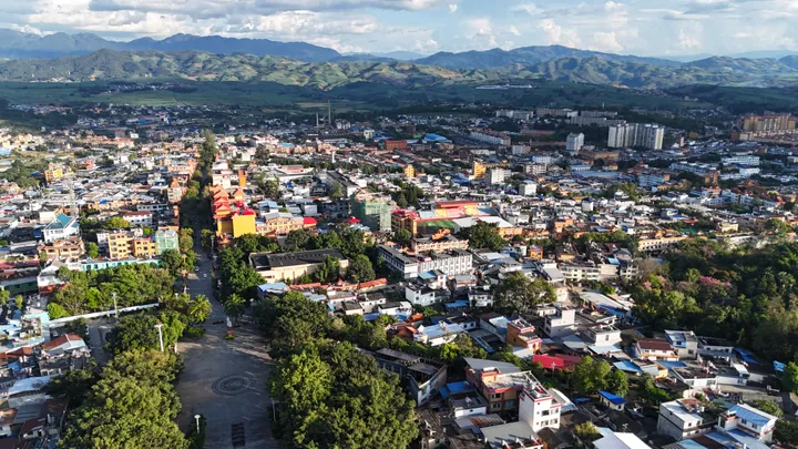
Photo adjustments
Full frame retained; proportionally resized and converted to WebP. No retouching or changes to the photographed subject. Card displays may crop the view.
- Administrative area
- Autonomous county · 自治县
- Part of
- Lincang
- Chinese name
- 耿马傣族佤族自治县
- Local areas
- Autonomous county guide
Area & population
- Area in the source
- 3,837.00 km²
- Population · 2020 census
- 285,683
- Administrative seat
- Gengma
Source: cited geographic source, as of the dates shown.
Paper-making in Mangtuan
In Mangtuan Village (芒团村), Zhaha Community (遮哈社区), craftspeople make Dai paper using paper-mulberry bark. Ai Ying (艾影) has developed notebooks, lamps, fans and bags from the traditional material. Nanting Painting Academy (南汀画院) founder He Xinguo (何新国) also established a workshop where visitors can try Dai pottery and paper-making.
Va douchi from Sipaishan
In Laozhai Village (老寨村), Sipaishan Township (四排山乡), local soybeans are soaked, washed, cooked, pounded, shaped into blocks and dried to make Va douchi (佤族豆豉). The dark, glossy blocks have a strong salty flavour. They are toasted over a fire, then pounded with salt and small chillies to make a seasoning. Newer forms include bottled paste and seasoning powder used with cured pork, cold dishes and tofu.
Sources for this guide
孟定:山水烟火里的傣味非遗 · Gengma County People’s Government / Gengma Xianfeng
耿马佤族豆豉:藏在云南边疆的非遗风味 · Gengma County People’s Government / Gengma Converged Media
Original English written from the listed sources and checked sentence by sentence against quoted extracts by a separate reviewer. Updated 2026-09-27.
Explore Gengma Dai and Va Autonomous County
Core places to explore, with English and Chinese names.
Places to explore around Gengma Dai and Va Autonomous County
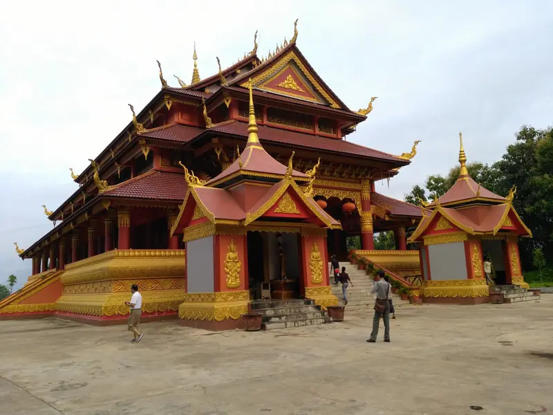 Mengding Dongjing Buddhist Temple ·
 Plan your visit
Getting there
Gengma Dai and Va Autonomous County is about 80 km in a straight line from central Lincang. Search for 耿马傣族佤族自治县 in a map app to find stations and your accommodation.
Where to stay →Build your route
Start with Mengding Dongjing Buddhist Temple. The linked place guides have entrance and visit details.
Continue with Lincang →More in Lincang
Sources & geographic information
Administrative names and parent areas: Official geographic directory · Reference date 2026-09-06.
Photo: Mengding Dongjing Buddhist Temple · Source photographer · License not provided. EXIF orientation normalized; resized without changing aspect ratio; converted to WebP. No subject edits.
Map data © OpenStreetMap contributors. Pins mark approximate centres, not entrances or boundaries.