


Get to know Yunxian
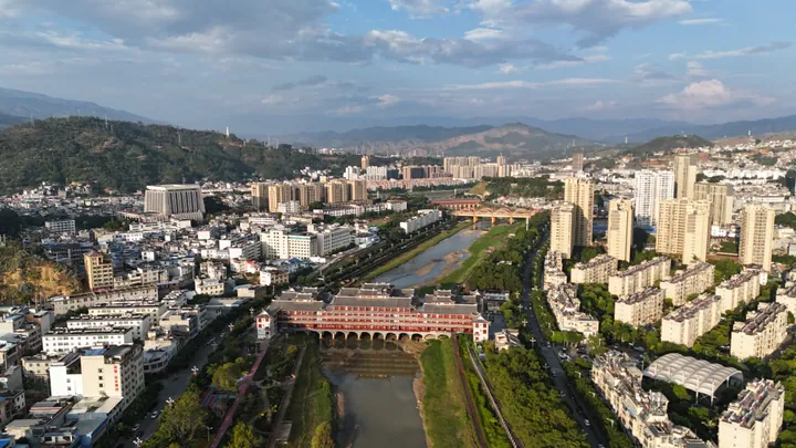
Photo adjustments
Full frame retained; proportionally resized and converted to WebP. No retouching or changes to the photographed subject. Card displays may crop the view.
- Administrative area
- County · 县
- Part of
- Lincang
- Chinese name
- 云县
- Local areas
- County guide
Area & population
- Area in the source
- 3,760.00 km²
- Population · 2020
- 389,180
Source: cited geographic source, as of the dates shown.
Setting and landscape
The county lies at the southern end of the longitudinal valleys of the Hengduan Mountains (横断山). Its terrain rises on the eastern and western sides and is lower in the middle. Mountains, river valleys and warm basins create marked differences in climate within the county.
What to see
Baili Changhu (百里长湖) is the county’s Lancang River lake scenic area. At Toudaoshui Wine Valley (头道水酒谷), milling rooms, stone mills and a carved wall depicting wine history accompany the wooded valley setting. Baiyingshan (白莺山) has a natural museum concerned with the evolution of tea trees.
Food and local products
Chicken rice noodles (鸡肉米线) combine rice noodles with chicken and a strongly flavoured chicken broth. Ham and papaya chicken (火腿木瓜鸡) pairs salty ham with the sourness of papaya. Tea and walnuts are also established agricultural products of Yunxian.
Sources for this guide
云县 · Lincang Municipal Government
云县:大山深处的旅居胜地 · Yunnan Provincial Publicity Department; Yunxian Converged Media Centre
Original English written from the listed sources and checked sentence by sentence against quoted extracts by a separate reviewer. Updated 2026-09-30.
Explore Yunxian
Core places to explore, with English and Chinese names.
Places to explore around Yunxian
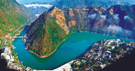 Manwan Hundred-Li Long Lake ·
 Plan your visit
Getting there
Yunxian is about 60 km in a straight line from central Lincang. Search for 云县 in a map app to find stations and your accommodation.
Where to stay →Build your route
Start with Manwan Hundred-Li Long Lake. The linked place guides have entrance and visit details.
Continue with Lincang →More in Lincang
Sources & geographic information
Administrative names and parent areas: Official geographic directory · Reference date 2026-09-06.
Photo: Manwan Hundred-Li Long Lake · Source photographer · License not provided. EXIF orientation normalized; resized without changing aspect ratio; converted to WebP. No subject edits.
Map data © OpenStreetMap contributors. Pins mark approximate centres, not entrances or boundaries.