


Get to know Nanhu District

- Administrative area
- District · 市辖区
- Part of
- Jiaxing
- Chinese name
- 南湖区
- Local areas
- District guide
Area & population
- Population · 2020
- 839,433
Source: cited geographic source, as of the dates shown.
An island garden
Huxin Island (湖心岛) was created in 1548 from silt dredged from the city’s waterways. Yanyu Tower (烟雨楼) was moved onto it the following year. Later buildings included Qinghui Hall (清晖堂), Baomei Pavilion (宝梅亭) and an imperial stele pavilion (御碑亭), forming a Jiangnan (江南) garden complex centred on the tower.
The lake and the Red Boat
The final session of the party’s first national congress took place on a boat on South Lake in early August 1921. Nanhu Revolutionary Memorial Hall (南湖革命纪念馆), established in 1959, preserves this history through revolutionary objects, documents, paintings and calligraphy. Its first displays used the older buildings on Huxin Island, making the island part of both garden history and political remembrance.
Sources for this guide
百年党史悟初心 梦想红船再起航②| 红船与南湖 Red Boat and Nanhu Lake · Zhejiang Provincial Foreign Affairs Office
南湖旅游 · Zhejiang Nanhu Culture and Tourism Group
Original English written from the listed sources and checked sentence by sentence against quoted extracts by a separate reviewer. Updated 2026-09-30.
Explore Nanhu District
Core places to explore, with English and Chinese names.
Places to explore around Nanhu District
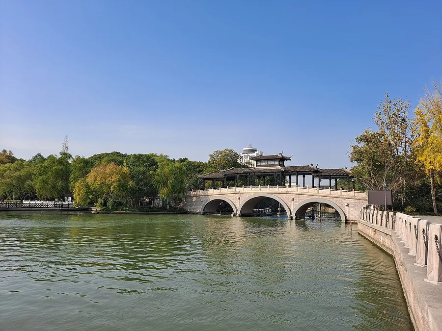 A waterside bridge and pavilion at South Lake in Jiaxing. Photographed on 13 November 2021.
South Lake (Jiaxing)南湖
Jiaxing’s South Lake combines a central-island garden with the commemoration of the Communist Party’s first congress. Misty Rain Tower occupies the island formed through historical dredging, while the Red Boat nearby is a later…
Read the place guide →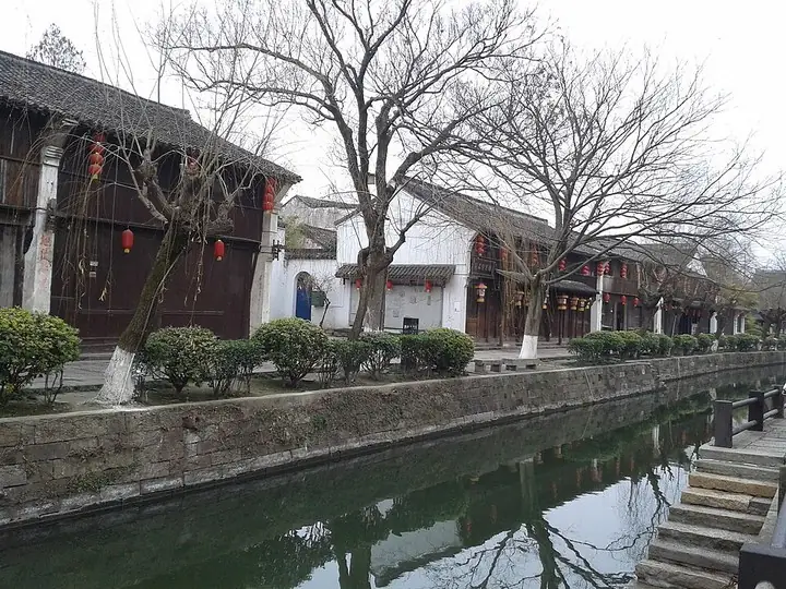 Canal-side buildings of Yuehe Street, Jiaxing · 嘉兴月河历史街区河岸建筑 Photograph date recorded by the source: 1 February 2015, 14:14:51.
Yuehe Street月河历史街区
Yuehe is a restored commercial neighbourhood around canals connected with Jiaxing’s old moat. Its shop and workshop buildings give the district a different character from the city’s grand private houses: narrow trading fronts…
Read the place guide →Plan your visit
Getting there
Nanhu District covers the centre of Jiaxing. Search for 南湖区 in a map app to find stations and your accommodation.
Where to stay →Build your route
South Lake (Jiaxing) and Yuehe Street are about 2 km apart in a straight line. The linked place guides have entrance and visit details.
Continue with Jiaxing →More in Jiaxing
Sources & geographic information
Administrative names and parent areas: Official geographic directory · Reference date 2026-09-06.
Photo: South Lake (Jiaxing) · 钉钉 · CC BY-SA 4.0. Proportionally resized and converted to WebP without cropping, retouching or changing the photographed subject.
.jpg)
Photo: Yuehe Street · Antigng · Antigng — 月河历史街区.jpg — CC BY-SA 4.0 · CC BY-SA 4.0. The exact downloaded source bytes are separately retained and hashed. Prepared JPEG is proportionally reduced to a maximum 720-pixel long edge; full frame retained, no subject alteration. Final website rendition: full frame retained, proportionally resized to at most 720 pixels and converted to WebP. No additional retouching or subject alteration. Card displays may crop the view.

Map data © OpenStreetMap contributors. Pins mark approximate centres, not entrances or boundaries.